


Charger images
Les formats d'image autorisés sont de type jpeg, png ou gif
La taille maximale du fichier doit être de 20MB
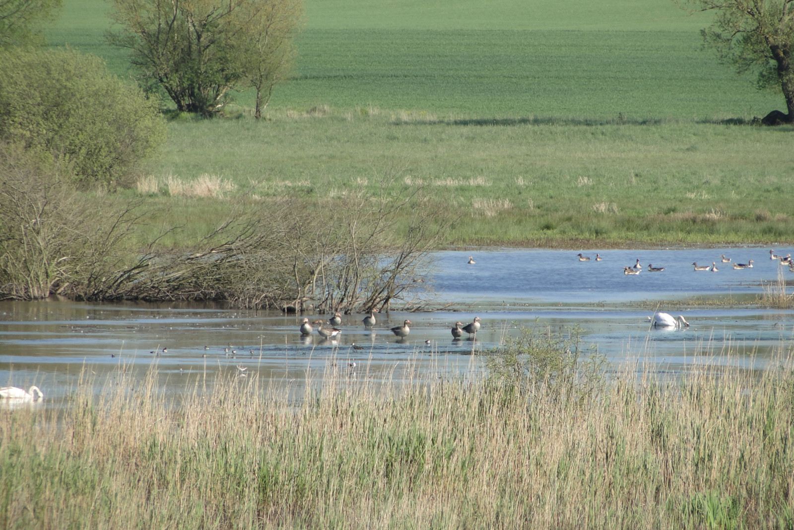
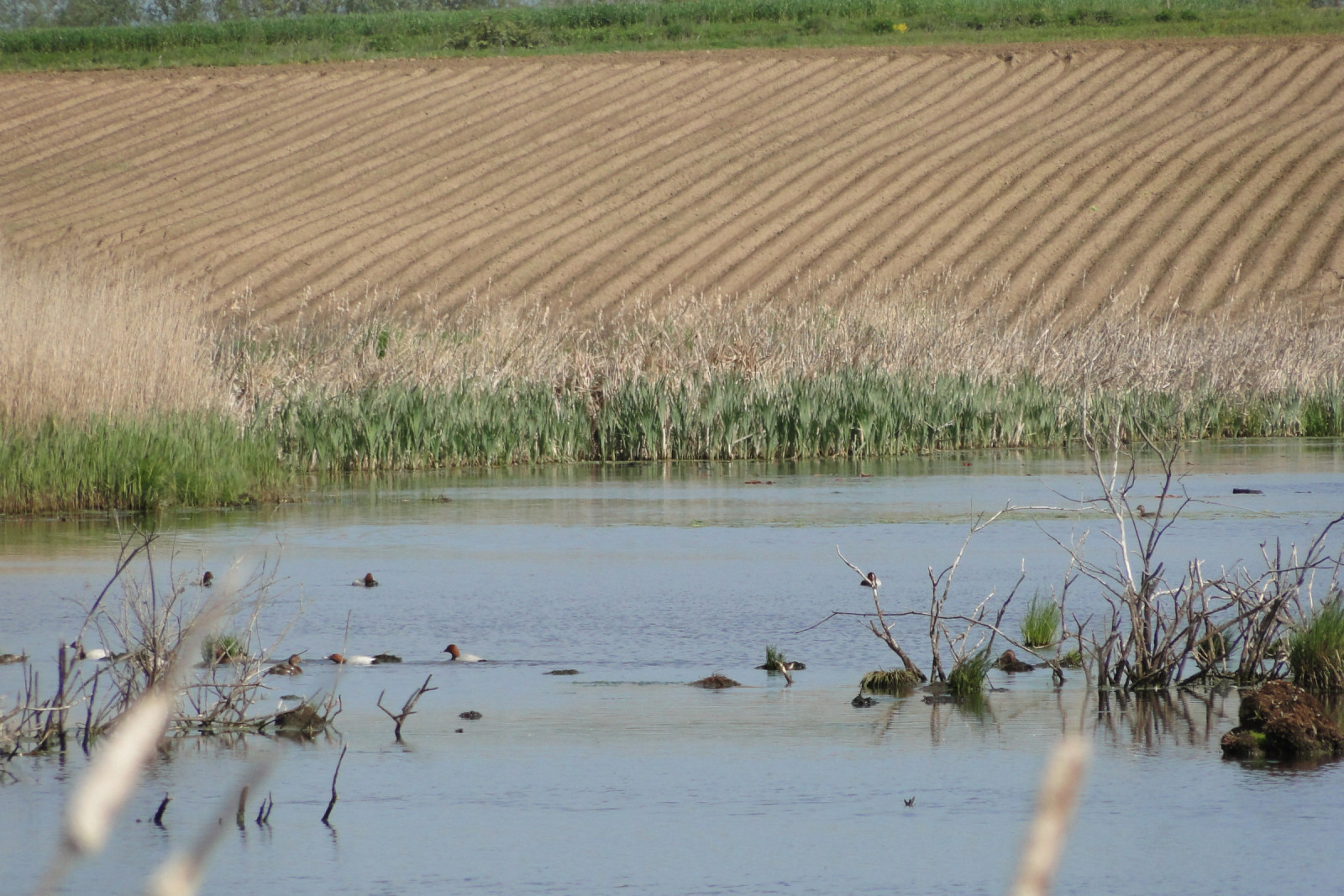
Permanent flooding among fields. From spring to summer usually many water birds, and when the water level is low also waders.
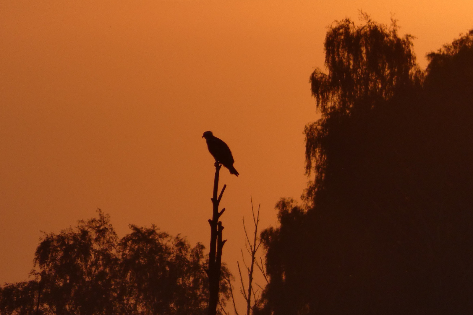
Łabędzie Rozlewisko is a mid-field backwater that is a breeding ground for Canard chipeau, Cygne tuberculé, Grèbe castagneux, Grèbe jougris, Mouette rieuse, Sterne pierregarin, Foulque macroule, Butor étoilé and Busard des roseaux. During the migration period, significant numbers of various ducks, and in favorable water level conditions, the possibility of observing Chevalier sylvain, Chevalier aboyeur, Combattant varié and Bécasseau variable. The place is a roost for Grue cendrée. Among predators, you can often find here: Pygargue à queue blanche, Balbuzard pêcheur and Aigle pomarin.
_________________________
Polski: Rozciągnięte rozlewisko, zwłaszcza jako miejsce lęgowe: Canard chipeau , Cygne tuberculé , Grèbe castagneux , Grèbe jougris , Mouette rieuse , Sterne pierregarin , Foulque macroule , Busard des roseaux , Butor étoilé. Na przelotach stada kaczkowatych, a przy odpowiednich warunkach Chevalier sylvain , Chevalier aboyeur , Combattant varié , Bécasseau variable . Noclegowisko Grue cendrée. Polowania Pygargue à queue blanche, Aigle pomarin i Balbuzard pêcheur.
The two best routes to get to Łabędzie Rozlewisko from the south: 1. By car in Benice turn left towards Ducin and behind the buildings take a dirt, bumpy road to the right to the very edge of the floodplain (may be impassable). 2. Park on the side of the road along the Benice-Chomino road and a marked footpath along the western edge of the floodplain (difficult, overgrown road).
_________________________
Polski: Dwie najlepsze trasy dojazdu od południa: 1. Samochodem w Benicach w lewo w kierunku Ducina i za zabudowaniami polną, wyboistą drogą w prawo do samego brzegu rozlewiska (może być nieprzejzdna). 2. Parkowanie na poboczu wzdłuż drogi Benice-Chomino i zaznaczoną ścieżką pieszo wzdłuż zachodniego brzegu rozlewiska (droga trudna, zarośnięta).
It is possible to walk along the entire western bank of the floodplain, but there are no roads or paths (the route leads through fields and wasteland).
_________________________
Polski: Można przejść wzdłuż całego zachodniego brzegu rozlewiska, ale nie ma dróg ani ścieżek (trasa prowadzi przez przez pola i nieużytki).
 ) Insérez les noms d'oiseau dans votre langue. Ils seront automatiquement traduits pour les autres usagers !
Votre feedback sera transmis à l’auteur.rice de cette zone et à l’équipe éditoriale de Birdingplaces, qui l’utiliseront pour améliorer la qualité des informations. (Vous souhaitez publier un commentaire visible en bas de page ? Fermez cette fenêtre et choisissez l’Option 1 : « Publier un commentaire, un conseil ou une observation ».)
Veuillez fournir des suggestions d'améliorations ou d'ajouts au texte de ce site ornithologique.
Veuillez fournir vos suggestions d'améliorations ou d'ajouts à la carte.
Veuillez fournir des suggestions d'améliorations ou d'ajouts à la liste des oiseaux.
Cliquez sur l'icône de l'oiseau () Insérez les noms d'oiseau dans votre langue. Ils seront automatiquement traduits pour les autres usagers !