


Charger images
Les formats d'image autorisés sont de type jpeg, png ou gif
La taille maximale du fichier doit être de 20MB
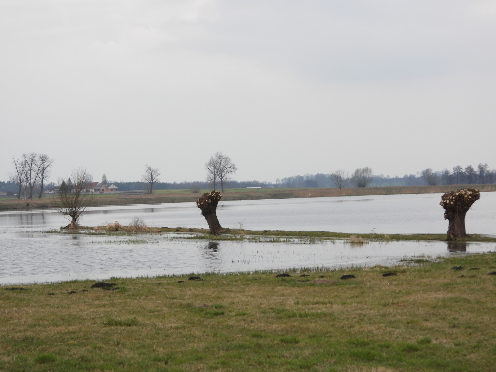

A vast floodplain along the Kościan (Obra River) Canal between Krzywiń and Jurkowo. During spring migration it is rich in various species of birds.
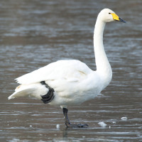
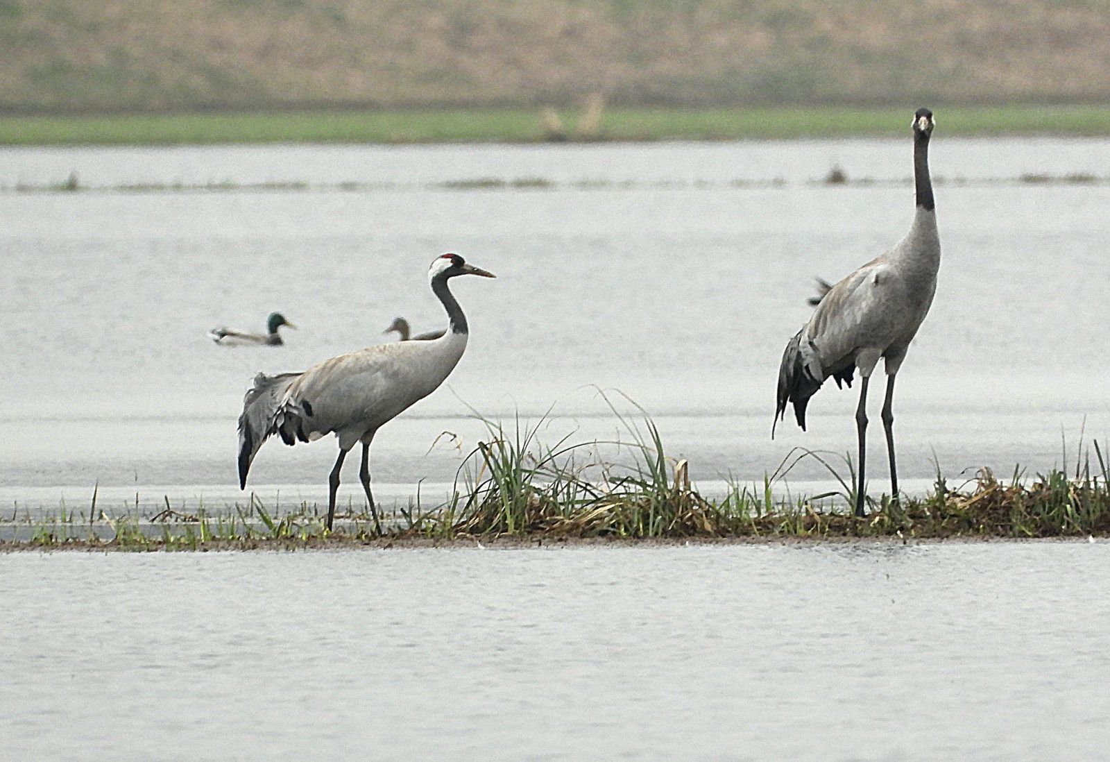
The Krzywiń Floodplains are surrounded by an area of a typical agricultural landscape in south-western Wielkopolska, shaped by a glacier (hilly). The birdwatching site consists of several viewpoints located between Krzywiń and village Jurkowo. In early spring, the meadows and reed beds located in the valley are flooded and then many migrating birds find shelter there, including Canard pilet, Sarcelle d'été, Canard siffleur, Combattant varié, Grue cendrée and many others.
____________________________
Polski: Sąsiedztwo to obszar typowego krajobrazu rolniczego południowo- zachodniej Wielkopolski, ukształtowanego przez lodowiec (pagórkowaty). Miejsce obserwacji ptaków składa się z kilku punktów widokowych znajdujących się pomiędzy miejscowościami Krzywiń i Jurkowo. W okresie wczesnej wiosny położone w dolinie łąki i trzcinowiska są zalewane i wówczas znajduje tam schronienie wiele wędrujących ptaków, wśród nich między innymi można wymienić: Canard pilet, Sarcelle d'été, Canard siffleur, Combattant varié, Grue cendrée.
The Krzywiń Floodplains area is relatively extensive, and the viewpoints are far apart. Therefore, it is best to move around the area by car or bicycle. Field roads lead directly to the observation points, which may be difficult to access for cars - in this case, the car should be left at the exit from the asphalt road and continue on foot. The total route marked on the map is about 15 km. The marked viewpoints are relatively small and the walk should not be difficult (the area may be wet). Click on a P in the map to get directions.
___________________________
Polski: Teren obserwacji, jest stosunkowo rozległy, a punkty widokowe są od siebie oddalone. W związku z tym najlepiej poruszać się w terenie samochodem lub rowerem. Bezpośrednio do miejsc obserwacji prowadzą w większości polne drogi, które mogą być trudno dostępne dla samochodów osobowych - w takim przypadku samochód należy pozostawić przy zjeździe z drogi asfaltowej i dalej ruszyć pieszo. Całkowita trasa dookoła według zaznaczonej marszruty wynosi około 15 km. Wskazane punkty widokowe są stosunkowo niewielkie i spacer nie powinien być uciążliwy (teren może być podmokły). Kliknij na P aby uzyskać wskazówki dojazdu.
In Krzywiń there is a historic wooden windmill, and at the viewpoint between Krzywiń and Jurkowo there are remains of a medieval stronghold.
_______________________
Polski: W Krzywiniu znajduje się zabytkowy wiatrak drewniany, a przy punkcie widokowym pomiędzy Krzywiniem i Jurkowem pozostałości średniowiecznego grodu.
 ) Insérez les noms d'oiseau dans votre langue. Ils seront automatiquement traduits pour les autres usagers !
Votre feedback sera transmis à l’auteur.rice de cette zone et à l’équipe éditoriale de Birdingplaces, qui l’utiliseront pour améliorer la qualité des informations. (Vous souhaitez publier un commentaire visible en bas de page ? Fermez cette fenêtre et choisissez l’Option 1 : « Publier un commentaire, un conseil ou une observation ».)
Veuillez fournir des suggestions d'améliorations ou d'ajouts au texte de ce site ornithologique.
Veuillez fournir vos suggestions d'améliorations ou d'ajouts à la carte.
Veuillez fournir des suggestions d'améliorations ou d'ajouts à la liste des oiseaux.
Cliquez sur l'icône de l'oiseau () Insérez les noms d'oiseau dans votre langue. Ils seront automatiquement traduits pour les autres usagers !