


Charger images
Les formats d'image autorisés sont de type jpeg, png ou gif
La taille maximale du fichier doit être de 20MB
An interesting area near national parks on the Polish side of the Oder River.
The observation site of Kaleńsko is a mixture of riverside areas, a pond (created after excavation), a meadow, and a forest. The place gathers birds typical of the lower Oder valley and interesting seasonal migrants. The terrain is flat and relatively easy to explore. There are artificial, floating nesting platforms for terns on the pond.
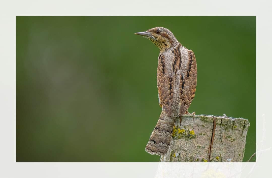
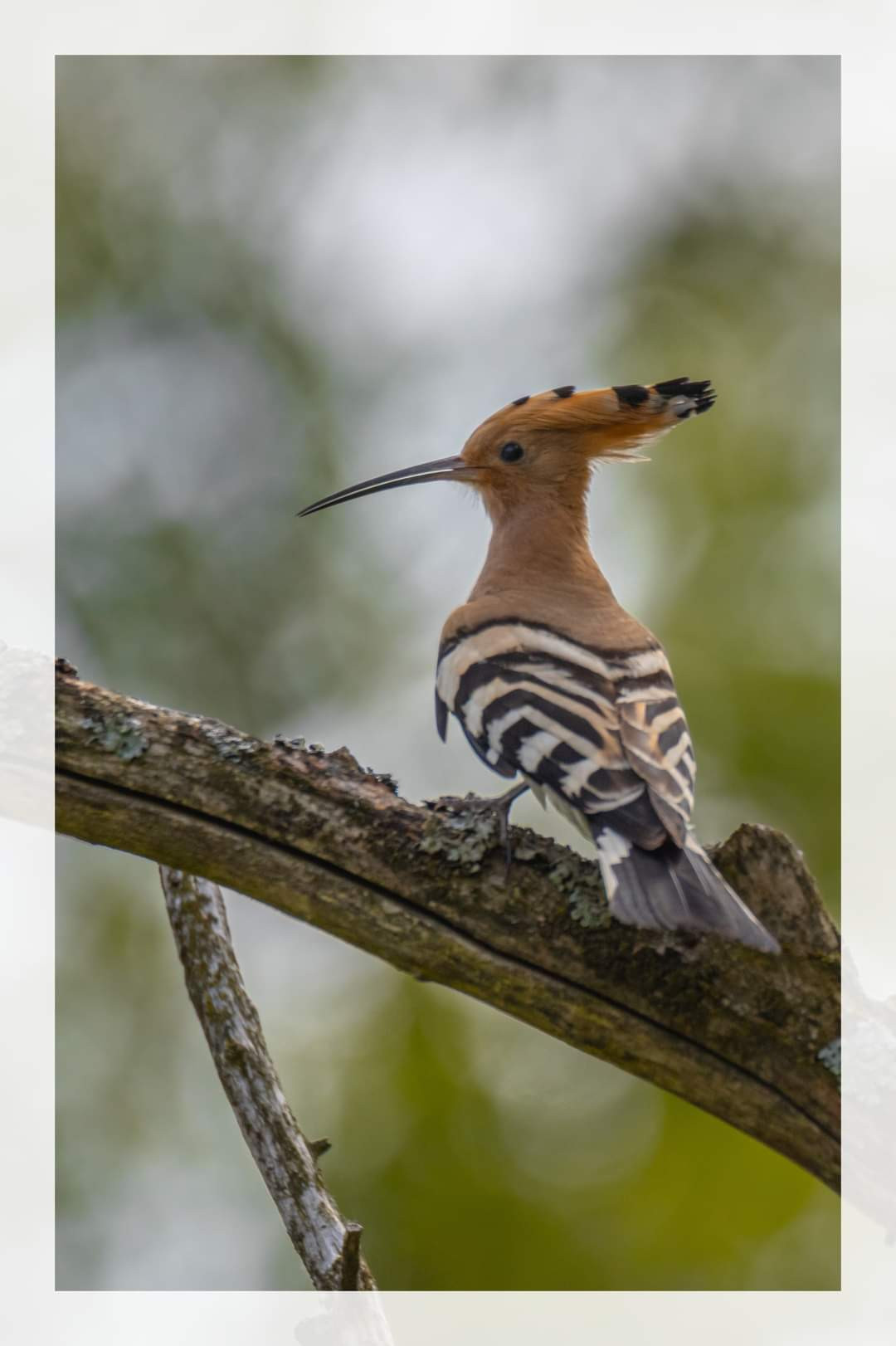
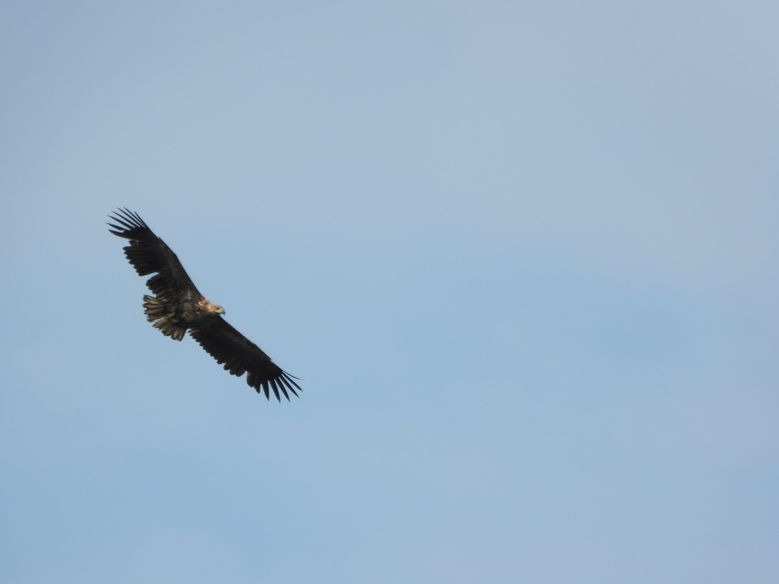
Among other things, you can meet here : Huîtrier pie, Cigogne noire, Grand Gravelot, Guifette noire, Sterne pierregarin, Guifette leucoptère, Guifette moustac, Huppe fasciée, Milan royal, Milan noir, Oie cendrée, Ouette d'Égypte, Vanneau huppé, Pygargue à queue blanche, Loriot d'Europe, Sterne naine.
_________________________
Polski: Miejsce obserwacji jest mieszanką terenów nadrzecznych, stawu (powstałego po wyrobisku), łaki, i lasu. Miejsce gromadzi ptaki charakterystyczne dla doliny dolnej Odry oraz ciekawych sezonowych migrantów. Teren jest płaski i stosunkowo łatwy do eksploracji. Na stawie znajdują się sztuczne, pływające platformy lęgowe dla rybitw.
Między innymi możesz tutaj spotkać: Huîtrier pie, Cigogne noire, Grand Gravelot, Guifette noire, Sterne pierregarin, Guifette leucoptère, Guifette moustac, Huppe fasciée, Milan royal, Milan noir, Oie cendrée, Ouette d'Égypte, Vanneau huppé, Pygargue à queue blanche, Loriot d'Europe, Sterne naine..
It's best to explore Kaleńsko on foot - the paths are sometimes overgrown with grass and not much paved. The easiest way to get there is by car and parking in the place indicated on the map. There is a convenient parking lot with benches and educational boards. Press on P in the map for directions.
_________________________
Polski: Miejsce najlepiej ekspolorować pieszo - ściezki miejscami są zarośnięte trawą i mało uczśszcznane. Na miejsce najłatwiej dojechać samochodem i zaparkować w miejscu wskazanym na mapie. Znajduje się tam wygodny parking z ławkami i tablicami edukacyjnymi. Kliknij na P aby uzyskać wskazówki dojazdu.
Nearby there are interesting historical places and two national parks - the Lower Oder Park on the western bank of the Oder and the Warta Mouth National Park on the eastern bank.
_________________________
Polski: W pobliżu znajdują się ciekawe miejsca historyczne oraz dwa parki narodowe - Park Dolnej Odry na zachodnim po brzegu Odry oraz Park Narodowy Ujście Warty na wschodnim brzegu.
 ) Insérez les noms d'oiseau dans votre langue. Ils seront automatiquement traduits pour les autres usagers !
Votre feedback sera transmis à l’auteur.rice de cette zone et à l’équipe éditoriale de Birdingplaces, qui l’utiliseront pour améliorer la qualité des informations. (Vous souhaitez publier un commentaire visible en bas de page ? Fermez cette fenêtre et choisissez l’Option 1 : « Publier un commentaire, un conseil ou une observation ».)
Veuillez fournir des suggestions d'améliorations ou d'ajouts au texte de ce site ornithologique.
Veuillez fournir vos suggestions d'améliorations ou d'ajouts à la carte.
Veuillez fournir des suggestions d'améliorations ou d'ajouts à la liste des oiseaux.
Cliquez sur l'icône de l'oiseau () Insérez les noms d'oiseau dans votre langue. Ils seront automatiquement traduits pour les autres usagers !