


Charger images
Les formats d'image autorisés sont de type jpeg, png ou gif
La taille maximale du fichier doit être de 20MB


A beautiful and swampy wet forest of mainly poplars and oaks that is good for birding and nice to walk in.
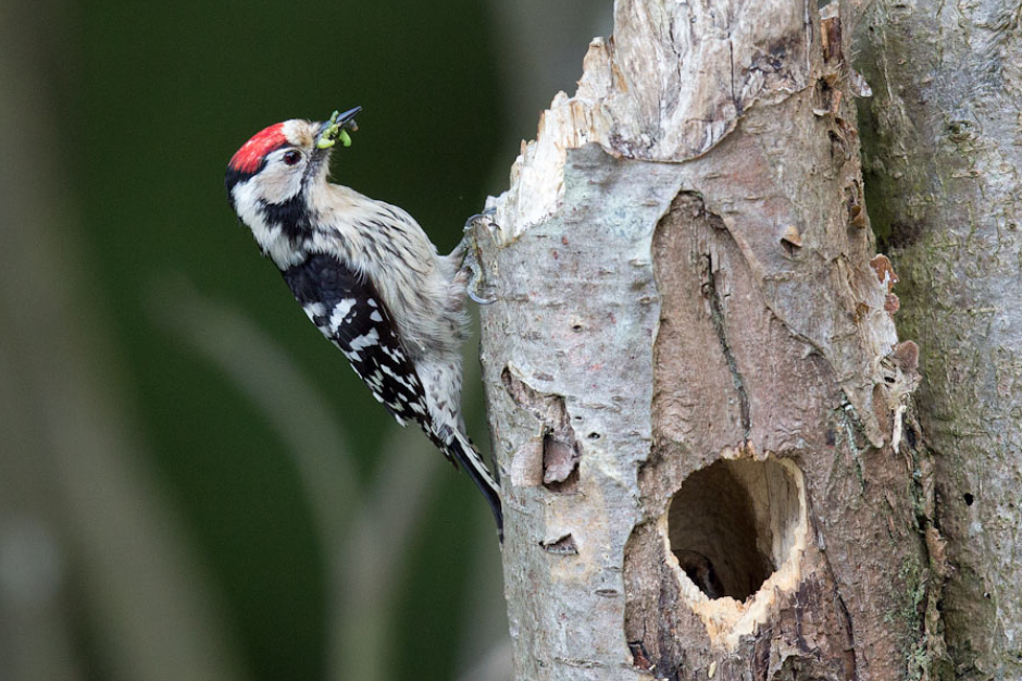
The Wijboschbroek is a nature reserve of 150 hectares wet forest north of the village of Schijndel. Many special plants grow here because of the loamy, wet and nutrient-rich soil of the forest. After the area was largely deforested, it became agricultural land in the nineteenth century with 'beemden' (hay meadows) on the lower, wet parts. In the twentieth century, the entire area again became forest with mainly poplars. Nowadays it's a beautiful forest for walking and in the spring the forest is full of birds. From Gobemouche noir and Pic épeichette (and four other species of woodpecker) to Loriot d'Europe.
_________________________
Nederlands: Het Wijboschbroek is een natuurgebied van 150 hectare nat bos ten noorden van het dorp Schijndel. Door de leemachtige, natte en voedselrijke bodem van het bos groeien hier veel bijzondere planten. Nadat het gebied grotendeels was ontbost, werd het in de negentiende eeuw landbouwgrond met op de lager gelegen, natte delen 'beemden' (hooilanden). In de twintigste eeuw werd het hele gebied weer bos met voornamelijk populieren. Tegenwoordig is het een prachtig bos om in te wandelen en vooral in de lente zit het bos vol vogels. Van Gobemouche noir en Pic épeichette (en vier andere soorten spechten) tot Loriot d'Europe.
You can park on the parking on the Aakendonk road (see the P on the map). From there you can make a nice circular walk of 6,5 km. It is a wet area, so bring waterproof shoes. The route is largely signposted with yellow triangles, but a few signs are missing. But the route is also marked on the map below, so if you open the map on your phone, you can also follow the route on your phone.
_________________________
Nederlands: Je kunt parkeren op de parkeerplaats aan de Aakendonkweg (Klik op de P in de kaart voor een routebeschrijving). Van daaruit kun je een mooie rondwandeling maken van 6,5 km. Het is een nat gebied, dus neem waterdichte schoenen mee. De route is grotendeels bewegwijzerd met gele driehoekjes, maar een paar bordjes ontbreken Maar de route staat ook aangegeven op de kaart hieronder, dus als je de kaart op je telefoon opent, kun je de route ook op je telefoon volgen.
 ) Insérez les noms d'oiseau dans votre langue. Ils seront automatiquement traduits pour les autres usagers !
Votre feedback sera transmis à l’auteur.rice de cette zone et à l’équipe éditoriale de Birdingplaces, qui l’utiliseront pour améliorer la qualité des informations. (Vous souhaitez publier un commentaire visible en bas de page ? Fermez cette fenêtre et choisissez l’Option 1 : « Publier un commentaire, un conseil ou une observation ».)
Veuillez fournir des suggestions d'améliorations ou d'ajouts au texte de ce site ornithologique.
Veuillez fournir vos suggestions d'améliorations ou d'ajouts à la carte.
Veuillez fournir des suggestions d'améliorations ou d'ajouts à la liste des oiseaux.
Cliquez sur l'icône de l'oiseau () Insérez les noms d'oiseau dans votre langue. Ils seront automatiquement traduits pour les autres usagers !