


Charger images
Les formats d'image autorisés sont de type jpeg, png ou gif
La taille maximale du fichier doit être de 20MB


Former production forests named after the nearby Peel air base. All Dutch species of woodpeckers and many other forest birds can be seen there.
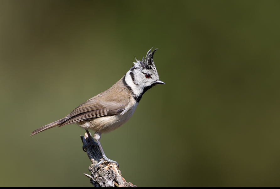
The Vliegveldbossen together with Testrik and Kempkesberg form a forest area of 471 ha. The forests are named after the Peel Air Base, to the east and south of which these forests lie. The trees were once planted for timber production. The relatively monotonous forests consist mainly of coniferous forests, but heather remnants and pieces of deciduous forest also occur. The 5 species of woodpeckers, birds of prey and other forest birds such as Gobemouche noir, Rougequeue à front blanc, Mésange huppée and Pipit des arbres make it a nice area for birders. On the south side, a former racing circuit was moved a number of years ago and the old terrain has been restored to nature and a large pool has been dug. This large open space is also a good place to watch birds.
_________________________
Nederlands: De Vliegveldbossen ten zuiden van het dorp Vredepeel vormen, samen met Testrik en Kempkesberg, een bosgebied van 471 ha. De bossen zijn vernoemd naar de Vliegbasis de Peel, ten oosten en ten zuiden waarvan deze bossen liggen. De bomen zijn ooit aangeplant op woeste peelgronden ten behoeve van houtproductie. De relatief monotone bossen bestaan voornamelijk uit naaldhout, maar ook heiderestanten en stukjes loofbos komen voor. De 5 soorten spechten, roofvogels en andere bosvogels zoals Gobemouche noir, Rougequeue à front blanc, Mésange huppée en Pipit des arbres maken het voor vogelaars toch een aardig gebied. Aan de zuidkant is een aantal jaren geleden een voormalig racecircuit verplaatst en het oude terrein is teruggeven aan de natuur en er is een grote poel gegraven. Deze grote open plek is ook een goede plek om vogels te kijken.
On the south side of the area by the Bakelsedijk you can park at the former race circuit and explore the area on foot from there. The circulare route on the map is 4 km long.
_________________________
Nederlands: Aan de zuidkant van het gebied bij de Bakelsedijk kun je parkeren bij het voormalige racecircuit en van daaruit te voet het gebied verkennen. De route op de kaart hieronder is 4 km lang.
 ) Insérez les noms d'oiseau dans votre langue. Ils seront automatiquement traduits pour les autres usagers !
Votre feedback sera transmis à l’auteur.rice de cette zone et à l’équipe éditoriale de Birdingplaces, qui l’utiliseront pour améliorer la qualité des informations. (Vous souhaitez publier un commentaire visible en bas de page ? Fermez cette fenêtre et choisissez l’Option 1 : « Publier un commentaire, un conseil ou une observation ».)
Veuillez fournir des suggestions d'améliorations ou d'ajouts au texte de ce site ornithologique.
Veuillez fournir vos suggestions d'améliorations ou d'ajouts à la carte.
Veuillez fournir des suggestions d'améliorations ou d'ajouts à la liste des oiseaux.
Cliquez sur l'icône de l'oiseau () Insérez les noms d'oiseau dans votre langue. Ils seront automatiquement traduits pour les autres usagers !