


Charger images
Les formats d'image autorisés sont de type jpeg, png ou gif
La taille maximale du fichier doit être de 20MB
-Oerdblinkert, Ameland, Friesland (1).JPG)
-Oerdblinkert, Ameland, Friesland (3).JPG)
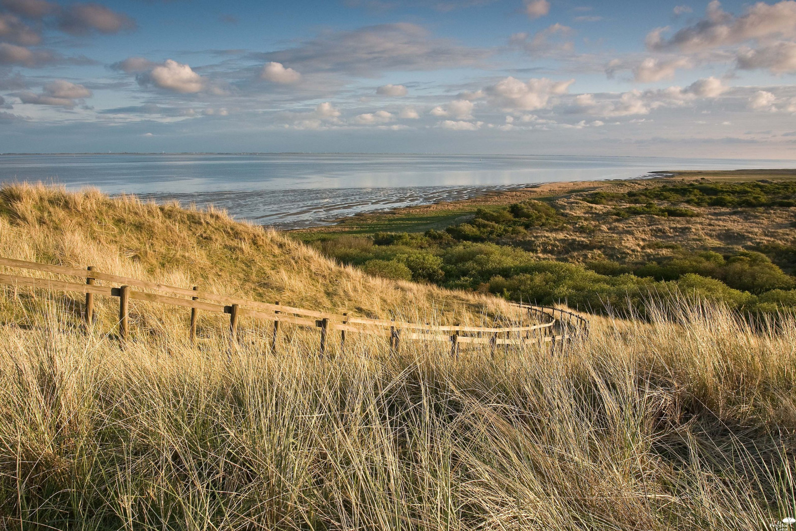
Landscape of old high dunes, salt marshes and moist dune valleys where seawater flows in and out freely through channels. Very rich in birds.
The Oerd is a relatively extensive nature reserve on the east side of the Dutch Wadden Sea island of Ameland. It is an old and overgrown dune complex, of which the Oerdblinkert with 24 meters is the highest dune on the island. At the foot of this is a hide, at the top is an information panel and an orientation table. The landscape consists of old high dunes and moist dune valleys where the seawater flows in and out freely through channels. Many types of birds, both migratory and breeding birds. In the eastern part of the old dunes is a huge Goéland argenté colony with about 3,000 pairs. The Goéland cendré also has some breeding colonies there. Other breeding birds include Busard Saint-Martin, Courlis cendré, Avocette élégante, Sterne pierregarin, Traquet motteux and Locustelle tachetée.
_________________________
Nederlands: Het Oerd is een relatief omvangrijk natuurgebied aan de oostzijde van het Nederlandse waddeneiland Ameland. Het is een oud en begroeid duinencomplex, waarvan de Oerdblinkert met 24 meter het hoogste duin van het eiland is. Aan de voet hiervan staat een schuilhut, op de top staat een informatiepaneel en een oriëntatietafel. Dit is een goede plek om kiekendieven te zien jagen. Met wat geluk heb je ook kans om hier een velduil te zien. Het landschap bestaat uit oude hoge duinen, kwelders en vochtige duinvalleien waar het zeewater via geulen vrij in- en uitstroomt. Veel soorten vogels, zowel trekvogels als broedvogels. In het oostelijke gedeelte van de oude duinen zit een enorme zilvermeeuwkolonie met zo'n 3000 paren. Ook de stormmeeuw heeft er enkele broedkolonies. Andere broedvogels zijn onder meer de blauwe en bruine kiekendief, wulp, kluut, visdief, tapuit en sprinkhaanzanger.
Only accessible by bike or on foot. On the map you see a circular walk of 4 km through the Oerd area wich also passes the Oerdblinkert.
_________________________
Nederlands: Alleen bereikbaar met de fiets of lopend. Op de kaart zie je een rondwandeling van 4 km door het gebied die ook langs de Oerdblinkert loopt.
 ) Insérez les noms d'oiseau dans votre langue. Ils seront automatiquement traduits pour les autres usagers !
Votre feedback sera transmis à l’auteur.rice de cette zone et à l’équipe éditoriale de Birdingplaces, qui l’utiliseront pour améliorer la qualité des informations. (Vous souhaitez publier un commentaire visible en bas de page ? Fermez cette fenêtre et choisissez l’Option 1 : « Publier un commentaire, un conseil ou une observation ».)
Veuillez fournir des suggestions d'améliorations ou d'ajouts au texte de ce site ornithologique.
Veuillez fournir vos suggestions d'améliorations ou d'ajouts à la carte.
Veuillez fournir des suggestions d'améliorations ou d'ajouts à la liste des oiseaux.
Cliquez sur l'icône de l'oiseau () Insérez les noms d'oiseau dans votre langue. Ils seront automatiquement traduits pour les autres usagers !