


Charger images
Les formats d'image autorisés sont de type jpeg, png ou gif
La taille maximale du fichier doit être de 20MB

Munnikenland is the name of the extreme western part of the Bommelerwaard. A birdrich headland between the confluent rivers Waal and the Afgedamde Maas.
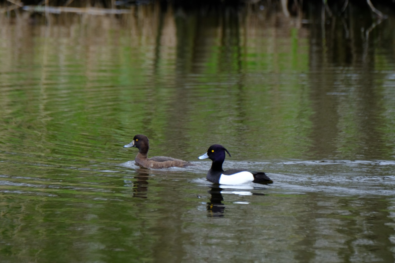
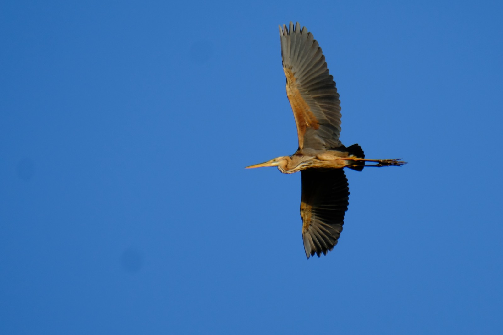
Munnikenland is a wetland nature reserve in the western tip of the province of Gelderland, near the famous Slot Loevestein (castle). Free-living herds of large grazers migrate through the nature reserve, which contribute to the natural wealth in the area and helps to keep the landscape open. It is a nice area for walking and bird watching. Especially in spring , when migrating birds pass through and many birds can be seen. Among the birds you can see here are Oie cendrée, Oie rieuse, Bernache nonnette, Bernache du Canada, Héron pourpré, Aigrette garzette, Butor étoilé, Pic épeiche and Martin-pêcheur d'Europe. The Pygargue à queue blanche and Balbuzard pêcheur are regularly spotted here. You can also see sleeping places of Grand Cormoran and in the right time of the year at sunset swarms of Étourneau sansonnet that dive into the reeds to rest.
_________________________
Nederlands: Munnikenland is de naam van het uiterste westen van de Bommelerwaard. Een vogelrijke landtong tussen de samenvloeiende rivieren de Waal en de Afgedamde Maas. Munnikenland ligt vlakbij Slot Loevestein. Kuddes grote grazers trekken door het natuurgebied, wat bijdraagt aan de natuurlijke rijkdom in het gebied en helpt het landschap open te houden. Het is een mooi gebied om te wandelen en vogels te kijken. Vooral in het voorjaar en tijdens de vogeltrek zijn er veel vogels te zien. Vogels die je hier kunt zien zijn Oie cendrée, Oie rieuse, Bernache nonnette, Bernache du Canada, Héron pourpré, Aigrette garzette, Butor étoilé, Pic épeiche en Martin-pêcheur d'Europe. De Pygargue à queue blanche en Balbuzard pêcheur worden hier regelmatig gespot. Ook zie je slaapplaatsen van Grand Cormoran en in de juiste tijd van het jaar bij zonsondergang zie je zwermen Étourneau sansonnet die in het riet duiken om te rusten.
There is a parking at the beginning of the area (see the P on the map). From there you can explore the area on foot. Depending of the height of the river which parts of the area you can explore. The area may be wet. So bring boots or waterproof high walking shoes! The route that is shown on the map is about 9 km.
_________________________
Nederlands: Er is een parkeerplaats bij het begin van het gebied (zie de P op de plattegrond). Van daaruit kun je de omgeving te voet verkennen. Afhankelijk van de hoogte van het waterpeil kun je de diverse delen van het gebied verkennen. Het gebied kan nat zijn. Dus neem laarzen of waterdichte hoge wandelschoenen mee! De route die op de kaart wordt weergegeven, is ongeveer 9 km.
 ) Insérez les noms d'oiseau dans votre langue. Ils seront automatiquement traduits pour les autres usagers !
Votre feedback sera transmis à l’auteur.rice de cette zone et à l’équipe éditoriale de Birdingplaces, qui l’utiliseront pour améliorer la qualité des informations. (Vous souhaitez publier un commentaire visible en bas de page ? Fermez cette fenêtre et choisissez l’Option 1 : « Publier un commentaire, un conseil ou une observation ».)
Veuillez fournir des suggestions d'améliorations ou d'ajouts au texte de ce site ornithologique.
Veuillez fournir vos suggestions d'améliorations ou d'ajouts à la carte.
Veuillez fournir des suggestions d'améliorations ou d'ajouts à la liste des oiseaux.
Cliquez sur l'icône de l'oiseau () Insérez les noms d'oiseau dans votre langue. Ils seront automatiquement traduits pour les autres usagers !