


Charger images
Les formats d'image autorisés sont de type jpeg, png ou gif
La taille maximale du fichier doit être de 20MB
_0.jpg)
_0.jpg)
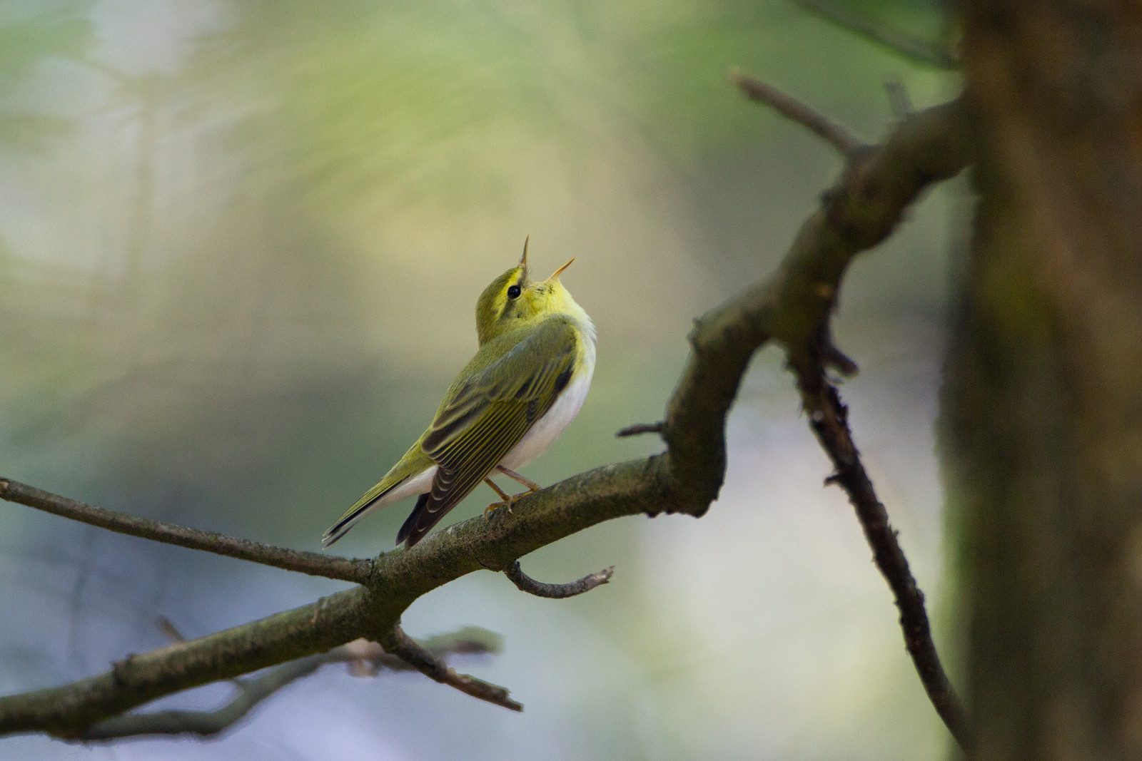
Nice walk through mixed forest. The Meiersbos is visited relatively little and the paths are therefore often pleasantly quiet. Good for seeing forest birds.
Nice 7 km walk through mixed forest. The Meiersbos used to be part of the Eerde Estate. You can still recognize the estate character along the way from the rhododendron bushes, the beech avenues and, for example, the tomb of the estate. The Meiersbos is good for seeing forest birds like Pic épeiche, Pic mar, Pic noir, Grand Corbeau, Mésange noire, Mésange huppée, Sittelle torchepot, Grimpereau des jardins, Gobemouche noir, Pouillot siffleur, Pinson des arbres, Gros-bec casse-noyaux and Tarin des aulnes.
_________________________
Nederlands: Mooie wandeling van 7 km door gemengd bos. Het Meiersbos wordt relatief weinig bezocht en de paden zijn er dus vaak aangenaam rustig. Het Meiersbos is onderdeel van de boswachterij Ommen (762 hectare) en maakte vroeger deel uit van het Landgoed Eerde. Het landgoedkarakter kun je onderweg nog herkennen aan de rododendronstruiken, de beukenlanen en bijvoorbeeld de graftombe van het landgoed. Het Meiersbos is goed voor het zien van bosvogels als Pic épeiche, Pic mar, Pic noir, Grand Corbeau, Mésange noire, Mésange huppée, Sittelle torchepot, Grimpereau des jardins, Gobemouche noir, Pouillot siffleur, Pinson des arbres, Gros-bec casse-noyaux en Tarin des aulnes.
The big Meiersbos parking lot is hidden in the forest and is not signposted from the road. Click on the P in the map for directions. A marked walking route (yellow arrows) of 7 km starts from the parking lot. Excellent marking of the route. However, at one place along the way the marking is a bit unclear (this place is marked on the map with a star).
_________________________
Nederlands: De ruime parkeerplaats van het Meiersbos ligt verscholen in het bos en staat vanaf de weg niet aangegeven. Klik op de P in de kaart voor een routebeschrijving. Vanaf de parkeerplaats start een gemarkeerde wandelroute (gele pijltjes) van 7 km. Uitstekende markering van de route. Op één plek onderweg is de markering echter een beetje onduidelijk (deze plek is op de kaart aangegeven met een ster).
 ) Insérez les noms d'oiseau dans votre langue. Ils seront automatiquement traduits pour les autres usagers !
Votre feedback sera transmis à l’auteur.rice de cette zone et à l’équipe éditoriale de Birdingplaces, qui l’utiliseront pour améliorer la qualité des informations. (Vous souhaitez publier un commentaire visible en bas de page ? Fermez cette fenêtre et choisissez l’Option 1 : « Publier un commentaire, un conseil ou une observation ».)
Veuillez fournir des suggestions d'améliorations ou d'ajouts au texte de ce site ornithologique.
Veuillez fournir vos suggestions d'améliorations ou d'ajouts à la carte.
Veuillez fournir des suggestions d'améliorations ou d'ajouts à la liste des oiseaux.
Cliquez sur l'icône de l'oiseau () Insérez les noms d'oiseau dans votre langue. Ils seront automatiquement traduits pour les autres usagers !