


Charger images
Les formats d'image autorisés sont de type jpeg, png ou gif
La taille maximale du fichier doit être de 20MB
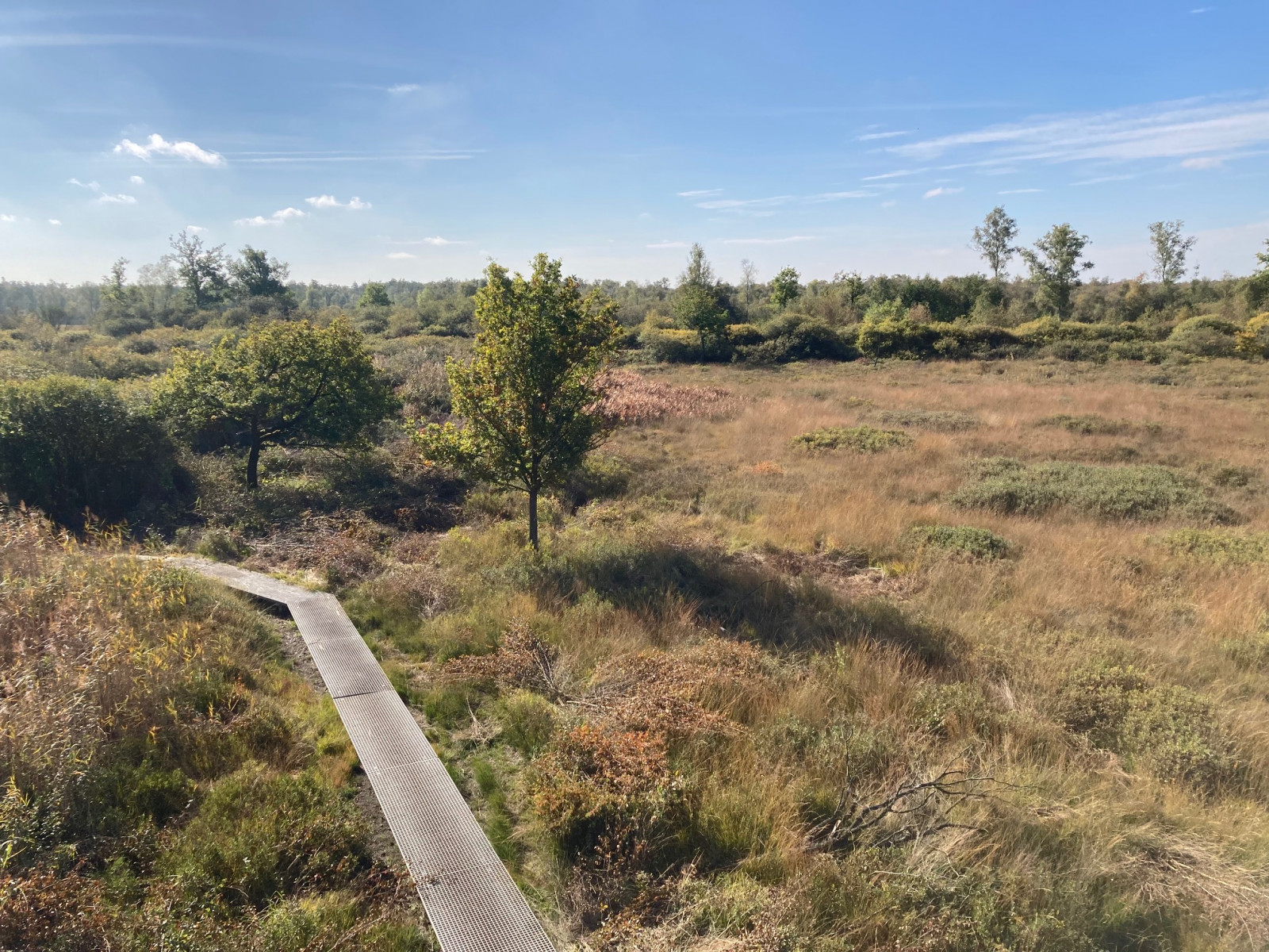

The Meddose Veen is part of the larger Korenburgerveen and consists of a beautiful variety of landscapes and therefore many species of birds!
The "Meddose Veen" is part of the larger Korenburgerveen and consists of a beautiful variety of landscapes, like peat lands, swamps, forests and open grasslands. The area is also famous for its rare breeding species: Grue cendrée. During the breeding season, you can observe flying adults (and sometimes juveniles).
The area is home to many species of breeding songbird, like Gorgebleue à miroir, Coucou gris and Bouvreuil pivoine. In the peat land area, small flocks of Bécassine des marais can be seen flying from one area to the next. The scattered bushes are great for singing Bruant jaune. The forests are great for woodpeckers and typical species, like Mésange huppée and Mésange noire. Several viewing points next to the route are good for observing waders, like Chevalier sylvain, Chevalier aboyeur and Chevalier arlequin.
_________________________
Nederlands: Het Meddose Veen maakt deel uit van het grotere Korenburgerveen en bestaat uit een prachtige afwisseling van landschappen, zoals veengebieden, moerassen, bossen en open graslanden. Het gebied staat ook bekend om zijn zeldzame broedsoort Grue cendrée. Tijdens het broedseizoen kun je vliegende adulten (en soms juvenielen) tegenkomen!
Het gebied is de thuisbasis van vele soorten broedende zangvogels, zoals Gorgebleue à miroir, Coucou gris en Bouvreuil pivoine. In het veengebied zie je kleine zwermen Bécassine des marais van het ene gebied naar het andere vliegen. De verspreide struiken zijn geweldig om zingende Bruant jaune te zien. De bossen zijn goed voor spechten en soorten zoals Mésange huppée en Mésange noire. Verschillende uitkijkpunten langs de route zijn goed voor het observeren van steltlopers, zoals Chevalier sylvain, Chevalier aboyeur en Chevalier arlequin.
The Meddose Veen is located northwest of the city of Winterswijk. Press P on the map for directions to the parking lot. The area has typical wooden paths which lead you over the wet areas. These paths are very narrow and you can fall off when losing your balance. Also, the sandy parts of the route can be muddy. The circular walking route indicated on the map is about 3,5 km long.
_________________________
Nederlands: Het Meddose Veen ligt ten noordwesten van Winterswijk. Druk op P in de kaart voor een routebeschrijving naar de parkeerplaats. Het gebied heeft verhoogde houten paden die je over de natte gebieden leiden. Deze paden zijn erg smal en je kunt eraf vallen als je uit balans raakt. Ook kunnen de zanderige delen van de route modderig zijn. De wandelroute die is aangegeven op de kaart is ongeveer 3,5 km lang. De uitkijktoren die ooit in het gebied aanwezig was, is afgebroken.
 ) Insérez les noms d'oiseau dans votre langue. Ils seront automatiquement traduits pour les autres usagers !
Votre feedback sera transmis à l’auteur.rice de cette zone et à l’équipe éditoriale de Birdingplaces, qui l’utiliseront pour améliorer la qualité des informations. (Vous souhaitez publier un commentaire visible en bas de page ? Fermez cette fenêtre et choisissez l’Option 1 : « Publier un commentaire, un conseil ou une observation ».)
Veuillez fournir des suggestions d'améliorations ou d'ajouts au texte de ce site ornithologique.
Veuillez fournir vos suggestions d'améliorations ou d'ajouts à la carte.
Veuillez fournir des suggestions d'améliorations ou d'ajouts à la liste des oiseaux.
Cliquez sur l'icône de l'oiseau () Insérez les noms d'oiseau dans votre langue. Ils seront automatiquement traduits pour les autres usagers !