


Charger images
Les formats d'image autorisés sont de type jpeg, png ou gif
La taille maximale du fichier doit être de 20MB


Nature reserve near Breda around the valley of the Mark stream. Good hiking trails and cycling paths, with possibility to visit the nearby the Mastbos forest.
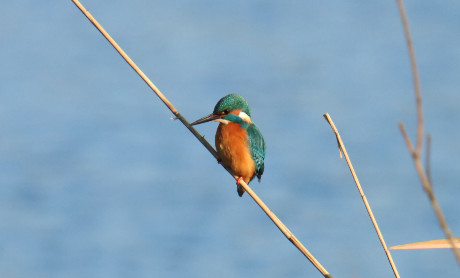
The Markdal is a green meadow valley and water area near Breda around the brook De Mark. You will find waterfowl such as Canard chipeau, Tadorne de Belon and Canard colvert, but sometimes also other nice birds, such as Cigogne blanche (with nest) Martin-pêcheur d'Europe, Épervier d'Europe, Spatule blanche en Rousserolle effarvatte. The area has a beautifully landscaped walking path (unpaved) and cycling path (paved) that starts in the city of Breda and continues to the Belgian border. In wet weather, the walking path can only be walked in boots. You can also easily make the shortcut to the nearby Mastbos.
_________________________
Nederlands: Het Markdal is een groen weide en watergebied bij Breda rondom de beek De Mark. Je vind er watervogels zoals Canard chipeau, Tadorne de Belon en Canard colvert, maar soms ook andere mooie soorten, zoals Cigogne blanche (met nest), Martin-pêcheur d'Europe, Épervier d'Europe, Spatule blanche en Rousserolle effarvatte. Het gebied heeft een mooi aangelegd wandelpad (onverhard) en fietspad (verhard) dat begint in de Bredase wijk Ginneken nabij horecagelegenheden en doorloopt tot aan de Belgische grens. Bij nat weer is het wandelpad deels alleen te lopen met laarzen aan. Ook kun je gemakkelijk de doorsteek maken naar het nabijgelegen Mastbos.
You can explore the area on foot or by bike. If you come on foot or by bike, the starting point of the walking/cycling path is easy to reach from the Duivelsbrug. If you come by car, you can park at Restaurant Bouvigne Paradijs or at De Kogelvanger Eten & Drinks on the Galderseweg and walk/cycle into the area from there. You can also go through it by canoe/kayak, but not with a motorized boat, as there are a number of locks in the water (crossing area available for the canoe/kayak). Click on a P in the map for directions.
_________________________
Nederlands: Je kunt het gebied zowel te voet als met de fiets verkennen. Kom je te voet of met de fiets, dan is het startpunt van het wandel/fietspad gemakkelijk te bereiken vanaf de Duivelsbrug. Kom je met de auto, dan kun je parkeren bij Restaurant Bouvigne Paradijs of bij De Kogelvanger Eten & drinken aan de Galderseweg en vanaf daar het gebied in lopen/fietsen. Je kunt er ook doorheen met de kano/kajak/sup, maar niet met een gemotoriseerde boot, aangezien er een aantal sluizen in het water zitten (oversteekplaats aanwezig voor de kano/kajak/sup). Klik op een P in de kaart voor een routebeschrijving.
 ) Insérez les noms d'oiseau dans votre langue. Ils seront automatiquement traduits pour les autres usagers !
Votre feedback sera transmis à l’auteur.rice de cette zone et à l’équipe éditoriale de Birdingplaces, qui l’utiliseront pour améliorer la qualité des informations. (Vous souhaitez publier un commentaire visible en bas de page ? Fermez cette fenêtre et choisissez l’Option 1 : « Publier un commentaire, un conseil ou une observation ».)
Veuillez fournir des suggestions d'améliorations ou d'ajouts au texte de ce site ornithologique.
Veuillez fournir vos suggestions d'améliorations ou d'ajouts à la carte.
Veuillez fournir des suggestions d'améliorations ou d'ajouts à la liste des oiseaux.
Cliquez sur l'icône de l'oiseau () Insérez les noms d'oiseau dans votre langue. Ils seront automatiquement traduits pour les autres usagers !