


Charger images
Les formats d'image autorisés sont de type jpeg, png ou gif
La taille maximale du fichier doit être de 20MB


Lake in the city of Deventer that was created as a result of a dike breach in the river IJssel. The lake is surrounded by forest, reed fields and grasslands.
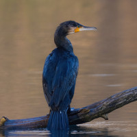
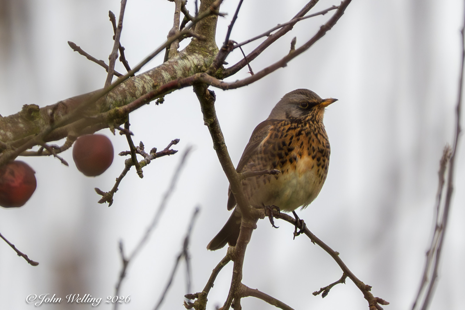
The Douwelerkolk was created as a result of a dike breach in the river IJssel. The area consists of marsh forests, reed and rush vegetation, damp roughs and drier grasslands. Due to the alternation of wet and dry, the different soil types and the natural management, this area attracts quite a few birds for an area that is enclosed by the city. Birds that you can see here include: Grèbe castagneux, Pic épeiche, Martin-pêcheur d'Europe, Fauvette à tête noire, Grande Aigrette, Grand Cormoran, Canard chipeau and Sarcelle d'hiver.
_________________________
Nederlands: De Douwelerkolk is het restant van een oude IJsselarm en ontstaan als gevolg van een dijkdoorbraak van de IJssel. De kolk ligt op de grens van het rivierenlandschap en het dekzandlandschap en bestaat uit moerasbosjes, riet- en biezenvegetaties, vochtige ruigten en drogere graslanden. Door de afwisseling van nat en droog, de verschillende grondsoorten en het natuurlijke beheer trekt dit dit gebied redelijk wat vogels voor een gebied dat is ingesloten door de stad. Vogels die je hier kunt zien zijn onder meer Grèbe castagneux, Pic épeiche, Martin-pêcheur d'Europe, Fauvette à tête noire, Grande Aigrette, Grand Cormoran, Canard chipeau en Sarcelle d'hiver.
The Douwelerkolk is enclosed by the city of Deventer. You can easily reach the area on foot or by bike from Deventer. Parking is available at the sports fields. Press P on the map for directions to the parking lot. The circular walk on the map is approximately 4 km.
_________________________
Nederlands: De Douwelerkolk is ingesloten door de stad Deventer. Je kunt het gebied te voet of met de fiets gemakkelijk vanuit Deventer bereiken. Parkeren kan bij de sportvelden. Druk op P in de kaart voor een routebeschrijving naar de parkeerplaats. De rondwandeling op de kaart is ongeveer 4 km.
 ) Insérez les noms d'oiseau dans votre langue. Ils seront automatiquement traduits pour les autres usagers !
Votre feedback sera transmis à l’auteur.rice de cette zone et à l’équipe éditoriale de Birdingplaces, qui l’utiliseront pour améliorer la qualité des informations. (Vous souhaitez publier un commentaire visible en bas de page ? Fermez cette fenêtre et choisissez l’Option 1 : « Publier un commentaire, un conseil ou une observation ».)
Veuillez fournir des suggestions d'améliorations ou d'ajouts au texte de ce site ornithologique.
Veuillez fournir vos suggestions d'améliorations ou d'ajouts à la carte.
Veuillez fournir des suggestions d'améliorations ou d'ajouts à la liste des oiseaux.
Cliquez sur l'icône de l'oiseau () Insérez les noms d'oiseau dans votre langue. Ils seront automatiquement traduits pour les autres usagers !