


Charger images
Les formats d'image autorisés sont de type jpeg, png ou gif
La taille maximale du fichier doit être de 20MB
Woodland, open heathland and fens. Relatively small and slightly hilly area with nice views.
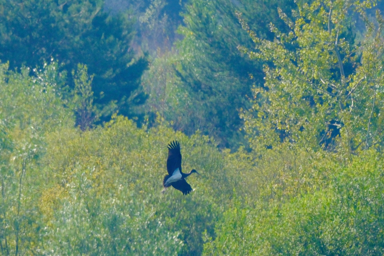
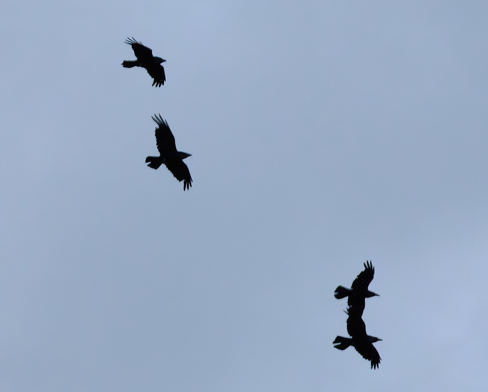
Dikkenberg is a relatively small area with nice relief in the landscape. Open heathland near old fen area and mixed forest. Thanks to the relief you have a nice view of a fen called 'oude Heerenven' (bring a telescope) to see water birds. The Engoulevent d'Europe is seen and heard on the heathland. There is a roofed bird hide at the other fen the 'Westmeerven'. In the summer it is also a beautiful place for butterflies and dragonflies. Birds that are seen in and around Dikkenberg include Milan royal, Bondrée apivore, Loriot d'Europe, Canard pilet, Gobemouche noir and Grand Corbeau.
_________________________
Nederlands: Dikkenberg is een relatief klein gebied met mooi relief in het landschap. Open heide landschap in de buurt van oud vengebied en gemengd bos. Dankzij het relief heb je een mooi uitzicht op het oude Heerenven (telescoop meenemen) om watervogels te zien. Op de heide wordt de Engoulevent d'Europe gezien en gehoord. Er is een vogelkijkhut bij het Westmeerven. In de zomer ook mooie plek voor vlinders en libellen. Vogels die in en rond Dikkenberg worden gezien zijn onder meer Milan royal, Bondrée apivore, Loriot d'Europe, Canard pilet, Gobemouche noir en Grand Corbeau.
Dikkenberg is part of the Maasduinen National Park and is located between the village of Wellerlooi and the De Hamert estate. There is a small parking lot at the end of the Paaldijk. Press P on the map for directions. The walking route indicated on the map is approximately 6 km.
_________________________
Nederlands: Dikkenberg is onderdeel van Nationaal Park Maasduinen en ligt tussen het plaatje Wellerlooi en landgoed De Hamert. Aan het einde van de Paaldijk is een kleine parkeerplaats. Druk op de P in de kaart voor een routebeschrijving. De wandelroute die is aangegeven op de kaart is ongeveer 6 km.
The Dutch province of Limburg offers some good birdwatching possibilities, but Maasduinen National Park is possibly the best. The Hamert Estate covers a large area of heath, mixed forest and bogs that attract a large variety of bird species. Immerse yourself in this beautiful nature reserve with a professional guide.
Kelvin Klaassen is a spirited nature- and bird guide who knows this area like the back of his hand. He organises bird tours for groups and individuals throughout the year, and will show you countless birds around Maasduinen National Park.
Discuss the possibilities with Kelvin. Every tour is made in accordance with your wishes and birding watching needs. Tours are available in English and Dutch. For more information about the options, tours, prices, and contact details, please visit his website Nature with Kelvin.
 ) Insérez les noms d'oiseau dans votre langue. Ils seront automatiquement traduits pour les autres usagers !
Votre feedback sera transmis à l’auteur.rice de cette zone et à l’équipe éditoriale de Birdingplaces, qui l’utiliseront pour améliorer la qualité des informations. (Vous souhaitez publier un commentaire visible en bas de page ? Fermez cette fenêtre et choisissez l’Option 1 : « Publier un commentaire, un conseil ou une observation ».)
Veuillez fournir des suggestions d'améliorations ou d'ajouts au texte de ce site ornithologique.
Veuillez fournir vos suggestions d'améliorations ou d'ajouts à la carte.
Veuillez fournir des suggestions d'améliorations ou d'ajouts à la liste des oiseaux.
Cliquez sur l'icône de l'oiseau () Insérez les noms d'oiseau dans votre langue. Ils seront automatiquement traduits pour les autres usagers !