


Charger images
Les formats d'image autorisés sont de type jpeg, png ou gif
La taille maximale du fichier doit être de 20MB
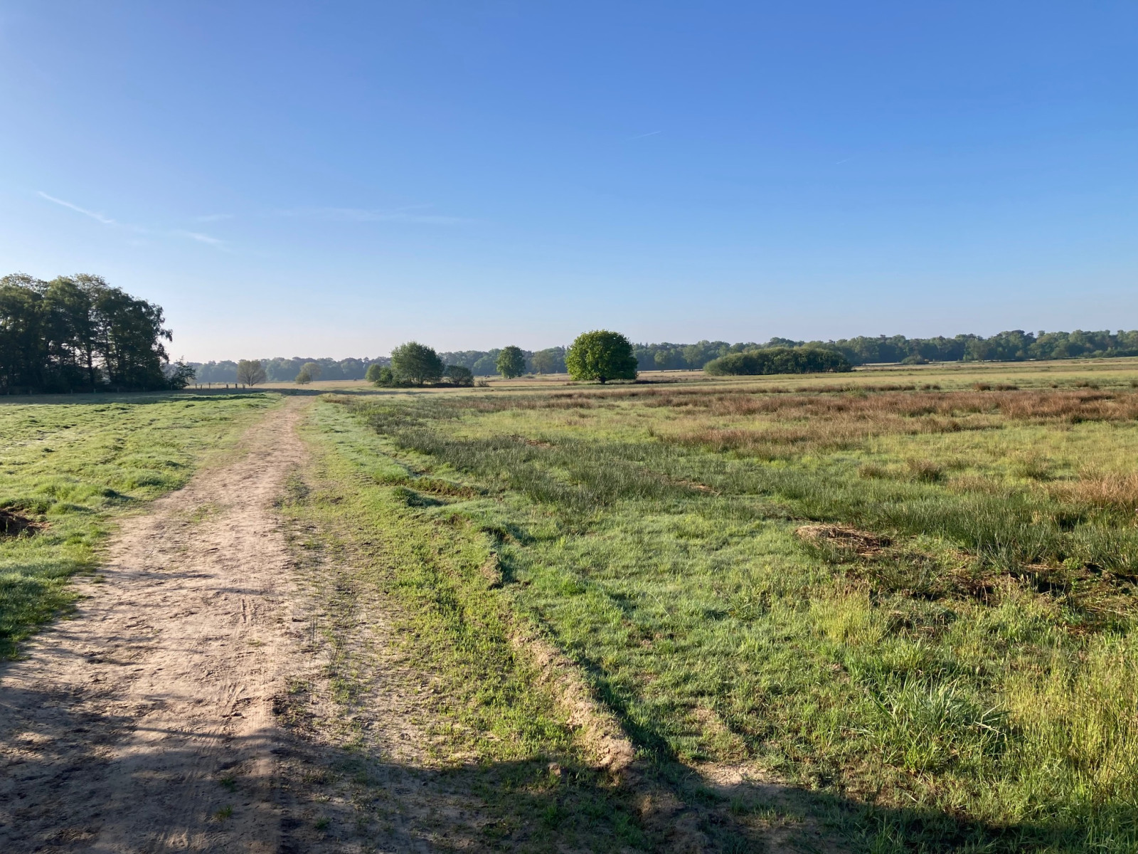
Very varied nature reserve with heathland, fens and forests on the border of the Netherlands and Belgium.
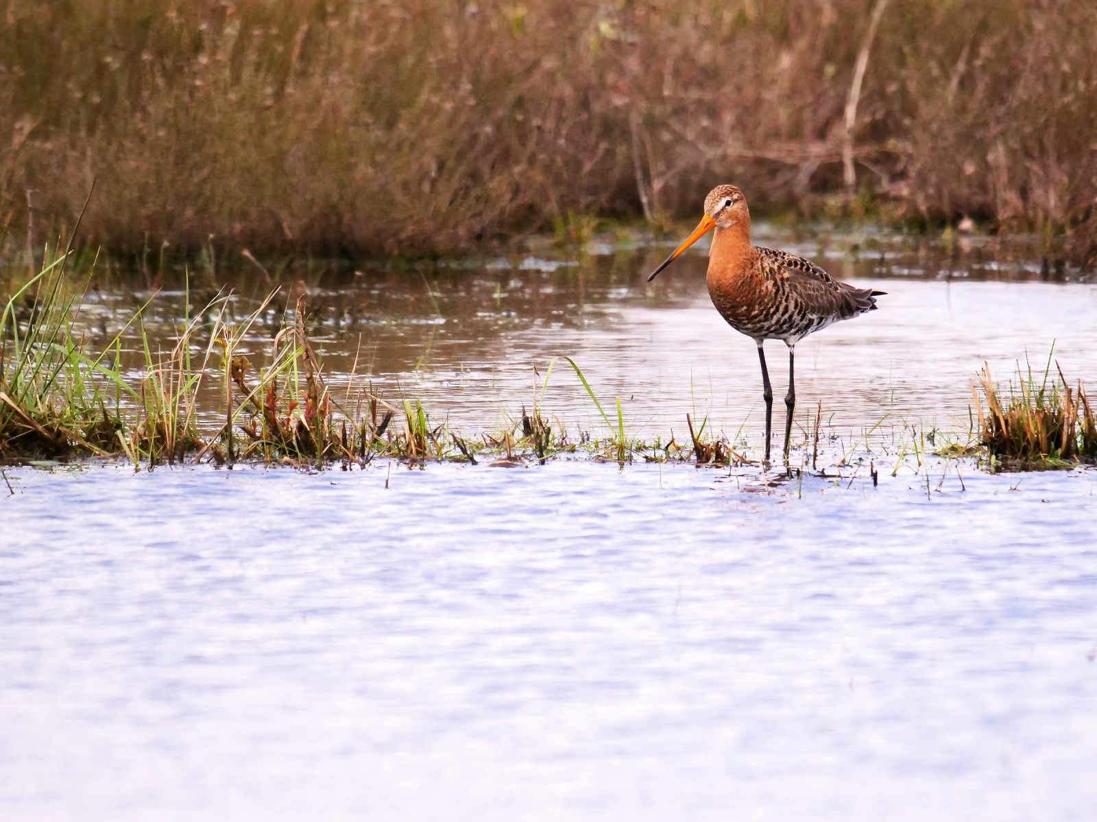
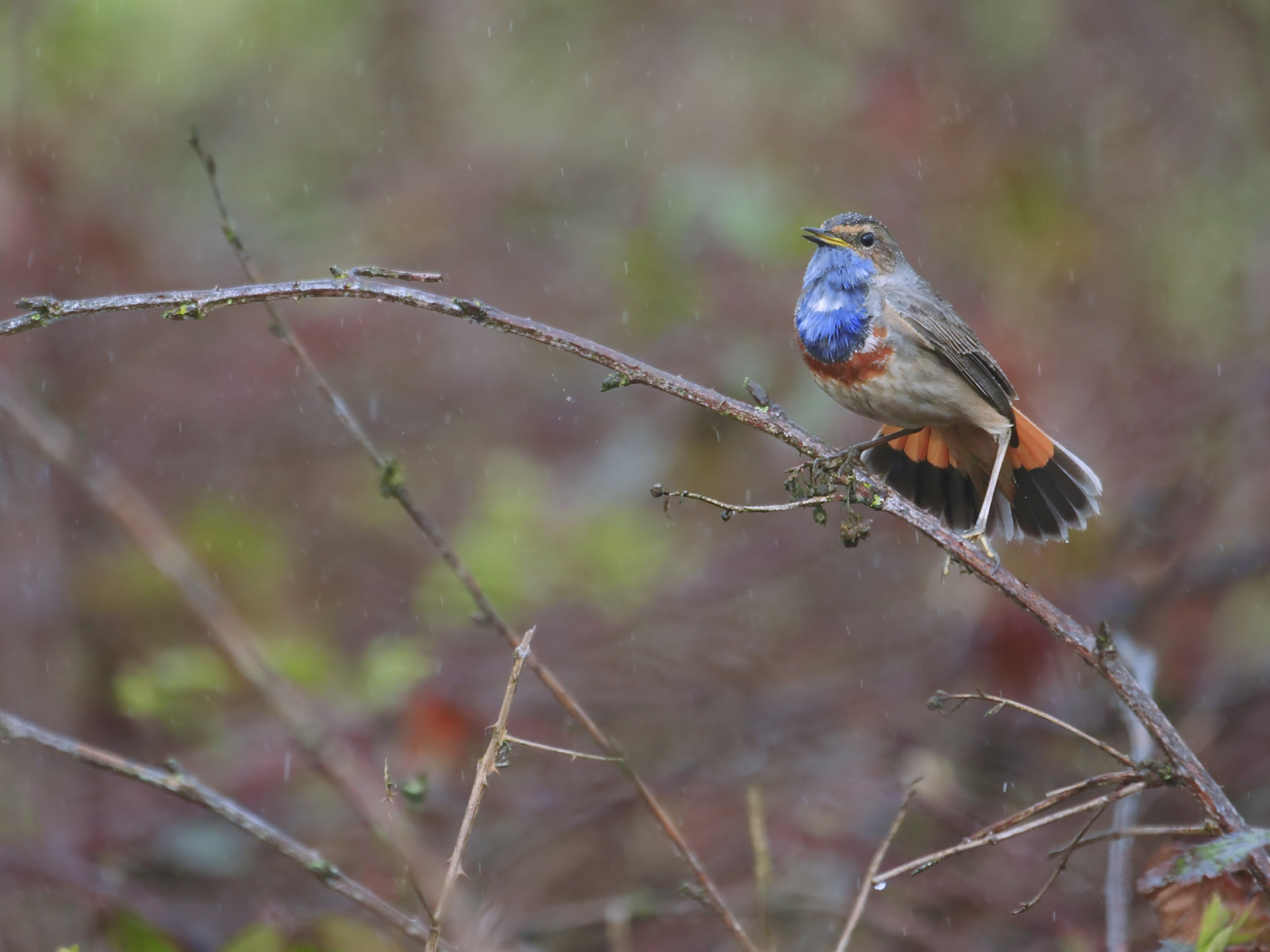
The Castelreesche Heide is a varied nature reserve with heathland, fens and forests. Belgium is located both north and south and is connected to the cross-border nature reserve Het Merkske. Birds you may encounter in the area are Autour des palombes, Barge à queue noire, Oie de la toundra, Alouette lulu, Faucon hobereau and Engoulevent d'Europe and at Het Merkske (a stream that is a tributary of the Mark, and the natural border between the Netherlands and Belgium) you can see and Loriot d'Europe with a bit of luck.
_________________________
Nederlands: De Castelreesche Heide is een gevarieerd natuurgebied met heide, vennen en bossen. België ligt zowel ten noorden als ten zuiden en sluit aan bij het grensoverschrijdend natuurgebied Het Merkske. Vogels die je in het gebied kunt tegenkomen zijn Autour des palombes, Barge à queue noire, Oie de la toundra, Alouette lulu, Faucon hobereau en Engoulevent d'Europe en bij Het Merkske (een zijriviertje van de Mark, en de natuurlijke grens tussen Nederland en België) kun je met een beetje geluk Rossignol philomèle en Loriot d'Europe zien.
The Castelreesche Heide is located on the border of the Netherlands and Belgium, south of the city of Breda and northwest of the city of Turnhout. Parking is available at the Natuurpunt visitor centre with ample parking in Wortel Kolonie in Belgium or the Staatsbosbeheer car park on the Hoogstratense Baan in the Netherlands. Press a P on the map for directions to a car park. The circular walk shown on the map is approximately 8.5 km long.
_________________________
Nederlands: De Castelreesche Heide ligt op de grens van Nederland en België ten zuiden van Breda en ten noordwesten van Turnhout. Parkeren kan bij het bezoekerscentrum Natuurpunt met ruime parking in Wortel Kolonie in België of de parkeerplaats van Staatsbosbeheer aan de Hoogstratense Baan in Nederland. Druk op een P in de kaart voor een routebeschrijving naar een parkeerplaats. De rondwandeling die is weergegeven op de kaart is ongeveer 8,5 km lang.
 ) Insérez les noms d'oiseau dans votre langue. Ils seront automatiquement traduits pour les autres usagers !
Votre feedback sera transmis à l’auteur.rice de cette zone et à l’équipe éditoriale de Birdingplaces, qui l’utiliseront pour améliorer la qualité des informations. (Vous souhaitez publier un commentaire visible en bas de page ? Fermez cette fenêtre et choisissez l’Option 1 : « Publier un commentaire, un conseil ou une observation ».)
Veuillez fournir des suggestions d'améliorations ou d'ajouts au texte de ce site ornithologique.
Veuillez fournir vos suggestions d'améliorations ou d'ajouts à la carte.
Veuillez fournir des suggestions d'améliorations ou d'ajouts à la liste des oiseaux.
Cliquez sur l'icône de l'oiseau () Insérez les noms d'oiseau dans votre langue. Ils seront automatiquement traduits pour les autres usagers !