
.jpg)


Charger images
Les formats d'image autorisés sont de type jpeg, png ou gif
La taille maximale du fichier doit être de 20MB
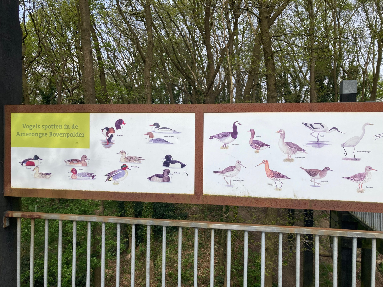
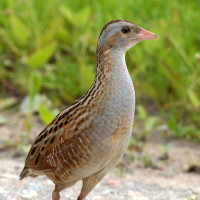
The Amerongse Bovenpolder is a marsh area in the floodplain of the river Nederrijn with the chance of nice waders during migration.
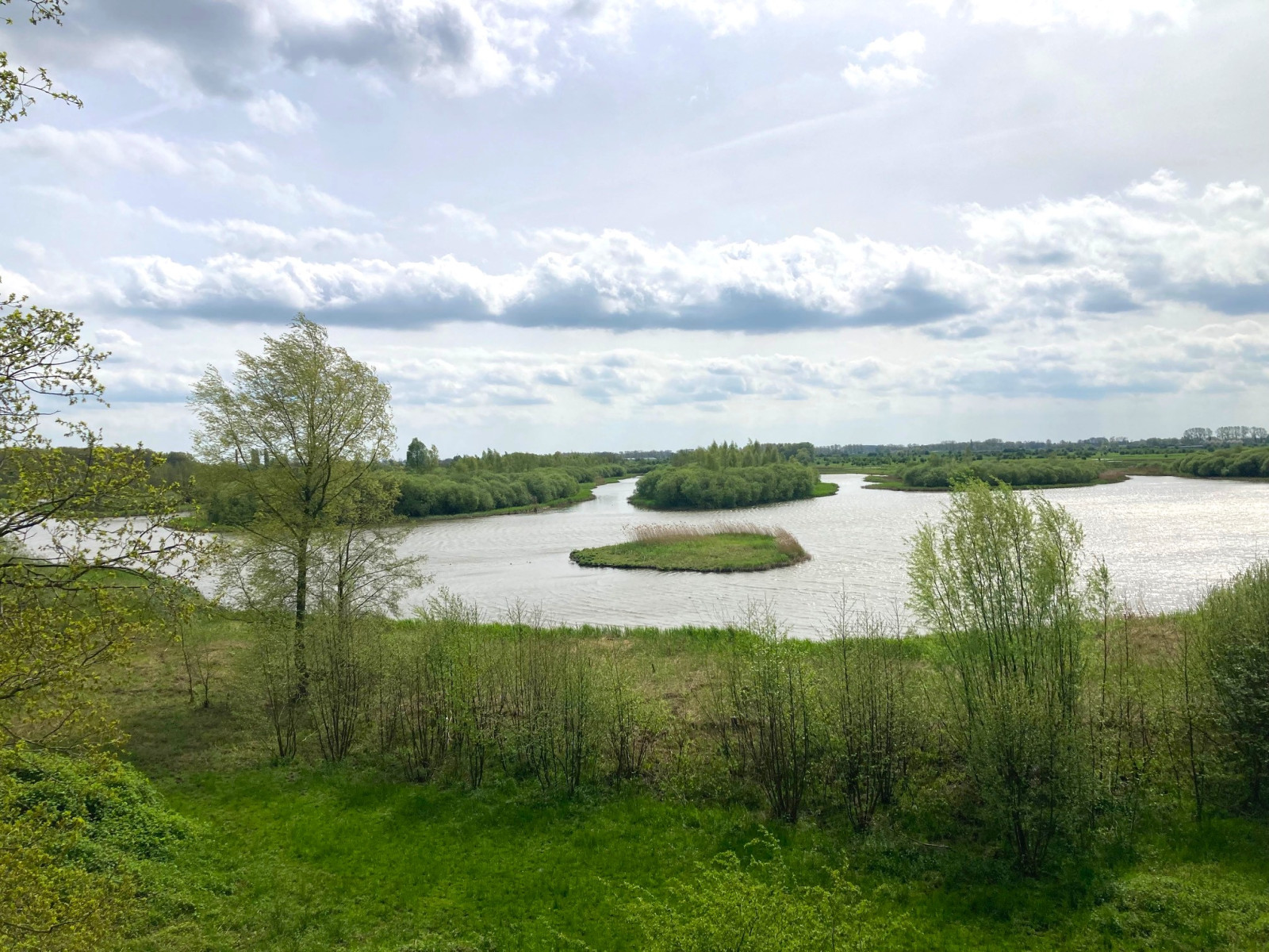
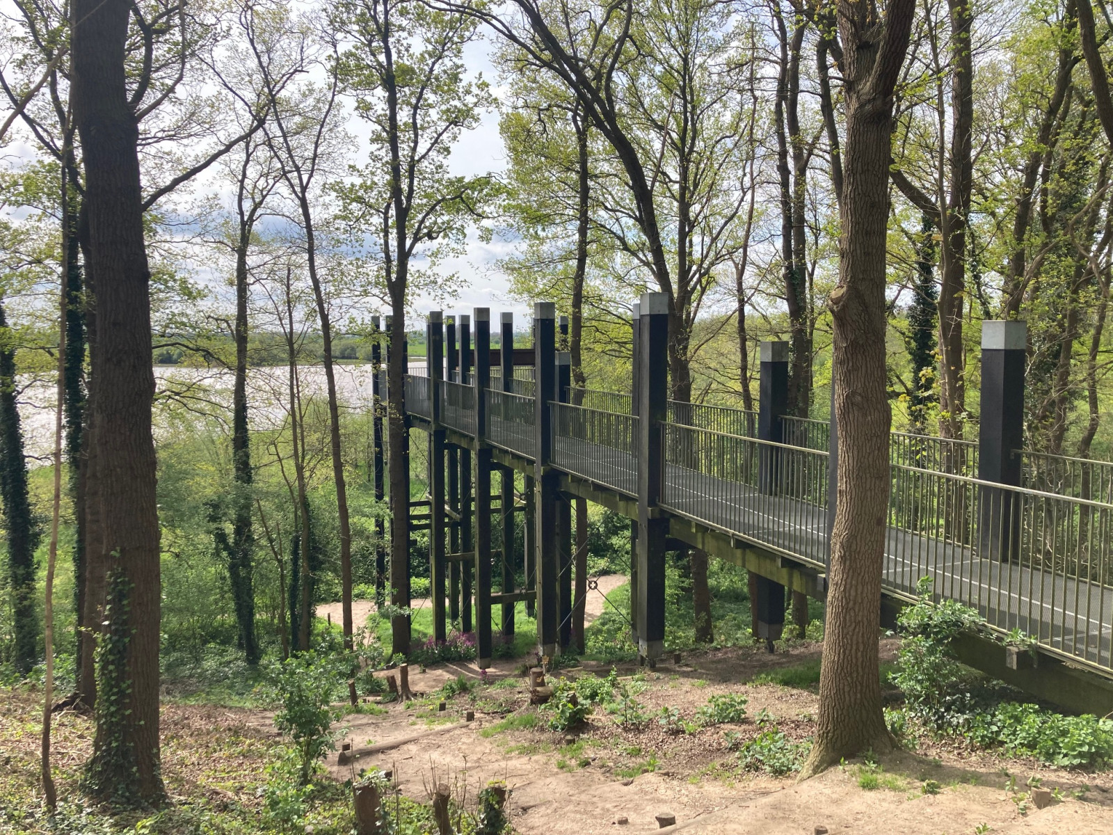
The Amerongse Bovenpolder is located at the foot of the Utrechtse Heuvelrug. From the parking lot you walk through the forest to a viewing platform from where you have a nice overview of the area. Most waders and waterfowl can be seen from this location. Next to the viewing platform, a path leads down, and you can walk into the polder. Note that the western part of the polder is open in spring and summer, but closed in the winter as a resting place for geese from October 1st to April 1st. The eastern part of the Amerongse Bovenpolder, on the other hand, is open in the autumn and winter and closed from April 1st to October 1st. So one of the parts of the polder is always accessible for a walk.
_________________________
Nederlands: De Amerongse Bovenpolder is een moerasgebied in de uiterwaard van de Nederrijn met kans op leuke steltlopers tijdens de trek. De Amerongse Bovenpolder ligt aan de voet van de Utrechtse Heuvelrug. Vanaf de parkeerplaats loop je door het bos naar een uitkijkplatform vanwaar je een mooi overzicht hebt over het gebied. Vanaf deze locatie zijn ook de meeste steltlopers en watervogels te zien. Naast het uitkijkplatform loopt een pad naar beneden en kun je de polder in lopen. Maar let op: het westelijke deel van de polder is in de lente en zomer open, maar afgesloten in de winter als rustplaats voor ganzen van 1 oktober tot 1 april. Het oostelijk deel van de Amerongse Bovenpolder is juist open in het najaar en de winter en gesloten van 1 april tot 1 oktober. Er is dus altijd een van de delen van de polder toegankelijk om een wandeling te maken.
The Amerongse Bovenpolder is wedged between the town of Amerongen and the river Nederrijn. There is a large free parking lot at the Burgwal in Amerongen. Click on the P on the map for directions to the parking lot. From the parking lot you cross the provincial road and walk along a short path to the viewing platform with a beautiful view of the polder. You can easily return your telescope to the car if you later want to do the approximately 7 km eastern or western circular walk indicated on the map.
_________________________
Nederlands: De Amerongse Bovenpolder ligt ingeklemd tussen Amerongen en de Nederrijn. Aan de Burgwal in Amerongen is een grote gratis parkeerplaats. Klik op de P in de kaart voor een routebeschrijving naar de parkeerplaats. Met openbaar vervoer bereik je de Amerongse Bovenpolder het gemakkelijkst met buslijn 350. Bus 350 rijdt tussen Wageningen – Rhenen – Amerongen – Doorn – Zeist – Utrecht. Vanaf halte 'Amerongen - Amerongse Berg' is het ongeveer tien minuten lopen naar de ingang van de Bovenpolder bij de parkeerplaats aan de Burgwal. Vanaf de parkeerplaats steek je de provinciale weg over en je loopt via een kort wandelpad naar het uitkijkplatform met een mooi uitzicht op de polder. Je kunt gemakkelijk je telescoop terugbrengen naar de auto als je daarna de oostelijke of westelijke rondwandeling van ongeveer 7 km wilt doen die op de kaart staan aangegeven.
 ) Insérez les noms d'oiseau dans votre langue. Ils seront automatiquement traduits pour les autres usagers !
Votre feedback sera transmis à l’auteur.rice de cette zone et à l’équipe éditoriale de Birdingplaces, qui l’utiliseront pour améliorer la qualité des informations. (Vous souhaitez publier un commentaire visible en bas de page ? Fermez cette fenêtre et choisissez l’Option 1 : « Publier un commentaire, un conseil ou une observation ».)
Veuillez fournir des suggestions d'améliorations ou d'ajouts au texte de ce site ornithologique.
Veuillez fournir vos suggestions d'améliorations ou d'ajouts à la carte.
Veuillez fournir des suggestions d'améliorations ou d'ajouts à la liste des oiseaux.
Cliquez sur l'icône de l'oiseau () Insérez les noms d'oiseau dans votre langue. Ils seront automatiquement traduits pour les autres usagers !