


Charger images
Les formats d'image autorisés sont de type jpeg, png ou gif
La taille maximale du fichier doit être de 20MB

Path along the fast flowing stream Torrente Sanagra. Good place to find Cincle plongeur and Bergeronnette des ruisseaux.
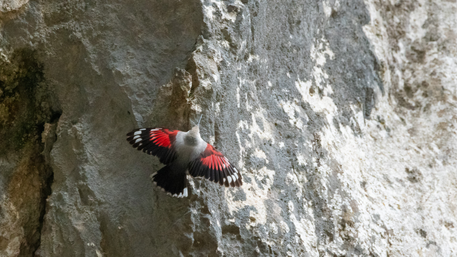
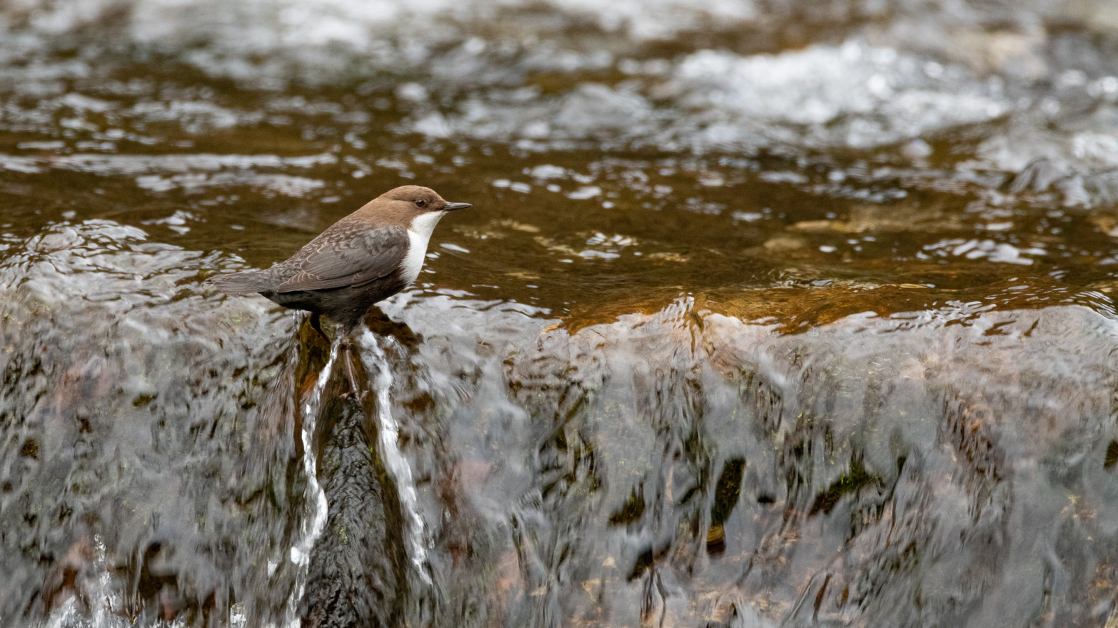
Val Sanagra is a rather wild river area with a path that runs along the river. In several places you can encounter the Cincle plongeur, Bergeronnette des ruisseaux, Bergeronnette grise and many other species. In the woods it is not uncommon to see the Grimpereau des jardins, Pic épeiche, Pic vert. Going higher along the river I was able to photograph the Tichodrome échelette.
_________________________
Italiano: Area fluviale piuttosto selvaggia caratterizzata da un sentiero che costeggia il fiume. In più punti si può incontrare il Cincle plongeur, Bergeronnette des ruisseaux, Bergeronnette grise e molte altre specie. Nei boschi non è raro vedere il Grimpereau des jardins, Pic épeiche, Pic vert. Salendo più in alto lungo il fiume ho potuto fotografare il Tichodrome échelette.
Val Sanagra is located west of Lake Como near the town of Loveno. The best way to access Val Sanagra is to reach the Loveno cemetery and park there. Press P on the map for directions. From the parking go along the path that crosses the clearing and then leads into the woods and follows the path to Saas Courbèè. The route shown on the map is about 3 km one way.
_________________________
Italiano: Il modo migliore per accedere è raggiungere il cimitero di Loveno e addentrarsi lungo il sentiero che attraversa la radura portandosi poi nel bosco e seguendo il sentiero per il Saas Courbèè.
 ) Insérez les noms d'oiseau dans votre langue. Ils seront automatiquement traduits pour les autres usagers !
Votre feedback sera transmis à l’auteur.rice de cette zone et à l’équipe éditoriale de Birdingplaces, qui l’utiliseront pour améliorer la qualité des informations. (Vous souhaitez publier un commentaire visible en bas de page ? Fermez cette fenêtre et choisissez l’Option 1 : « Publier un commentaire, un conseil ou une observation ».)
Veuillez fournir des suggestions d'améliorations ou d'ajouts au texte de ce site ornithologique.
Veuillez fournir vos suggestions d'améliorations ou d'ajouts à la carte.
Veuillez fournir des suggestions d'améliorations ou d'ajouts à la liste des oiseaux.
Cliquez sur l'icône de l'oiseau () Insérez les noms d'oiseau dans votre langue. Ils seront automatiquement traduits pour les autres usagers !