


Charger images
Les formats d'image autorisés sont de type jpeg, png ou gif
La taille maximale du fichier doit être de 20MB


The Steigerwald is a lower mountain range known for its ancient decidious forests. The described path is an easy option to find some of its typical birds.
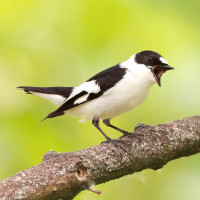
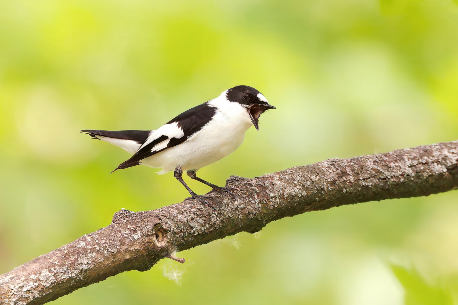
On the circular trail through Zeller Forst (length 10 km) there are good chances to see or hear Gobemouche noir, Gobemouche à collier, Pic noir, Pic mar, Gros-bec casse-noyaux, Roitelet triple-bandeau and Pouillot siffleur. For some years the Gobemouche nain has been heard singing (absent in 2020). It is believed to be at least an irregular breeder in the Steigerwald. The circular route is admittedly long, however there is no real shortcut. If you don't have much time turn around after the first 2 or 3 km on the "Schlangenweg". In the valley pay furthermore attention to possible flying over Bondrée apivore.
As of 2020 the former hiking car park is closed. You have to find a parking space in the village centre and walk the "Böhlstraße" (closed for public use) to the former car park (250 m). On the left you find a wooden sign post "Schlangenweg" marking the start of the "real" tour.
Leave the motorway A70 at Knetzgau and follow the signposts to the village Zell am Ebersberg. Just before leaving the latter you find on your right hand side the above mentioned "Böhlstraße" which has been closed for public use.
By public transport: You can reach Zell by bus (line 8178) from Haßfurt where the next railway station is situated.
After rainfalls the narrow trail in the wood can be wet and slippery for days. A hiking map is certainly of good use to find the right trail (the are only few signposts and many trails).
 ) Insérez les noms d'oiseau dans votre langue. Ils seront automatiquement traduits pour les autres usagers !
Votre feedback sera transmis à l’auteur.rice de cette zone et à l’équipe éditoriale de Birdingplaces, qui l’utiliseront pour améliorer la qualité des informations. (Vous souhaitez publier un commentaire visible en bas de page ? Fermez cette fenêtre et choisissez l’Option 1 : « Publier un commentaire, un conseil ou une observation ».)
Veuillez fournir des suggestions d'améliorations ou d'ajouts au texte de ce site ornithologique.
Veuillez fournir vos suggestions d'améliorations ou d'ajouts à la carte.
Veuillez fournir des suggestions d'améliorations ou d'ajouts à la liste des oiseaux.
Cliquez sur l'icône de l'oiseau () Insérez les noms d'oiseau dans votre langue. Ils seront automatiquement traduits pour les autres usagers !