


Charger images
Les formats d'image autorisés sont de type jpeg, png ou gif
La taille maximale du fichier doit être de 20MB
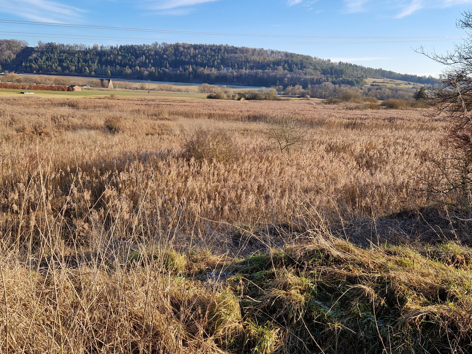

Fen, wetland and extensively used meadows in beautiful setting that probably deserves more ornithological attention than it gets.
The Schambachried in the Franconian Jura is the oldest nature reserve in Middle Franconia. This calcareous fen was traditionally used as a litter meadow, meaning it was managed without fertilizer input; as a result, the landscape is particularly valuable for rare plants. The seven-hectare area consists of a litter meadow in the center, which is mown once a year (1), wet meadows (2), extensive reed beds (3), and canals used by beavers. Ornithologically, the area is not frequently visited but probably deserves more attention.
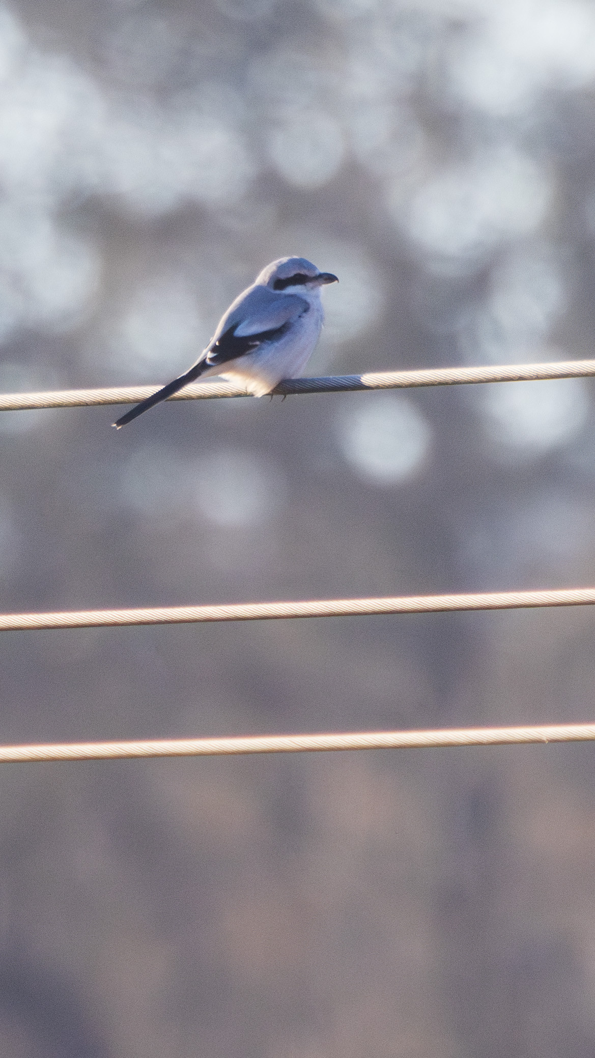
Breeding birds include Tarier pâtre, Râle d'eau, and Bruant des roseaux. Gorgebleue à miroir, Locustelle tachetée, Fauvette grisette, and Coucou gris have also been observed in the breeding season. During migration periods, Tarier des prés can be found here, and in winter, Pie-grièche grise has been recorded. One sighting of the rare Râle des genêts dates from 2016.
From the forests of the Nagelberg, at the foot of which the fen is located, the calls of woodpecker species (Pic vert, Pic noir, and Pic cendré, which has also been sighted in the area of the fen) can be heard, along with Geai des chênes. Autour des palombes might also visit the fen in search of food.
The Schambachried is located between Treuchtlingen and Schambach. Treuchtlingen is easily accessible by public transport, and from there, the fen can be reached on foot in 20 minutes or by bicycle in 5 minutes. The nearest parking lot is at the wildlife enclosure on the Nagelberg (click on "P" on the map to get directions). The paths around the fen are well-maintained and mostly wheelchair accessible. The best overview of a large part of the fen is from below a hunting seat, but it is also worthwhile to walk the paths along the edge of the reed beds. The circular walking route indicated on the map is about 5,5 km.
 ) Insérez les noms d'oiseau dans votre langue. Ils seront automatiquement traduits pour les autres usagers !
Votre feedback sera transmis à l’auteur.rice de cette zone et à l’équipe éditoriale de Birdingplaces, qui l’utiliseront pour améliorer la qualité des informations. (Vous souhaitez publier un commentaire visible en bas de page ? Fermez cette fenêtre et choisissez l’Option 1 : « Publier un commentaire, un conseil ou une observation ».)
Veuillez fournir des suggestions d'améliorations ou d'ajouts au texte de ce site ornithologique.
Veuillez fournir vos suggestions d'améliorations ou d'ajouts à la carte.
Veuillez fournir des suggestions d'améliorations ou d'ajouts à la liste des oiseaux.
Cliquez sur l'icône de l'oiseau () Insérez les noms d'oiseau dans votre langue. Ils seront automatiquement traduits pour les autres usagers !