


Charger images
Les formats d'image autorisés sont de type jpeg, png ou gif
La taille maximale du fichier doit être de 20MB
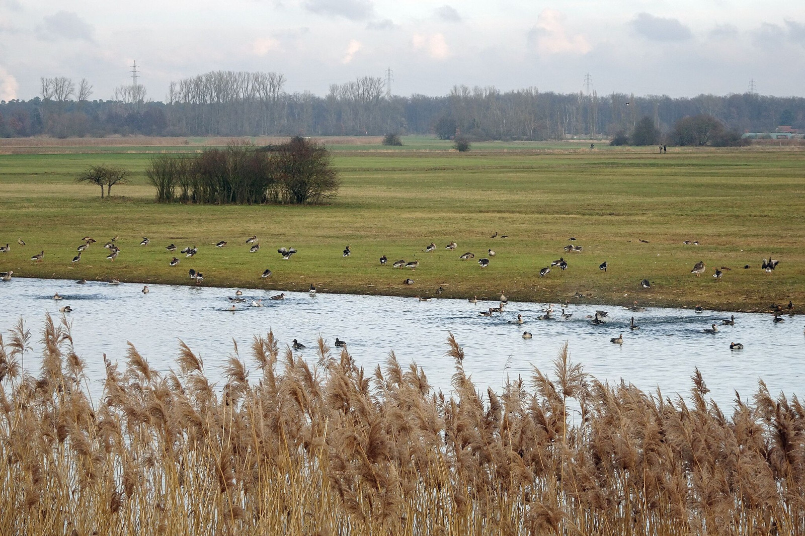

A floodplain area on the lower reaches of the Gersprenz stream with habitat for many bird species, including migratory birds.
The Hergershäuser Wiesen are a floodplain area of approximately 400 hectares and characterized by many different habitats; wet, dry and sandy. Large areas are irrigated with a wind pumping station and several temporary water-retaining ponds and extensive wet meadows are created. NABU Münster (Hesse) has been committed to protecting and caring for these valuable areas for decades and makes the area accessible through a marked circular trail and guided hikes.
Hergershäuser Wiesen is located between Münster, Altheim and Hergershausen. It is easy to explore the area from these places. Press a P in the map for directions to a parking spot. In addition, one of the trails starts from Altheim train station. If you walk all the trails that are shown on the map it is a distance of 11 km, but it is of course easy to make the walk shorter.
 ) Insérez les noms d'oiseau dans votre langue. Ils seront automatiquement traduits pour les autres usagers !
Votre feedback sera transmis à l’auteur.rice de cette zone et à l’équipe éditoriale de Birdingplaces, qui l’utiliseront pour améliorer la qualité des informations. (Vous souhaitez publier un commentaire visible en bas de page ? Fermez cette fenêtre et choisissez l’Option 1 : « Publier un commentaire, un conseil ou une observation ».)
Veuillez fournir des suggestions d'améliorations ou d'ajouts au texte de ce site ornithologique.
Veuillez fournir vos suggestions d'améliorations ou d'ajouts à la carte.
Veuillez fournir des suggestions d'améliorations ou d'ajouts à la liste des oiseaux.
Cliquez sur l'icône de l'oiseau () Insérez les noms d'oiseau dans votre langue. Ils seront automatiquement traduits pour les autres usagers !