


Charger images
Les formats d'image autorisés sont de type jpeg, png ou gif
La taille maximale du fichier doit être de 20MB
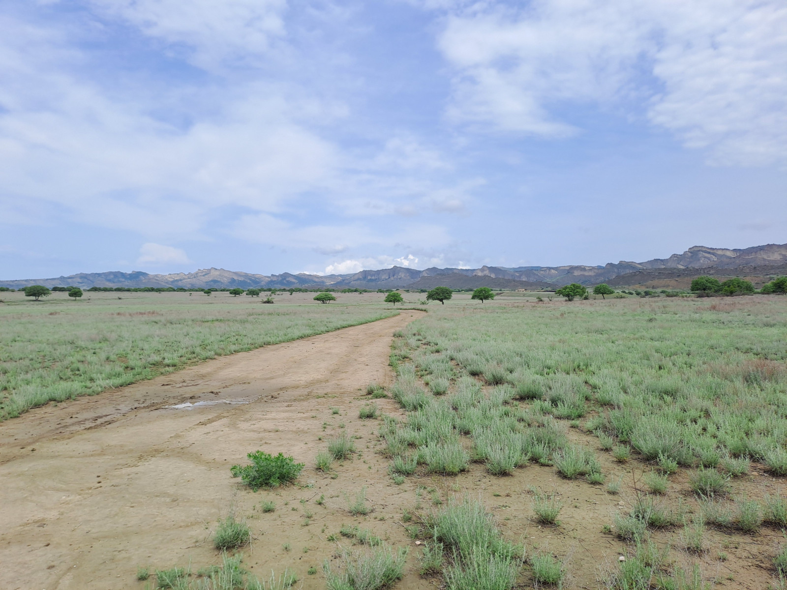
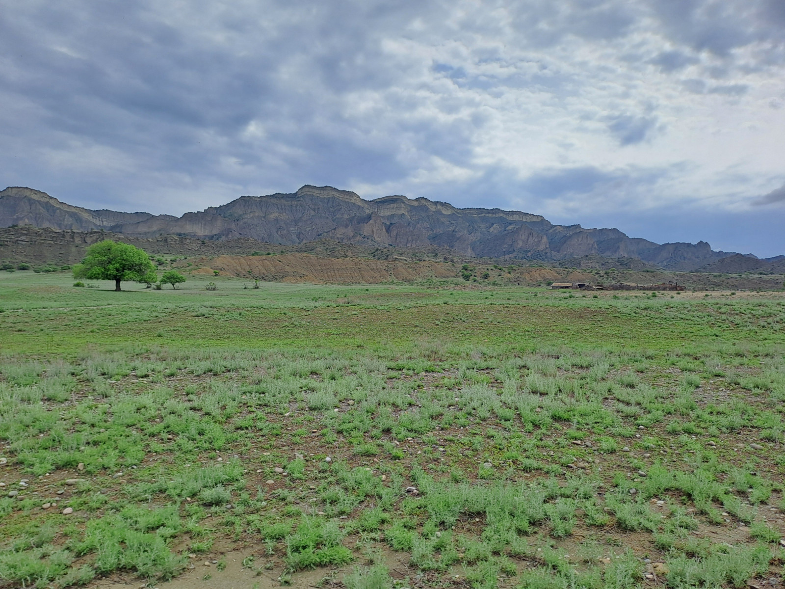
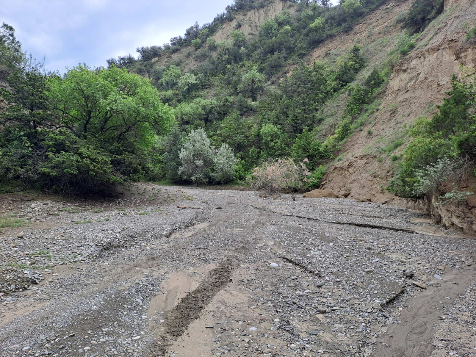
The western part of Vashlovani National Park consists of steppes, limestone cliffs and riverbeds.
The western part of Vashlovani National Park consists of a semi-desert region dominated by steppes, small deciduous forests, dwarf shrubs, and limestone cliffs. Annual rainfall is low. The northern part of the region consists of flat, dry terrain that gives way to hills and a riverbed surrounded by canyons and juniper vegetation. On the border with Azerbaijan, a steppe extends to the southernmost point of Georgia.
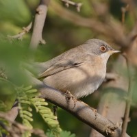
The canyons, riverbed and vegetation provide a habitat for breeding birds such as: Sittelle de Neumayer, Traquet oreillard, Perdrix choukar, Vautour fauve, Bruant fou, Moineau soulcie en Agrobate roux. The riverbed ends in flat terrain that changes into sparsely vegetated steppes. Here you can find the species: Pie-grièche à tête rousse, Pie-grièche à poitrine rose, Traquet isabelle Alouette calandrelle, Francolin noir,Alouette calandre, Circaète Jean-le-Blanc, Busard cendré , Aigle impérial and Vautour moine. Further south in the area Fauvette de Ménétries can be found.
During winter, the species spectrum is less abundant, but large numbers of Outarde canepetière can be present.
Vashlovani National Park is located in the Kakheti region of southeastern Georgia, near the border with Azerbaijan. The western part of Vashlovani National Park is accessible by high-clearance four-wheel drive vehicle. Be aware of muddy roads and high river water levels during heavy rainstorms.
The steppes are accessible by driving along a riverbed. From Kasristskali, take the dirt road southwest. This dirt road leads to the riverbed between the canyons (Pantishara Valley). The riverbed opens onto flat terrain, where you turn left to enter the steppe. From the steppe, you can continue driving southeast.
A border permit is required to enter the area. This permit can be obtained at the National Park Administration Office in Dedoplistsqaro. You may be checked by border police at various border checkpoints. You must carry your passport and border permit when exploring the area.
 ) Insérez les noms d'oiseau dans votre langue. Ils seront automatiquement traduits pour les autres usagers !
Votre feedback sera transmis à l’auteur.rice de cette zone et à l’équipe éditoriale de Birdingplaces, qui l’utiliseront pour améliorer la qualité des informations. (Vous souhaitez publier un commentaire visible en bas de page ? Fermez cette fenêtre et choisissez l’Option 1 : « Publier un commentaire, un conseil ou une observation ».)
Veuillez fournir des suggestions d'améliorations ou d'ajouts au texte de ce site ornithologique.
Veuillez fournir vos suggestions d'améliorations ou d'ajouts à la carte.
Veuillez fournir des suggestions d'améliorations ou d'ajouts à la liste des oiseaux.
Cliquez sur l'icône de l'oiseau () Insérez les noms d'oiseau dans votre langue. Ils seront automatiquement traduits pour les autres usagers !