Charger images
Les formats d'image autorisés sont de type jpeg, png ou gif
La taille maximale du fichier doit être de 20MB

This forest path allows you to discover the ruins of the penal colony and, after more than an hour of walking, you reach the Tonnégrande river.
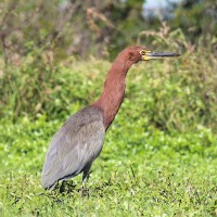
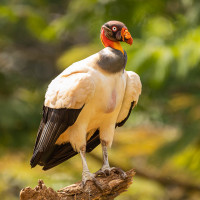
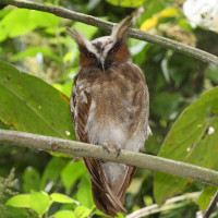
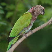
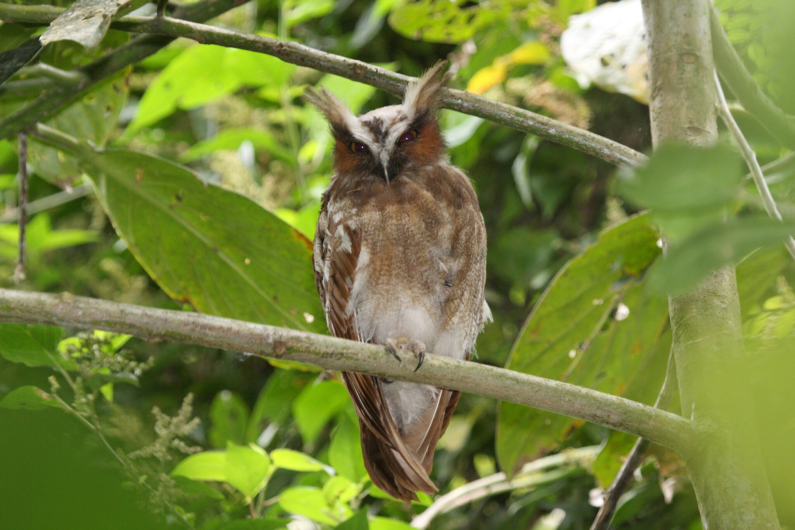
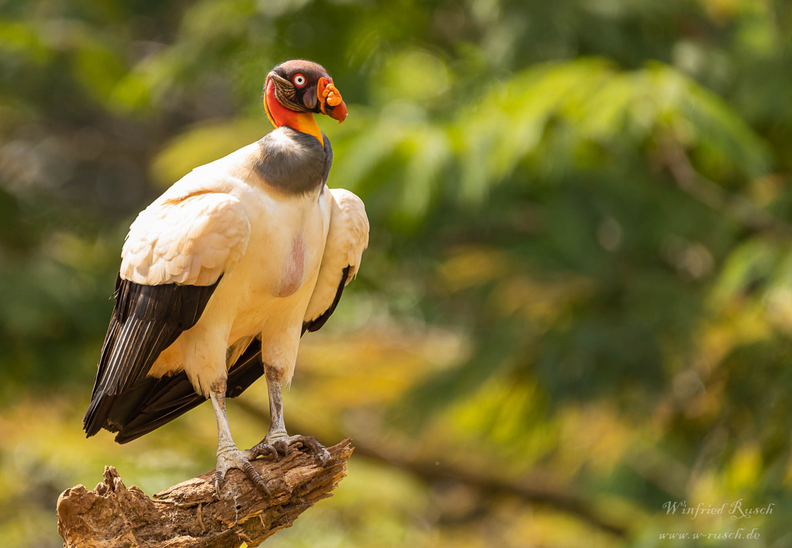
Sentier du Bagne des Amanites is a path through secondary forest. The trail allows you to observe species of undergrowth (sometimes of the canopy). You can also observe some species of amphibians and reptiles. Among the birds you can encounter are Crested Owl, Wedge-billed Woodcreeper, Grey-winged Trumpeter, Common Potoo, White-tailed Trogon, Channel-billed Toucan, Straight-billed Woodcreeper, Red-necked Woodpecker, White-crowned Manakin, Rufescent Tiger-Heron, Green Ibis, Collared Forest-Falcon, Black Nunbird, White-throated Toucan, Dusky-throated Antshrike, Black-headed Parrot, Golden-sided Euphonia, Black-necked Aracari, Screaming Piha, King Vulture, Waved Woodpecker, Guianan Warbling-Antbird, Russet-crowned Crake, Painted Parakeet, Red-fan Parrot, Black-throated Trogon, Dusky Parrot, Rufous-throated Antbird, Golden-headed Manakin, Purple Honeycreeper, Pectoral Sparrow, Black-headed Antbird, White-necked Thrush, Purple-throated Fruitcrow, Coraya Wren, Yellow-billed Jacamar, White-plumed Antbird, Black-eared Fairy, Black-faced Hawk, Tiny Hawk, Guianan Toucanet, Chestnut Woodpecker, Plain Xenops, Fasciated Antshrike, Mouse-colored Antshrike, Dusky-throated Antshrike, Paradise Jacamar, Lineated Woodpecker, Guianan Red-Cotinga, Rufous-capped Antthrush, Yellow-throated Woodpecker, Black-tailed Trogon and Fork-tailed Woodnymph.
________________________
Français: Ce layon aménagé à travers la forêt secondaire permet de découvrir les ruines du bagne et d’accéder après plus d’une heure de marche, à la rivière Tonnégrande. Le sentier en foret secondaire permet a la fois d'observer des espèces de sous-bois (parfois de canopée), il permet d'observer quelques espèces d'amphibiens et reptiles.
The start of the trail begins at the parking lot at PK 14.5 of the RD5, between Montsinéry and Tonnegrande (40 km from Cayenne). the trail is accessible on foot or by bike.
________________________
Français: Le début du sentier commence au parking au PK 14,5 de la RD5, entre Montsinéry et Tonnegrande (40 km de Cayenne). le sentier est accéssible à pied ou en vélo.

 ) Insérez les noms d'oiseau dans votre langue. Ils seront automatiquement traduits pour les autres usagers !
Votre feedback sera transmis à l’auteur.rice de cette zone et à l’équipe éditoriale de Birdingplaces, qui l’utiliseront pour améliorer la qualité des informations. (Vous souhaitez publier un commentaire visible en bas de page ? Fermez cette fenêtre et choisissez l’Option 1 : « Publier un commentaire, un conseil ou une observation ».)
Veuillez fournir des suggestions d'améliorations ou d'ajouts au texte de ce site ornithologique.
Veuillez fournir vos suggestions d'améliorations ou d'ajouts à la carte.
Veuillez fournir des suggestions d'améliorations ou d'ajouts à la liste des oiseaux.
Cliquez sur l'icône de l'oiseau () Insérez les noms d'oiseau dans votre langue. Ils seront automatiquement traduits pour les autres usagers !