
 Peter Watthy.jpg)


Charger images
Les formats d'image autorisés sont de type jpeg, png ou gif
La taille maximale du fichier doit être de 20MB
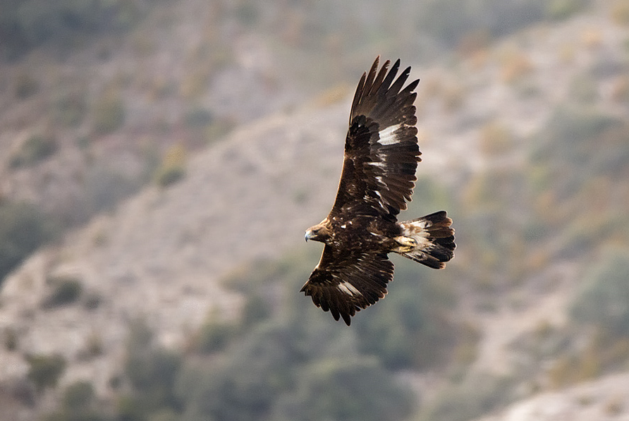
More than 150 bird species can be seen in the surroundings of this beautiful mountain pass in Parc National du Mercantour.
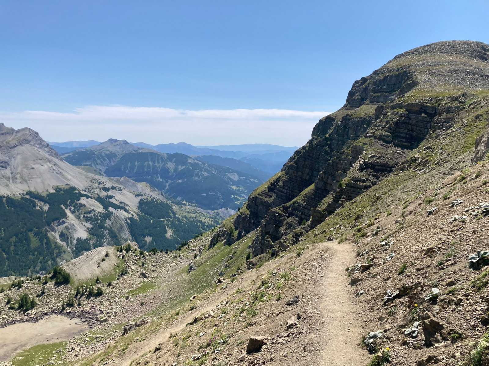
Col de la Cayolle (2326 m) is a high mountain pass in the Parc National du Mercantour. Without question this is the most beautiful and unspoiled route through the Mercantour, linking the upper Var valley to the valley of L’Ubaye. On the pass there is a parking from where you can explore the area which is characterised by open fields and mountain slopes, rocks, grassland and low vegetation. You can walk the beautiful 10 km long trail 'Circuit des Lacs' leading to various lakes, superb viewing points and crossing rocky grasslands. Along the way you can observe alpine fauna like chamois, ibex, marmots and of course many birds. Among the birds you can see are Crave à bec rouge, Chocard à bec jaune, Grand Corbeau, Venturon montagnard, Niverolle alpine, Bruant fou, Rougequeue noir, Traquet motteux and Merle à plastron as well as large birds of prey such as Vautour fauve, Circaète Jean-le-Blanc and Aigle royal. If you are lucky you can see Gypaète barbu that is gradually reintroduced in the area.
_________________________
Français: Le col de la Cayolle est situé à 2 326 mètres d'altitude. Le col fait partie du Parc National du Mercantour. Sur ce même territoire, 153 espèces d’oiseaux permettent des rencontres inattendues : la chouette de Tengmalm habituée aux basses températures côtoie le hibou petit-duc d’Afrique du Nord. Dans les airs ou sur terre, il est également possible d'observer le gypaète barbu (réintroduit dans le parc depuis 1993), l'aigle royal, le tétras lyre, le lagopède, mais aussi chocard à bec jaune ou crave à bec rouge en altitude.
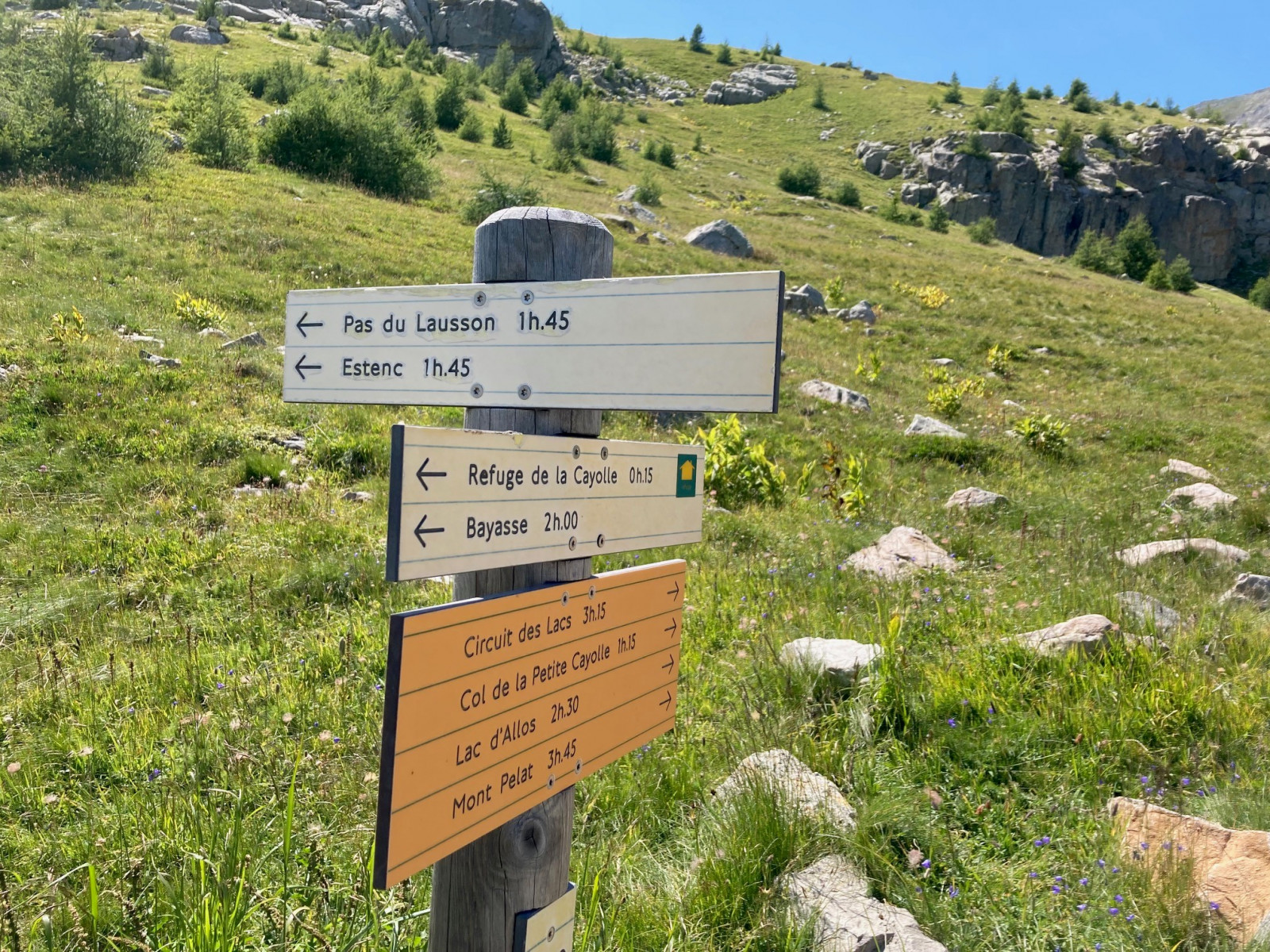
On the pass there is a parking from where you can explore the area. In summer it can be very busy, and when the parking lot is full you will have to park along the road. From the parking the trail 'Circuit des Lacs' starts. This beautiful 10 km walk bridges a height difference of 400 meters and is not too demanding, if you take your time for the walk. It takes you about 3,5 hours of walking over rocky paths, so put on good walking shoes. And add an hour extra for birding and stops along the way. The route is marked with yellow markers and also signposted. Of course if you don't want to make a long hike you can also explore just part of the route and then return. But I recommend to do the whole walk, because the scenery is fantastic.
_________________________
Français: Sur le col, il y a un parking d'où vous pouvez explorer les environs. En été, il peut être très fréquenté et lorsque le parking est plein, vous devrez vous garer le long de la route. Du parking commence le sentier 'Circuit des Lacs'. Cette belle balade de 10 km enjambe un dénivelé de 400 mètres et est un peu exigeante, mais si vous prenez votre temps c'est bien à faire. Il vous faut environ 3,5 heures de marche sur des chemins rocailleux, alors mettez de bonnes chaussures de marche. L'itinéraire est balisé par des balises jaunes. Mais si vous ne voulez pas faire une longue randonnée, vous pouvez également explorer une partie du parcours et revenir ensuite.
 ) Insérez les noms d'oiseau dans votre langue. Ils seront automatiquement traduits pour les autres usagers !
Votre feedback sera transmis à l’auteur.rice de cette zone et à l’équipe éditoriale de Birdingplaces, qui l’utiliseront pour améliorer la qualité des informations. (Vous souhaitez publier un commentaire visible en bas de page ? Fermez cette fenêtre et choisissez l’Option 1 : « Publier un commentaire, un conseil ou une observation ».)
Veuillez fournir des suggestions d'améliorations ou d'ajouts au texte de ce site ornithologique.
Veuillez fournir vos suggestions d'améliorations ou d'ajouts à la carte.
Veuillez fournir des suggestions d'améliorations ou d'ajouts à la liste des oiseaux.
Cliquez sur l'icône de l'oiseau () Insérez les noms d'oiseau dans votre langue. Ils seront automatiquement traduits pour les autres usagers !