


Charger images
Les formats d'image autorisés sont de type jpeg, png ou gif
La taille maximale du fichier doit être de 20MB
This hilly area is characterized by lakes, fields, woods and lots of shrubbery and earthen walls with old trees that separate the agricultural plots.
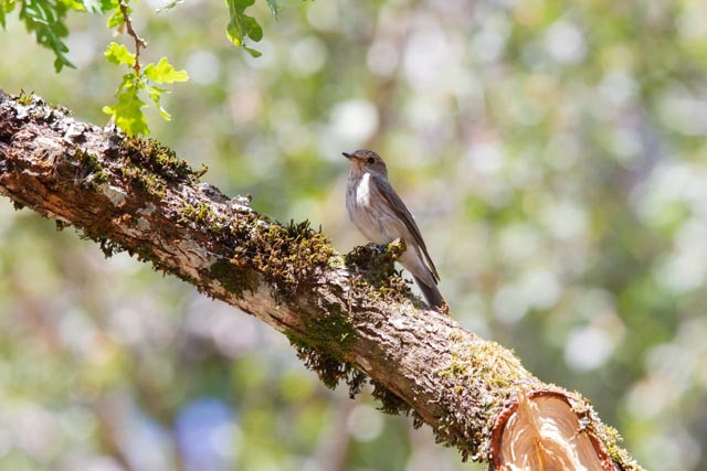
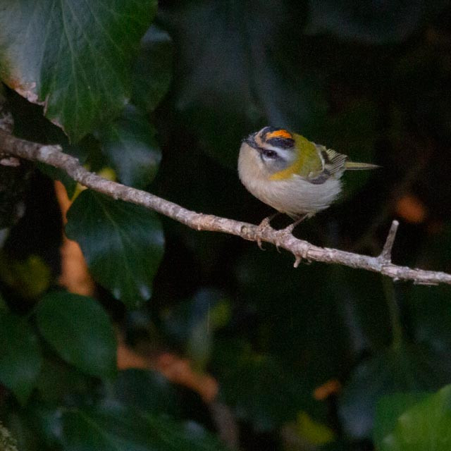
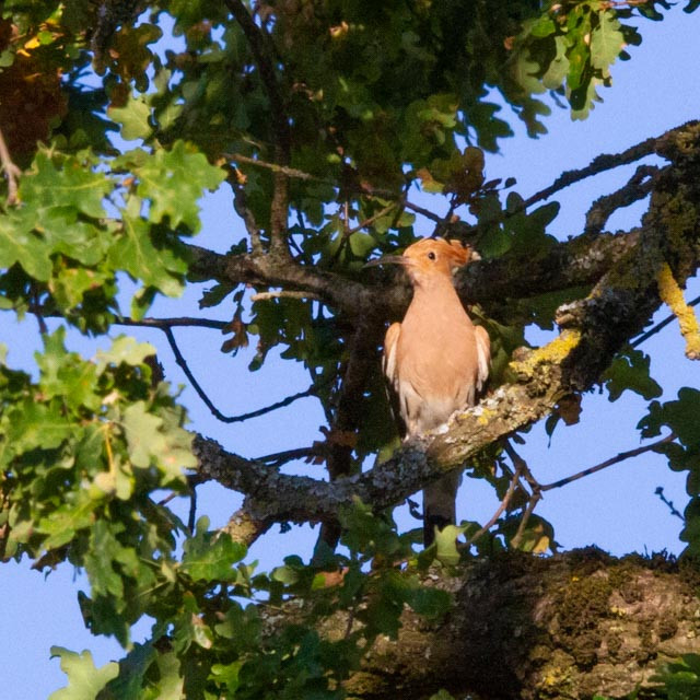
We regularly stay at camping Le Muret near Saint-Salvadou. This campsite is a bird magnet in the region. In the summer you can frequently observe Loriot d'Europe, but also Gobemouche gris hunting insects above the local lakes. From the campsite you can take a beautiful circular walk (5 km, see the map, good walking legs recommended) that leads you through varied habitats. For example, in 2022 we saw young Pie-grièche écorcheur who were still being fed on the electrical cables . Other birds you can see in the area are: Huppe fasciée, Bruant zizi, Milan royal, Milan noir, Tourterelle des bois, Gobemouche noir, Chouette hulotte, Grand Corbeau, Buse variable, Roitelet triple-bandeau, Pic mar, Pic épeiche, Sittelle torchepot, Mésange bleue, Mésange charbonnière, Pouillot siffleur, Pouillot fitis, Grimpereau des jardins and Héron cendré.
_________________________
Français: Une zone vallonnée est caractérisée par des lacs, des champs, des bois et de nombreux buissons et murs de terre avec de vieux arbres qui séparent les parcelles agricoles. Depuis camping Le Muret, vous pouvez faire une belle promenade circulaire (5 km, voir la carte) qui vous mène à travers des habitats variés.
The area is best explored on foot. It is extremely quiet, so every sound will betray your presence. On the other hand, some birds can be heard from a great distance. You can park opposite camping Le Muret (click on the P in the map for directions). There you can treat yourself to an espresso or a beer after your walk. The marked route (5 km) is largely on the asphalt road. The gradients in the area are impressive, so unfortunately unsuitable for wheelchairs.
_________________________
Français: Mieux exploré à pied. Vous pouvez vous garer en face du camping Le Muret (cliquez sur le P du plan pour l'itinéraire). Le parcours (5 km) est en grande partie sur la route goudronnée. Les dénivelés de la promenade sont impressionnants, donc malheureusement inadaptés aux fauteuils roulants.
I myself have only visited this area in the summer. Very curious if there are birdwatchers who have experience with this area in the winter months. Please leave a comment at the bottom of this page and I can include your experiences in the text.
 ) Insérez les noms d'oiseau dans votre langue. Ils seront automatiquement traduits pour les autres usagers !
Votre feedback sera transmis à l’auteur.rice de cette zone et à l’équipe éditoriale de Birdingplaces, qui l’utiliseront pour améliorer la qualité des informations. (Vous souhaitez publier un commentaire visible en bas de page ? Fermez cette fenêtre et choisissez l’Option 1 : « Publier un commentaire, un conseil ou une observation ».)
Veuillez fournir des suggestions d'améliorations ou d'ajouts au texte de ce site ornithologique.
Veuillez fournir vos suggestions d'améliorations ou d'ajouts à la carte.
Veuillez fournir des suggestions d'améliorations ou d'ajouts à la liste des oiseaux.
Cliquez sur l'icône de l'oiseau () Insérez les noms d'oiseau dans votre langue. Ils seront automatiquement traduits pour les autres usagers !