


Charger images
Les formats d'image autorisés sont de type jpeg, png ou gif
La taille maximale du fichier doit être de 20MB

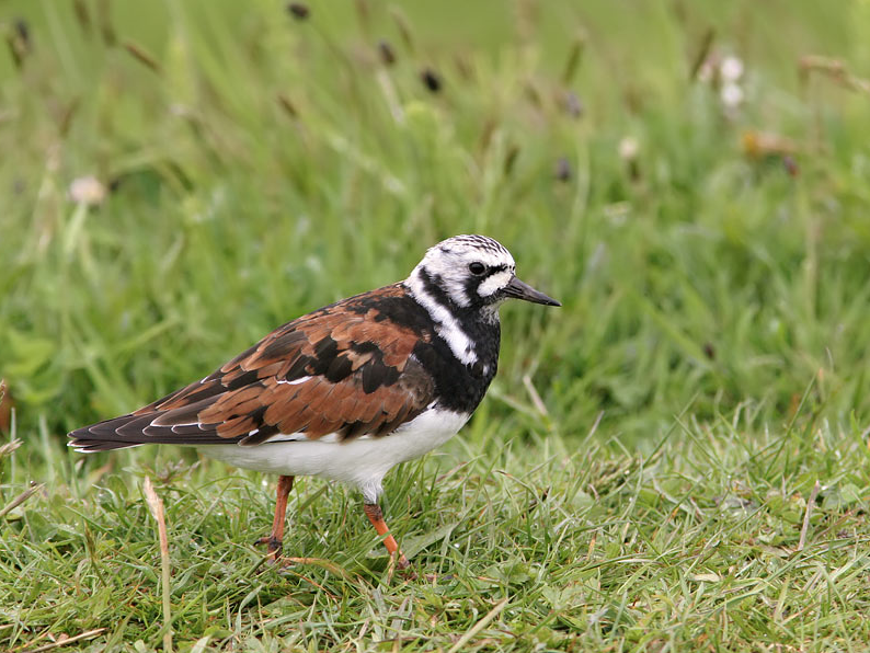
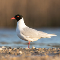
The estuary of the river Slack attracts many birds and is a stopover for birds that migrate along the coast.
Twice a day, the Slack, the coastal river that originates upstream of the Marquise and flows into the English Channel, fills with each tide with a large volume of seawater, taking the appearance of a small inland sea. The estuary is a very rich biotope that attracts many migratory birds and waders. For example Grand Gravelot, Tournepierre à collier, Bécasseau sanderling, Bécassine des marais, Chevalier guignette, Mouette mélanocéphale and Aigrette garzette.
_________________________
Français: Deux fois par jour en effet, la Slack, ce fleuve côtier qui prend naissance en amont de Marquise et qui se jette dans la Manche, se remplit à chaque marée d'un volume important d'eau de mer, prenant l'aspect d'une petite mer intérieure. C'est un biotope très riche qui permet à la faune marine de se reproduire tout en offrant une halte appréciable aux oiseaux migrateurs.
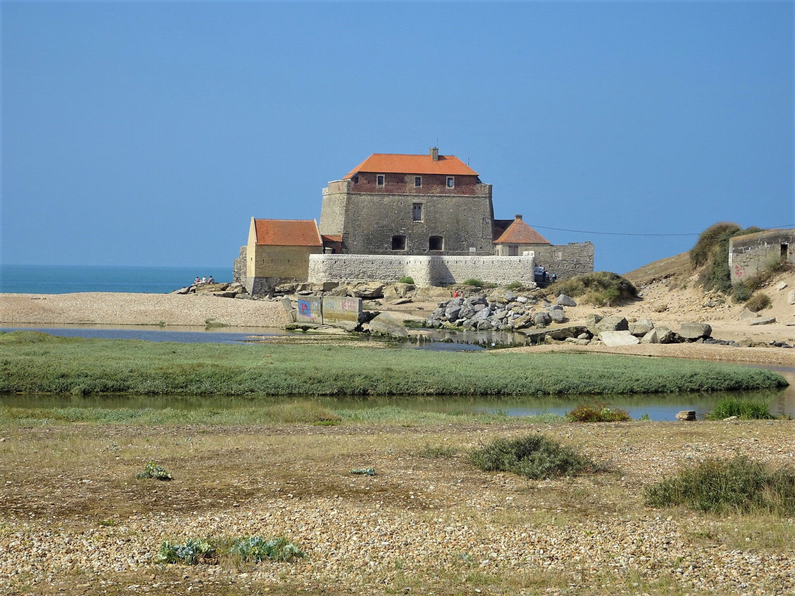
The Estuaire de la Slack is located directly south of the village of Ambleteuse. You can park on the small parking at the beginning of the estuary or in the village. During low tide you can make a 3 km circular walk around Fort Mahon (although it is possible that on some small parts you have to wade through shallow water). A circular walk is not not possible at high tide. See a link to the tide table below. Click on a P on the map for directions to a parking lot.
_________________________
Français: L'Estuaire de la Slack est situé directement au sud du village d'Ambleteuse. Vous pouvez vous garer sur le petit parking au début de l'estuaire ou dans le village. À marée basse, vous pouvez vous promener dans la zone, mais vous devez parfois patauger dans des eaux peu profondes. Ce n'est pas possible à marée haute. Cliquez sur un P sur la carte pour accéder à un parking.
Photo Ambleteuse - Fort Mahon by Pierre André Leclercq, CC BY-SA 4.0, https://creativecommons.org/licenses/by-sa/4.0, via Wikimedia Commons
 ) Insérez les noms d'oiseau dans votre langue. Ils seront automatiquement traduits pour les autres usagers !
Votre feedback sera transmis à l’auteur.rice de cette zone et à l’équipe éditoriale de Birdingplaces, qui l’utiliseront pour améliorer la qualité des informations. (Vous souhaitez publier un commentaire visible en bas de page ? Fermez cette fenêtre et choisissez l’Option 1 : « Publier un commentaire, un conseil ou une observation ».)
Veuillez fournir des suggestions d'améliorations ou d'ajouts au texte de ce site ornithologique.
Veuillez fournir vos suggestions d'améliorations ou d'ajouts à la carte.
Veuillez fournir des suggestions d'améliorations ou d'ajouts à la liste des oiseaux.
Cliquez sur l'icône de l'oiseau () Insérez les noms d'oiseau dans votre langue. Ils seront automatiquement traduits pour les autres usagers !