


Charger images
Les formats d'image autorisés sont de type jpeg, png ou gif
La taille maximale du fichier doit être de 20MB


Open area in the Dijle Valley with grasslands, wet areas and forest edges. Only accessible on foot and by bicycle.
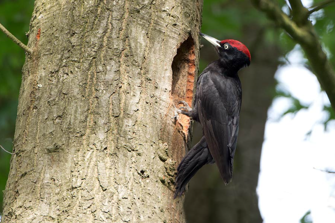
Mispeldonk is a particularly varied nature reserve with grasslands, hay meadows forest edges, moist deciduous forests and restored heathlands. The stream Boeimeerbeek meanders through that landscape. Here you can find common species such as Cigogne blanche, Pic vert, Tarier pâtre, Fauvette grisette, Coucou gris, but also rarer ones such as Pic noir and Pie-grièche écorcheur. Mispeldonk is only accessible on foot and by bicycle.
_________________________
Nederlands: Mispeldonk is een open gebied in de Dijlevallei met graslanden, natte delen en boszomen. Enkel te voet en met fiets toegankelijk. Een bijzonder gevarieerd natuurgebied met schrale graslanden, hooiweiden met houtkanten, vochtige loofbosjes en herstelde heidegebiedjes. Door dat landschap meandert de Boeimeerbeek. Je kan hier algemene soorten aantreffen zoals Cigogne blanche, Pic vert, Tarier pâtre, Fauvette grisette, Coucou gris, maar ook schaarsere zoals Pic noir en Pie-grièche écorcheur.
Mispeldonk is located east of the city of Mechelen. Access is possible via various roads: via Koninging Astridlaan, Koning Albertlaan, Boeimeerstraat or via Dijleweg. The area is connected to the Mechels Broek and the Barebeek estuary by designated hiking trails. Click on a P on the map for directions to a parking lot. The walking route indicated on the map is approximately 6 km.
_________________________
Nederlands: Mispeldonk ligt ten oosten van de stad Mechelen. Toegang is mogelijk langs verschillende wegen: via de Koninging Astridlaan, Koning Albertlaan, Boeimeerstraat of via de Dijleweg. Het gebied is met aangeduide wandelwegen verbonden met het Mechels Broek en de Barebeekmonding. Klik op een P in de kaart voor een routebeschrijving naar een parkeerplaats. De op de kaart aangegeven wandelroute is ongeveer 6 km.
 ) Insérez les noms d'oiseau dans votre langue. Ils seront automatiquement traduits pour les autres usagers !
Votre feedback sera transmis à l’auteur.rice de cette zone et à l’équipe éditoriale de Birdingplaces, qui l’utiliseront pour améliorer la qualité des informations. (Vous souhaitez publier un commentaire visible en bas de page ? Fermez cette fenêtre et choisissez l’Option 1 : « Publier un commentaire, un conseil ou une observation ».)
Veuillez fournir des suggestions d'améliorations ou d'ajouts au texte de ce site ornithologique.
Veuillez fournir vos suggestions d'améliorations ou d'ajouts à la carte.
Veuillez fournir des suggestions d'améliorations ou d'ajouts à la liste des oiseaux.
Cliquez sur l'icône de l'oiseau () Insérez les noms d'oiseau dans votre langue. Ils seront automatiquement traduits pour les autres usagers !