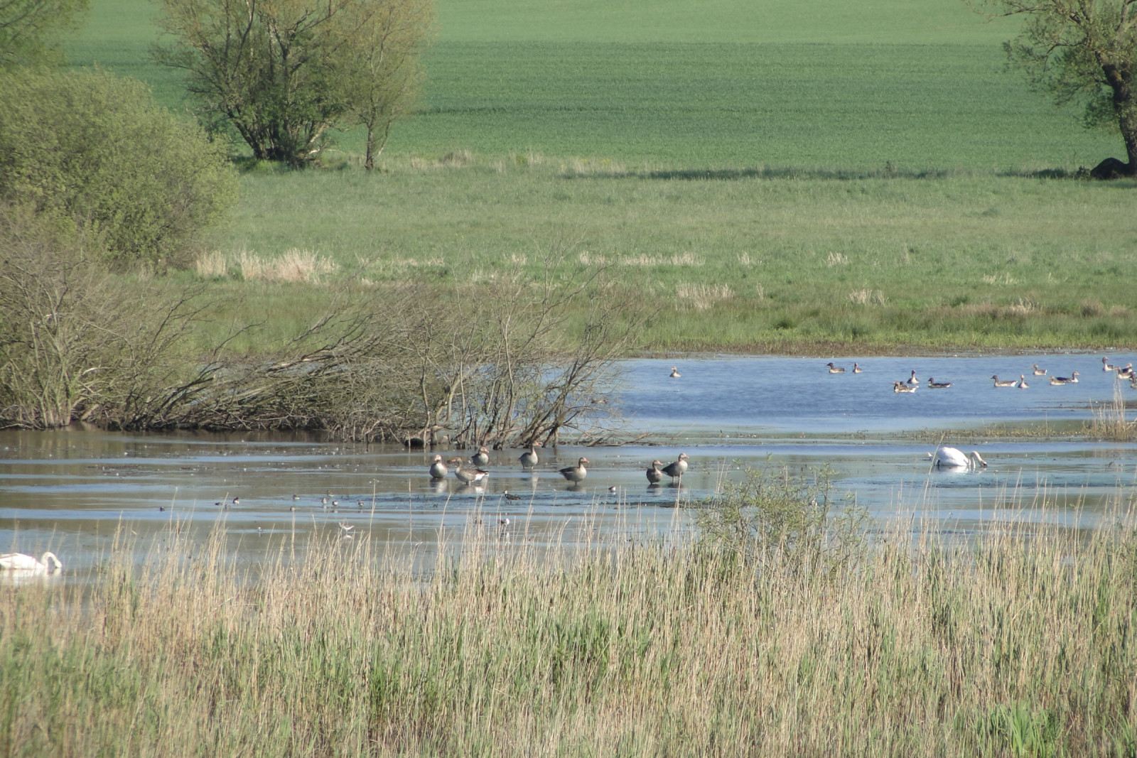
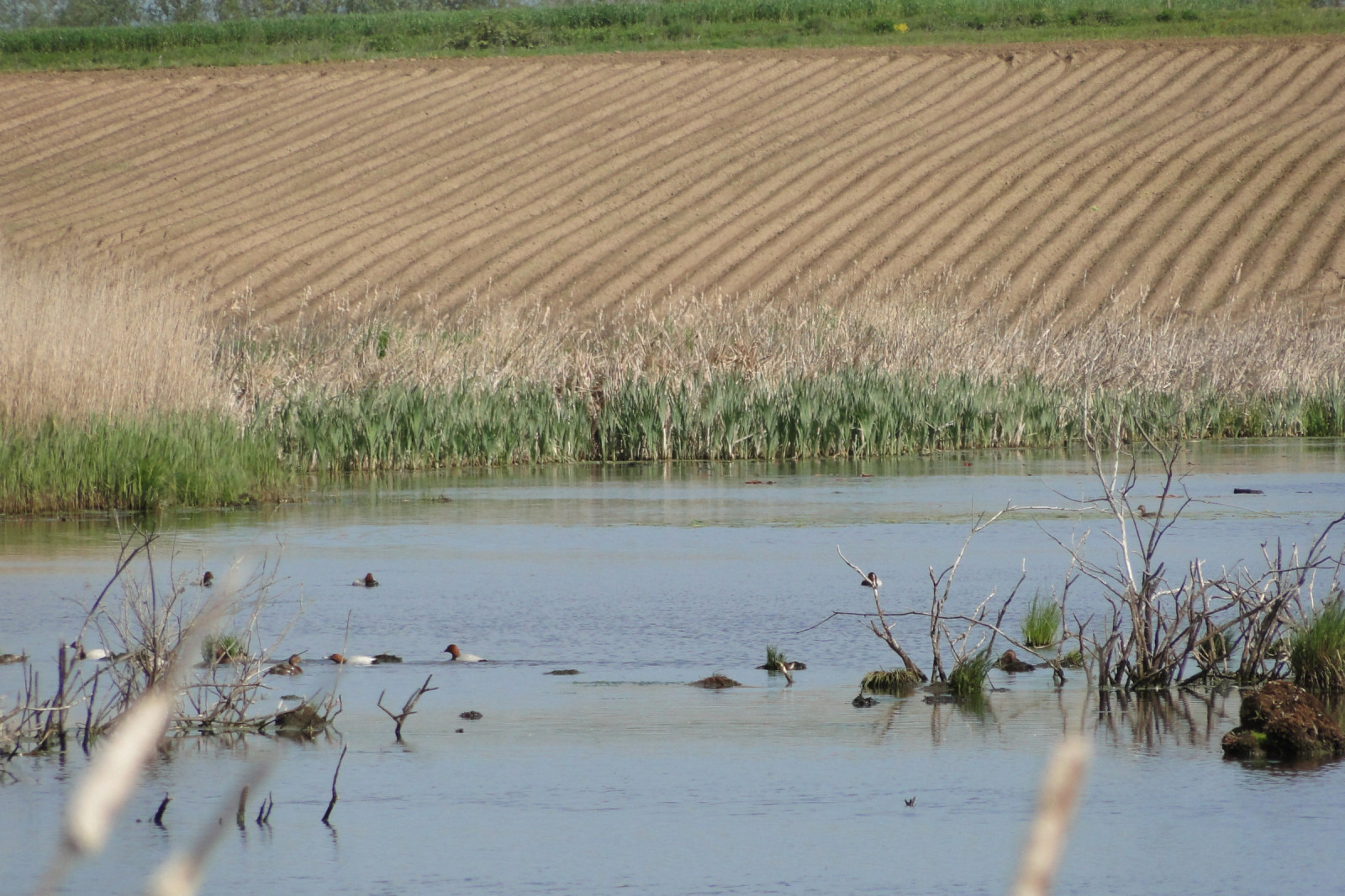
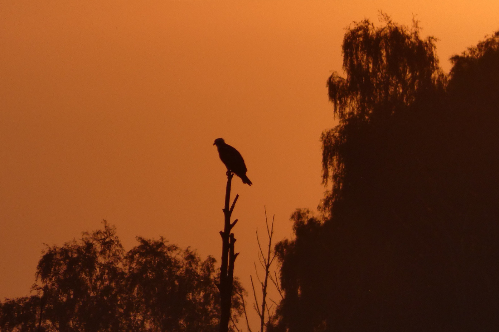
Description
Łabędzie Rozlewisko is a mid-field backwater that is a breeding ground for harmaasorsa, kyhmyjoutsen, pikku-uikku, härkälintu, naurulokki, kalatiira, nokikana, kaulushaikara and ruskosuohaukka. During the migration period, significant numbers of various ducks, and in favorable water level conditions, the possibility of observing liro, valkoviklo, suokukko and suosirri. The place is a roost for Kurki. Among predators, you can often find here: merikotka, sääksi (kalasääski) and pikkukiljukotka.
_________________________
Polski: Rozciągnięte rozlewisko, zwłaszcza jako miejsce lęgowe: harmaasorsa , kyhmyjoutsen , pikku-uikku , härkälintu , naurulokki , kalatiira , nokikana , ruskosuohaukka , kaulushaikara. Na przelotach stada kaczkowatych, a przy odpowiednich warunkach liro , valkoviklo , suokukko , suosirri . Noclegowisko Kurki. Polowania merikotka, pikkukiljukotka i sääksi (kalasääski).
Details
Access
The two best routes to get to Łabędzie Rozlewisko from the south: 1. By car in Benice turn left towards Ducin and behind the buildings take a dirt, bumpy road to the right to the very edge of the floodplain (may be impassable). 2. Park on the side of the road along the Benice-Chomino road and a marked footpath along the western edge of the floodplain (difficult, overgrown road).
_________________________
Polski: Dwie najlepsze trasy dojazdu od południa: 1. Samochodem w Benicach w lewo w kierunku Ducina i za zabudowaniami polną, wyboistą drogą w prawo do samego brzegu rozlewiska (może być nieprzejzdna). 2. Parkowanie na poboczu wzdłuż drogi Benice-Chomino i zaznaczoną ścieżką pieszo wzdłuż zachodniego brzegu rozlewiska (droga trudna, zarośnięta).
Terrain and Habitat
Wetland , Pond , Mud flats , Grassland , Scattered trees and bushesConditions
Flat , Wet , Open landscape , HillyCircular trail
NoIs a telescope useful?
Can be usefulGood birding season
Spring , SummerBest time to visit
SpringRoute
Narrow trail , Unpaved roadDifficulty walking trail
Average walkAccessible by
FootBirdwatching hide / platform
NoExtra info
It is possible to walk along the entire western bank of the floodplain, but there are no roads or paths (the route leads through fields and wasteland).
_________________________
Polski: Można przejść wzdłuż całego zachodniego brzegu rozlewiska, ale nie ma dróg ani ścieżek (trasa prowadzi przez przez pola i nieużytki).


 ) to insert bird names in your own language. The birdnames will automatically be translated for other users!