


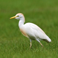
Description
Ballastière de Fretterans is located along the river Doubs and surrounded by meadows. Several viewpoints available on the Doubs. Good place to observe birds. Typical birds such as Paksujalka, pikkutylli, kalatiira or even sinirinta are found on the banks and willow groves of the Doubs. The area is regularly frequented by isokoskelo and kuningaskalastaja. One can easily observe mehiläissyöjä and törmäpääsky In the meadows it is possible to observe kuovi, pikkulepinkäinen and the pikkuvarpunen . In the spring the niittysuohaukka uses this landscape as a hunting area. During the migration period, many species stop off in this area such as sääksi (kalasääski), mustahaikara, punajalkahaukka or valkoviklo.
_________________________
Français: Ancienne zone de stockage des graviers et sables extraits du Doubs, zone en bordure de rivière et entourée de prairies. Plusieurs points de vues disponibles sur le Doubs et sur les grèves, possibilité de faire des observations et de se promener à travers le pâquier. On retrouve sur les grèves et saulaies du Doubs des oiseaux typiques comme l' Paksujalka , le pikkutylli , la kalatiira ou encore la sinirinta . La zone est régulièrment fréquentée par le isokoskelo ou encore le kuningaskalastaja. On peut y oberver facilement le mehiläissyöjä et l' törmäpääsky Dans les prairies il est possible d'observer le kuovi , la pikkulepinkäinen ou encore le pikkuvarpunen . Au printemps le niittysuohaukka utilise ce secteur comme zone de chasse. En période de migration de nombreuses espèces font halte dans ce secteur comme le sääksi (kalasääski) , la mustahaikara , le punajalkahaukka ou encore le valkoviklo.
Details
Access
Access via rue du Faubourg from the village of Fretterans. Click on a P in the map to get directions. The circular route you see on the map is about 4 km long.
_________________________
Français: Accès par la rue du Faubourg depuis le village de Fretterans. Cliquez sur un P sur la carte pour obtenir les directions. L'itinéraire circulaire que vous voyez sur la carte mesure environ 4 km.
Terrain and Habitat
Wetland , Plain , Forest , Grassland , Scattered trees and bushes , RiverConditions
Flat , Open landscapeCircular trail
YesIs a telescope useful?
Can be usefulGood birding season
All year roundBest time to visit
SpringRoute
Wide path , Unpaved roadDifficulty walking trail
EasyAccessible by
Foot , Bicycle , Car , WheelchairBirdwatching hide / platform
NoExtra info
Afin de permettre aux ornithologues locaux de continuer à protéger le site merci de renseigner vos observations sur le site www.Faune-France.org. Veuillez également respecter la réglementation qui interdit l'accès aux grèves, plages et îles sur ce site entre le 01 mars et le 31 juillet


 ) to insert bird names in your own language. The birdnames will automatically be translated for other users!