

Descripción
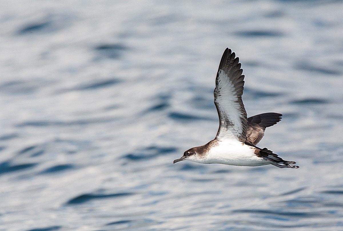
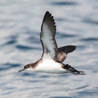
Sand Point at 158 foot tall, is a smaller version of Brean Down Nature Reserve and Brean Beach (see separate entry) further South. Sand Point lies North of Weston-Super-Mare, the point comprises of grassland (close cropped by rabbits), the slopes have Hawthorn (Crataegus), Elder (Sambucus) and Blackberry (Rubus) forming extensive scrubland. During Spring mornings this scrubland holds passage migrant Mosquitero Musical, Mosquitero Común, Buscarla Pintoja, Curruca Capirotada, Papamoscas Cerrojillo and Bisbita Arbóreo. More open areas have passage migrant Collalba Gris and Mirlo Capiblanco. Depending on season the seawatcher can expect to see Colimbo Chico, Pardela Pichoneta, Alcatraz Atlántico, Fulmar Boreal, Gaviota Tridáctila, Barnacla Carinegra, Ánade rabudo norteño, Págalo Parásito, Págalo Grande, Págalo Pomarino and the occasional Gaviota de Sabine (in Autumn), all during North West onshore winds in particular.
Sand Bay being on the Severn Estuary has a high tide range, birds can be at long distance at low tide, 2 hours either side of high tide improve your chance of seeing Chorlitejo Grande, Zarapito Trinador, Correlimos Tridáctilo and Correlimos Gordo (all in small numbers) during Spring and Autumn, Wintering birds include Zarapito Real, Archibebe Común, Chorlito Gris and sometimes 2000+ Correlimos Común, at high tide some birds use the saltmarsh at the North end of the beach as a high tide roost.
BE AWARE Livestock may be present on site.
Detalles
Accesso
BE AWARE, Weston-Super-Mare is known for it's large amount of roundabouts. On M5 motorway (Northbound or Southbound), exit at junction 21 signed Weston-S-Mare A370. At large roundabout take exit signed Weston-S-Mare A370, stay in Left hand lane, leave this road on Left slip road signed B3440. Continue on this road (crossing over A370), on this B3440 get in middle lane following signs to North Worle/Crematorium/Kewstoke/Sand Bay. Continue on this B3440 also called Queen's Way and follow signs (on multiple roundabouts) to Kewstoke/Sand Bay. On leaving Weston-Super-Mare the road becomes Lower Norton Road and eventually becomes narrow, at next junction on Kewstoke seafront turn Right signed Sand Point only, continue on this road (Beach Road) until reaching National Trust car park (Fee Payable) at the end of the road.


 ) insertar los nombres de aves en tu propio idioma. ¡Los nombres de las aves serán traducidos automáticamente para otros usuarios!