
Descripción
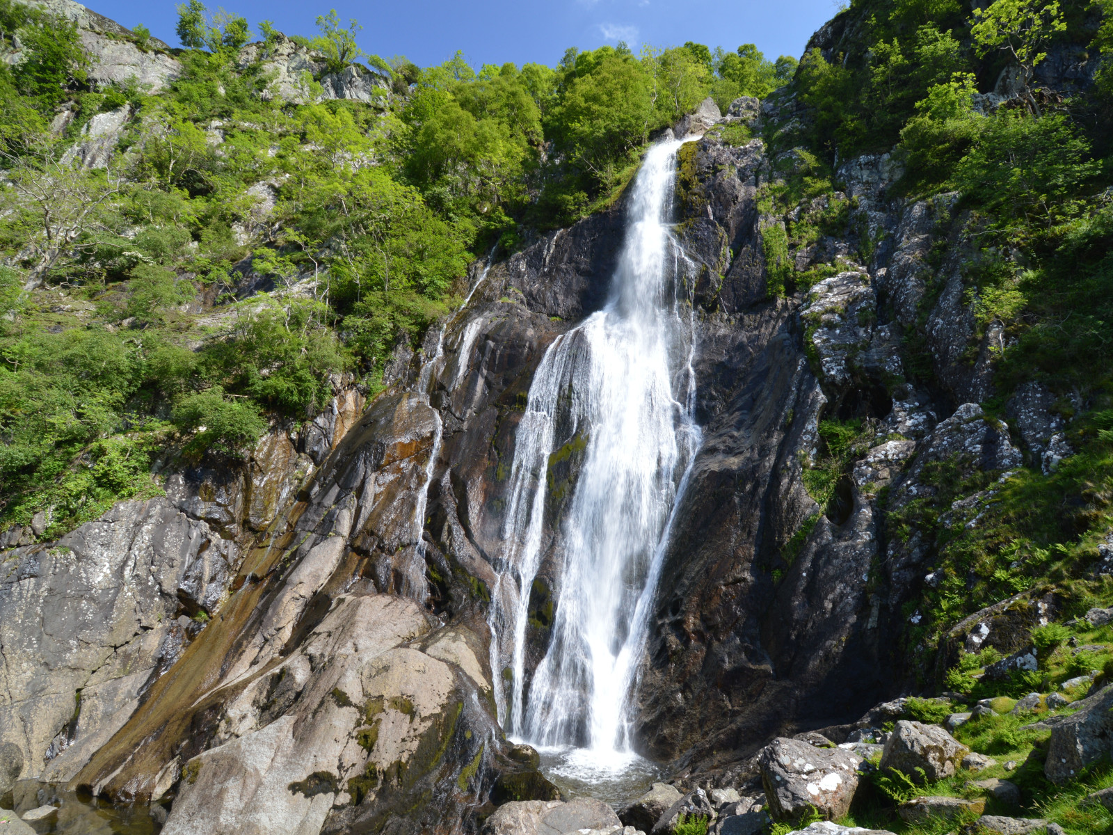
Aber Falls is located in one of the northernmost of Wales' classic hill valley woodlands. Easily accessible from the university city of Bangor and the North Wales coastal road. The semi-natural to natural woods of Oak, Ash, Alder, and Hawthorn are excellent breeding habitat for the four classical upland broadleaf woodland birds, Papamoscas Cerrojillo, Colirrojo Real, Bisbita Arbóreo and Mosquitero Silbador, as well as resident species like Pito Real and Zorzal Charlo. The river below the Falls, the Afon Goch, has Mirlo-acuático Europeo, Lavandera Cascadeña and Andarríos Chico. Around the cliffs beside the Falls, scan for Mirlo Capiblanco in spring and summer, and on the screes, Tarabilla Norteña, Tarabilla común and Collalba Gris. The area is bleak in winter, but flocks of Zorzal Alirrojo and Zorzal Real can be seen in the open ground, and Jilguero Lúgano and Pardillo Alpino feeding on seeds in the Alders and Birches.
A longer, strenuous option is to continue to the southeast of the falls; climb up the side of the former plantation to the northeast of the Falls, then cut straight up the open moor to Llwytmor (849 m) and on to Foel-fras (944 m) and Foel Grach (974 m), or even to Carnedd Llewelyn (1,064 m). Birds up here are few, but Cuervo Grande is reliable, Halcón Peregrino regular, Chova Piquirroja occasional, and in mid to late May, spring passage Chorlito Carambolo are frequently seen on the barren high tops. Be careful when descending to follow a safe path, don't try climbing down the cliffs beside Aber Falls!
Detalles
Accesso
Take the bus from Bangor to Llanfairfechan (and beyond), alight at Abergwyngregyn and walk from there; alternatively, cycling from either Bangor (10 km) or Llanfairfechan (4 km) rail stations. For cars, see the P sign on the map for directions.
Terreno y habitat
Bosque , Montaña , Cañón/acantilado , Árboles y arbustos dispersos , Pradera , Meseta , Valle , RíoCondiciones
Montañoso , Pantanoso , Montañoso , Rocoso , Paisaje abierto , ResbaladizoCamino circular
Sí¿Se necesita telescopio?
NoBuena época para el avistamiento de aves
Primavera , VeranoMejor momento para visitar
Primavera , VeranoRuta
Camino ancho , Camino sin asfaltar , Camino estrechoCamino difícil de andar
Caminata mediaAccesible vía
A pie , Bicicleta , CocheEscondite de observación / plataforma
NoInformación extra
Note that the mountain option should only be attempted during good weather (dry, with cloud base reliably above 1,500 m). With low cloud and rain - frequent at any time of the year - the moors become very dangerous, as it is easy to get lost and fall down any of the many crags. Make sure you are equipped for heavy rain at any time - this is a temperate rainforest area! In winter, deep snow can be expected above 300-400 m; do not attempt the mountains in this without good mountaineering experience!
Photo of Aber Falls by Clive Giddis, cc-by-sa license, from geograph.org.uk (photo 4006020).


 ) insertar los nombres de aves en tu propio idioma. ¡Los nombres de las aves serán traducidos automáticamente para otros usuarios!