.jpg)


Descripción
Vildmarksvägen (the Wilderness Route) is one of the most beautiful and highest roads in Sweden and runs across the Stekenjokk plateau between Lapland and Jämtland. A trip along the Stekenjokkvägen plateau during the height of summer is really nice. It is one of the places in Sweden that combines easily accessible mountain habitats with great birdwatching.
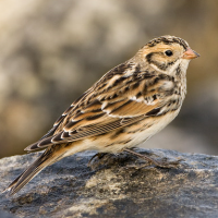
At the beginning of June, Stekenjokkvägen opens after being covered in snow during the winter. From then until August, birding is at its best. Ánade rabudo norteño, Porrón Bastardo, Págalo Rabero, Escribano Lapón, Negrón común, Pato Havelda, Lagópodo Común, Lagópodo Alpino, Chorlito Carambolo, Correlimos Oscuro, Correlimos Común, Correlimos de Temminck, Falaropo Picofino, Charrán ártico, Ruiseñor Pechiazul, Mirlo Capiblanco and Escribano Nival are all regularly breeding species.
Many birds can be spotted in the immediate vicinity of the road, which makes the observation of birds sometimes easy. But making a walk in the the relatively easy-to-hike mountain terrain is also a great experience. A couple of marked trails are open for hiking out on the mountain. Note that on the Jämtland side, the area is both a nature reserve and a bird protection area with no access outside the road area 10 June–10 July.
Detalles
Accesso
Vildmarksvägen (the Wilderness Route) runs across the Stekenjokk plateau across the bare mountains between Leipikvattnet in northernmost Jämtland and Klimpfjäll in southernmost Lapland. The route is only open from early June to mid-October. During the winter the road is closed due to the large amounts of snow. When the road opens in June, it is not unusual for the snow to still be several meters high on both sides of the road.
You get to the Stekenjokk plateau either from the south via Strömsund-Gäddede or from the north via Vilhelmina-Klimpfjäll. You can make many stops along the way. One of the best is at the small Hamptjärnen lake. It is just west of the road, and just north of the lake the road makes a sharp curve to the west. There is a car park next to the lake. Click on a P in the map to get directions.
Note: The weather can be harsh on the plateau, so if you want to make longer mountain hikes in the area you should have good mountain skills.
Terreno y habitat
Meseta , BrezalesCondiciones
Paisaje abierto , MontañosoCamino circular
Sí¿Se necesita telescopio?
Puede ser útilBuena época para el avistamiento de aves
VeranoMejor momento para visitar
VeranoRuta
Camino pavimentadoCamino difícil de andar
FácilAccesible vía
A pie , Coche , BicicletaEscondite de observación / plataforma
NoInformación extra
Photo Road through Stekejokk by Hans Tbg, CC BY-SA 4.0, https://creativecommons.org/licenses/by-sa/4.0, via Wikimedia Commons


 ) insertar los nombres de aves en tu propio idioma. ¡Los nombres de las aves serán traducidos automáticamente para otros usuarios!