

Descripción
Färnebofjärdens is a 101 square kilometer national park that is located along the Dalälven river and offers a wide variety of aquatic and forest birds. Along the shores Águila Pescadora and Pigargo Europeo hunt, while in the water Colimbo Ártico swim around. In the forest, species like Gallo lira común and Urogallo Común can be found. The national park is located along the "Limes Norrlandicus", meaning that both animals and plants from northern and southern Sweden meet here.
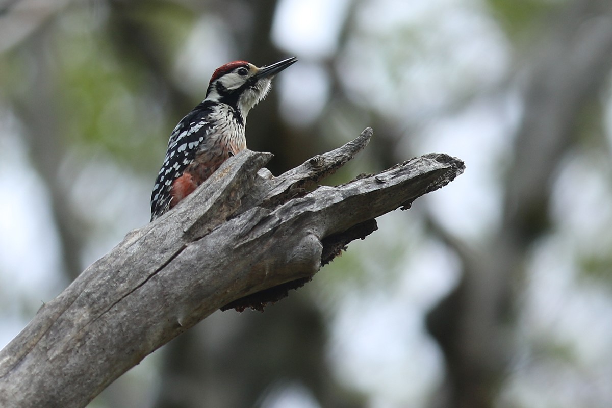
Because the river is surrounded by old growth forest, with actions being taken to create even more old, dead trees, this park has become the only place in Sweden where you can find all eight of Swedens woodpeckers: Pico tridáctilo, Pico Dorsiblanco, Pico Picapinos, Pico Menor, Picamaderos Negro. Pito Real, Pito Cano and Torcecuello Euroasiático. The park is also known for its owls like Mochuelo Alpino, Mochuelo Boreal and Cárabo Uralense.
Except for birds the park is also home to Otters and Beavers which are most easily seen during winter and spring.
The park is big and has many trails, like the hiking trails Upplandsleden and Gästrikeleden that go through the park. To explore the park as much as possible one can go by car and drive to the different places in the park and take hikes from there. Easiest is to start at the Naturum (visitor centre) in Gysinge where you can find lots of information about the park as well as exhibitions.
Detalles
Accesso
A good place to start is at the Naturum in Gysinge. Easiest to reach the naturum is by car. Click on a P in the map to get directions to that point. Buses are also available but only from Gävle and Sandviken and not directly from Uppsala.
There are many options for walks. On the map we have indicated just one option. A circular walk of 4 km southeast of Gysinge. The Bändan loop goes along the riverbank to the island of Mattön's southern tip and back through the forest. The trail goes on a wide path and over a wide span out over a river meadow. There are wind shelters along the trail. The loop is marked in red. Don't forget to bring insect repellent, because otherwise mosquitoes can sometimes spoil your walk.


 ) insertar los nombres de aves en tu propio idioma. ¡Los nombres de las aves serán traducidos automáticamente para otros usuarios!