Descripción
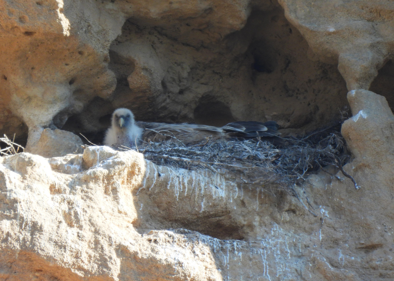
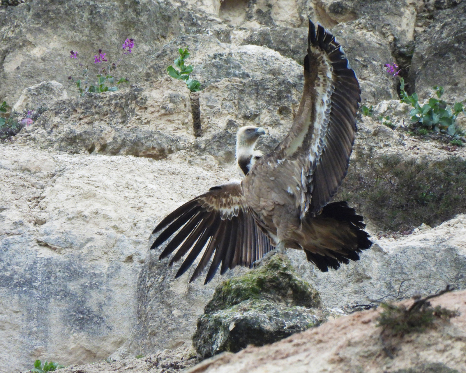
The main interest of the Pico Gurugú site is its Buitre Leonado colony, with a dozen pairs nesting on the cliff itself and several more on nearby cliffs. Other interesting species also nest here, such as Búho Real, Roquero Solitario, Chova Piquirroja, Cernícalo vulgar or Avión Roquero.
On the scrubby slopes and in the scattered trees, you can find Escribano Montesino, Cogujada Montesina, Curruca Rabilarga or Alcaudón Común, among others. Common forest birds such as the Iberian Pito Real, Pico Picapinos, Carbonero Común and Mito Común can be seen in the riparian vegetation of the Duero. The surrounding farmland is home to typical agricultural species such as Pardillo Común, Jilguero Europeo, Escribano Triguero and Cogujada Común.
_________________________
Español: El principal interés del sitio es su colonia de Buitre Leonado, con una decena de parejas nidificantes en el propio cortado y otras tantas en cortados próximos. En el lugar también nidifican otras especies interesantes como Búho Real, Roquero Solitario, Chova Piquirroja, Cernícalo vulgar o Avión Roquero.
En las laderas cubiertas de matorral y arbolado disperso se encuentran Escribano Montesino, Cogujada Montesina, Curruca Rabilarga o Alcaudón Común entre otros. En la vegetación de ribera del Duero se observan aves forestales comunes como pito ibérico, Pico Picapinos, Carbonero Común o Mito Común. Los campos de cultivo del entorno acogen a las típicas especies de medios agrícolas como Pardillo Común, Jilguero Europeo, Escribano Triguero o Cogujada Común.
Detalles
Accesso
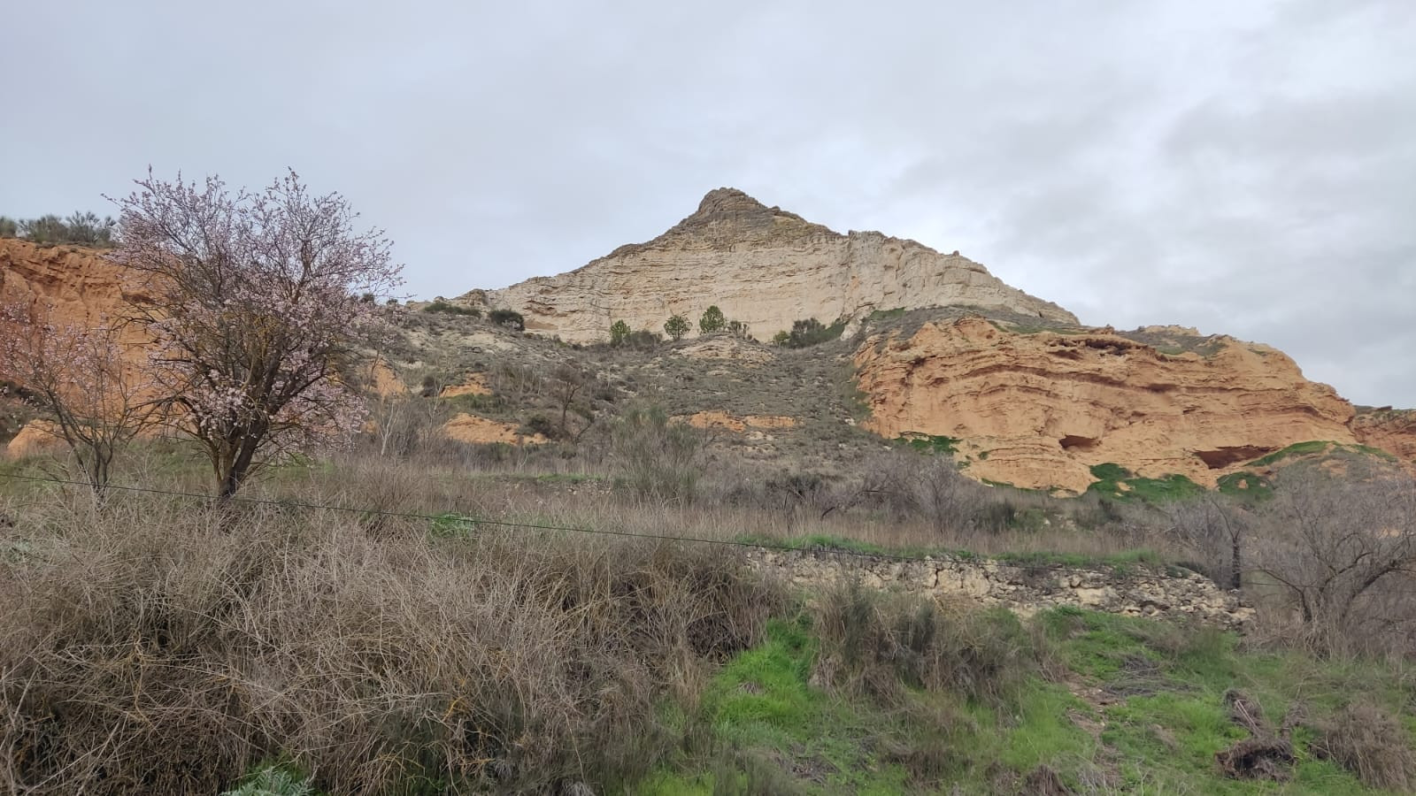
Pico Gurugú is located northeast of the town of Peñafiel. Easy access via the VP-3017 from Peñafiel to the village of Bocos de Duero. At the end of the village, Pico Gurugú is signposted. Parking is available at the foot of the cliff, next to the cemetery. Press P on the map for directions.
_________________________
Español: Acceso sencillo por la VP-3017 de Peñafiel a Bocos de Duero, al final del pueblo está señalizado el pico Gurugú. Se puede aparcar al pie del mismo cortado junto al cementerio. Presione P en el mapa para obtener instrucciones sobre cómo llegar al estacionamiento.
Terreno y habitat
Cañón/acantilado , Llanura , Río , Árboles y arbustos dispersosCondiciones
Plano , Paisaje abierto , RocosoCamino circular
No¿Se necesita telescopio?
Puede ser útilBuena época para el avistamiento de aves
Todo el añoMejor momento para visitar
PrimaveraRuta
Camino pavimentado , Camino sin asfaltarCamino difícil de andar
FácilAccesible vía
A pie , Coche , BicicletaEscondite de observación / plataforma
NoInformación extra
There is a marked path that leads up to the top of the cliff, offering views of the Duero Valley, the Cuco Valley, and the Peñafiel and Curiel castles. From the cemetery, you can follow a trail to Peña Ahumada.
_________________________
Español: Existe una senda señalizada por la que se puede subir andando a la parte alta del cortado desde donde disfrutar de la vista del Valle del Duero, el Valle del Cuco o los castillos de Peñafiel y de Curiel. Desde el cementerio se puede seguir a pie una pista hasta Peña Ahumada.


 ) insertar los nombres de aves en tu propio idioma. ¡Los nombres de las aves serán traducidos automáticamente para otros usuarios!