Descripción
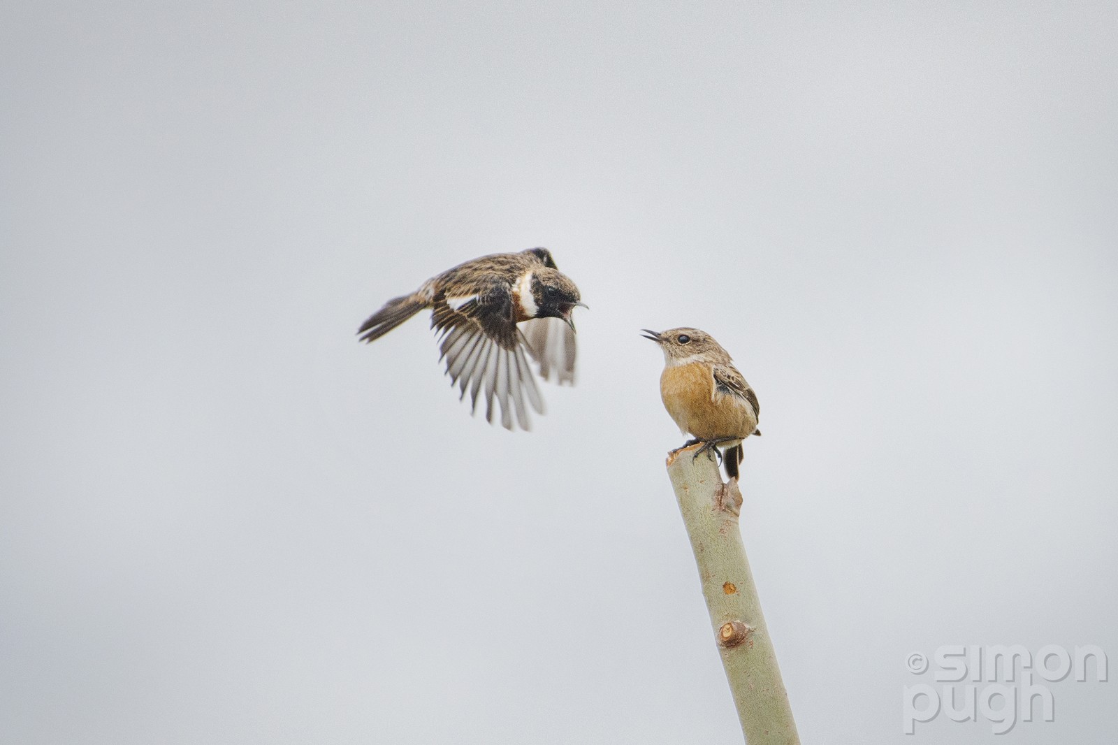
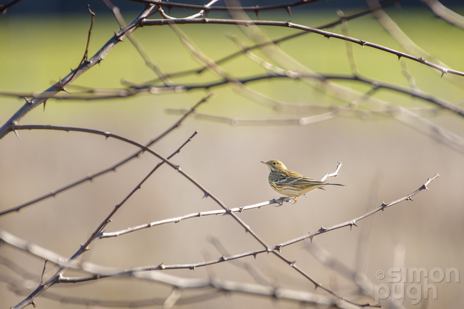
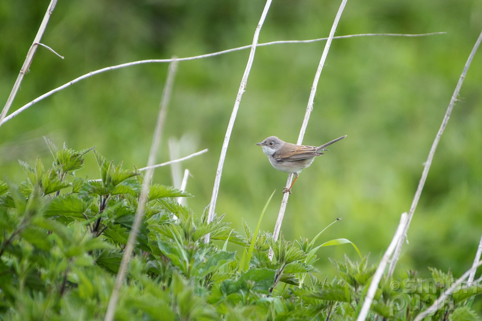
The Grensmaas nature reserve is located around the Maas/Meuse river and is just a few kilometers north of the city of Maastricht. It offers various habitats but comprises mainly of a wide grassy area (maybe 4km2) with clumps of trees, a large mudflat and a lake. Regular sightings in the area include all the usual birds such as Jilguero Europeo, Pico Picapinos, Cernícalo vulgar and Trepador Azul as well as Tarabilla común, Avión Zapador and Serreta Grande. The village of Itteren sits in the middle of the area and offers the possibility of a well-earned coffee and slice of pie.
_________________________
Nederlands: Dit nieuwe natuurgebied aan de Grensmaas bij Itteren ligt slechts enkele kilometers ten noorden van de stad Maastricht. Het bestaat uit grasvelden met struiken en bosjes, ruige rivieroevers en een meer. Je kunt vrij door het gebied struinen. Regelmatige waarnemingen in het gebied zijn alle gebruikelijke vogels zoals Jilguero Europeo, Pico Picapinos, Cernícalo vulgar en Trepador Azul evenals Tarabilla común, Avión Zapador en Serreta Grande. Het dorp Itteren ligt midden in het gebied en biedt de mogelijkheid voor een welverdiende koffie en een stukje taart.
Detalles
Accesso
The area is easily accessible by car and there is plenty of parking in the vicinity. Click on the P in the map to get directions to that spot. From Maastricht there is also the possibility to travel by bus (to Itteren) or by train to the neighbouring village of Bunde (then there's a 1 km walk to the area). The suggested circular walk on the map is about 8 km, but you can wander freely through the area, so it is easy to take a shorter, longer or different route.
_________________________
Nederlands: Het gebied is goed bereikbaar met de auto en er is voldoende parkeergelegenheid in de nabije omgeving. Klik op de P in de kaart om een routebeschrijving naar die plek te krijgen. Vanuit Maastricht is er ook de mogelijkheid om met de bus (naar Itteren) of met de trein naar het naburige dorp Bunde te reizen (dan is het 1 km lopen naar het gebied). De voorgestelde rondwandeling op de kaart is ongeveer 8 km, maar je kunt vrij door het gebied dwalen, dus het is gemakkelijk om een kortere, langere of andere route te nemen.
Terreno y habitat
Humedal , Árboles y arbustos dispersos , Pradera , Río , Lago , Pisos de barroCondiciones
Plano , Arenoso , Seco , Paisaje abierto , Nivel del agua alto probableCamino circular
Sí¿Se necesita telescopio?
Puede ser útilBuena época para el avistamiento de aves
Todo el añoMejor momento para visitar
PrimaveraRuta
Camino sin asfaltar , Camino estrecho , Camino anchoCamino difícil de andar
Caminata mediaAccesible vía
A pie , BicicletaEscondite de observación / plataforma
NoInformación extra
The Grensmaas project is the largest river project in progress in the Netherlands. It should better protect the environment against high water and flooding of the Meuse river. The work extends over a route of 43 kilometers north of Maastricht. About a thousand hectares of nature will be added in the Meuse valley between Maastricht and Roosteren. On the other side of the border, Belgium is also working on a natural Meuse. This creates a cross-border Maaspark of more than 2000 hectares of wild nature.
_________________________
Nederlands: Het project Grensmaas is het grootste rivierproject in uitvoering in Nederland. Het moet de omgeving beter beschermen tegen hoogwater en overstromingen. De werkzaamheden strekken zich uit over een traject van 43 kilometer ten noorden van Maastricht. Ongeveer duizend hectare natuur komt erbij in het Maasdal tussen Maastricht en Roosteren. Aan de andere kant van de grens werkt ook België aan een natuurlijke Maas. Zo ontstaat er een aaneengesloten en grensoverschrijdend Maaspark van ruim 2000 hectare wilde natuur.


 ) insertar los nombres de aves en tu propio idioma. ¡Los nombres de las aves serán traducidos automáticamente para otros usuarios!