Descripción
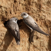
In the Archemermaten the river floods the nature reserve when the water levels are high. In this way the area serves as a temporary water storage. A bird viewing screen has been placed on the Marsweg, which can be used to view the ponds and the wet area. Here you can see many geese, ducks, herons and other water birds. Among the birds you can encounter are Cigüeña Blanca, Avefría Europea, Martín Pescador Común, Alcaudón Dorsirrojo, Lavandera Cascadeña, Tarabilla común, Camachuelo Común, Jilguero Lúgano, Escribano Cerillo and Avión Zapador.
_________________________
Nederlands: In het dal van rivier de Regge bij Archem ligt natuurontwikkelingsgebied Archemermaten. De rivier de Regge heeft hier haar oude loop teruggekregen. Bij hoog water mag de rivier overstromen zodat het natuurgebied hier onder water komt te staan. Zo dient het als tijdelijke waterberging. Op een bult aan de Marsweg is een scherm geplaatst waarover naar de aangelegde plassen in het natte gebied gekeken kan worden. Hier kun je veel ganzen, eenden, reigers en andere watervogels zien en in de omgeving ook Cigüeña Blanca, Avefría Europea, Martín Pescador Común, Alcaudón Dorsirrojo, Lavandera Cascadeña, Tarabilla común, Camachuelo Común, Jilguero Lúgano, Escribano Cerillo en Avión Zapador.
Detalles
Accesso
Take the exit of the N347 near Lemele to Archem/Marienberg. At the next intersection, drive straight ahead onto the sandy path. The moment the road makes a bend, the birdwatching screen is on the left. Click on the P in the map for directions or coordinates.
_________________________
Nederlands: Neem de afslag van de N347 ter hoogte van Lemele naar Archem/Marienberg. Bij de eerstvolgende kruising rij je rechtdoor het zandpad op. Op het moment dat de weg een bocht maakt staat aan de linkerkant het vogelkijkscherm. Klik op de P in de kaart voor een routebeschrijving of coördinaten.
