

Descripción
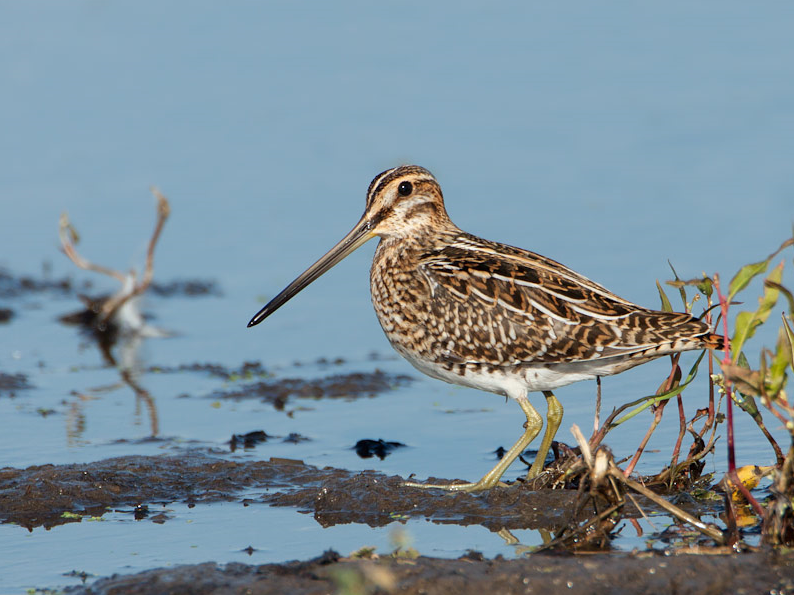
NSG Salbruch is a diverse nature reservoir along the Niers river. Around Clörather Mühle some ponds have been created in the former river bed of the Niers, which has been straightened in the early 20th century. In the summer a pair of Cigüeña Blanca breeds regularly next to the old water mill. Many other birds, such as Ostrero Euroasiático, several specias of ducks and other waterfowl (Ánade friso, Ánade azulón, Focha Común, Zampullín Común, Gallineta Común) , and many songbirds (most notably Tarabilla común, Curruca Zarcera, Curruca Mosquitera, Oropéndola Europea) breed or stay the summer in this area, which contains different habitats of ponds and wetlands, greenland with hedges and small groups of trees, smaller forested areas and a former quarry pond. It's a good area to look out for birds of prey, such has Busardo ratonero, Cernícalo vulgar, Milano Real, Aguilucho Lagunero Occidental, Milano Negro, Azor Común, Gavilán Común, Alcotán Europeo during summer and Aguilucho pálido during winter. Along the Niers river you can search for a hunting Martín Pescador Común. During migration season, many resting birds can be observed. Typical species are Agachadiza común, Archibebe Claro, Andarríos Bastardo, Andarríos Grande, Chorlitejo Chico, Combatiente and others. Best location to watch these migratory birds are the ponds at Clörather Mühle and the Damoklesteich (the small pond at the end of a dirt road behind the old water mill). During winter many resting waterfowl can be seen on the quarry lake Rahserbruch and on the ponds at the Clörather Mühle. These contain many ducks such as Cerceta Común , Cuchara Común, Silbón Europeo or Porrón Moñudo.
Detalles
Accesso
There is no dedicated parking area for this reservoir, but usually you should be able to find a space on the field access roads at the edges of the area (make sure, you don't block the road for farm traffic or residents as a few residents live in the area). The circular walking route indicated on the map is about 7 km long.


 ) insertar los nombres de aves en tu propio idioma. ¡Los nombres de las aves serán traducidos automáticamente para otros usuarios!