Descripción
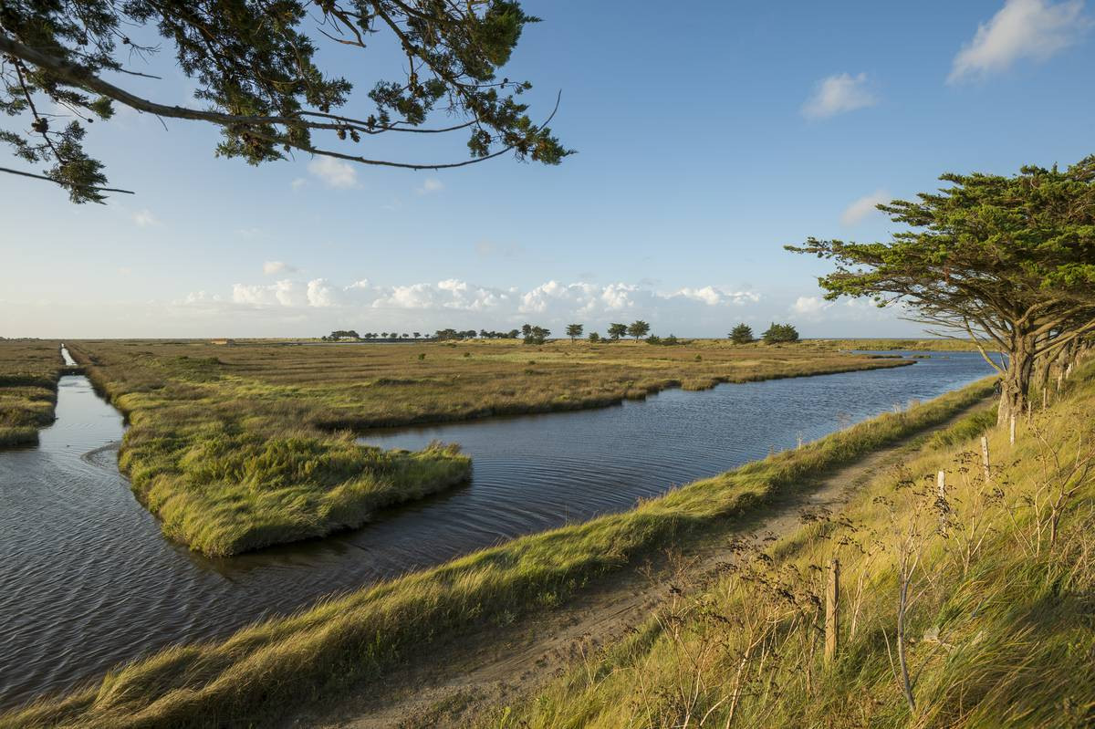
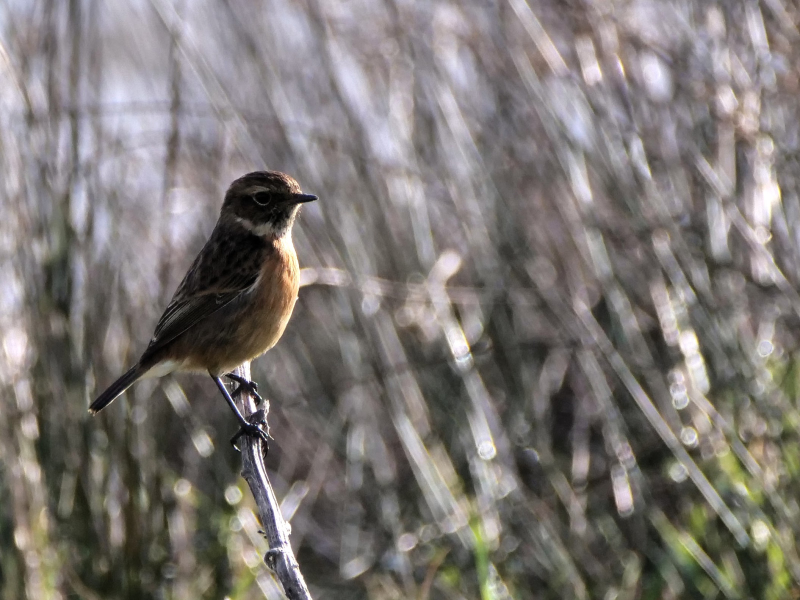
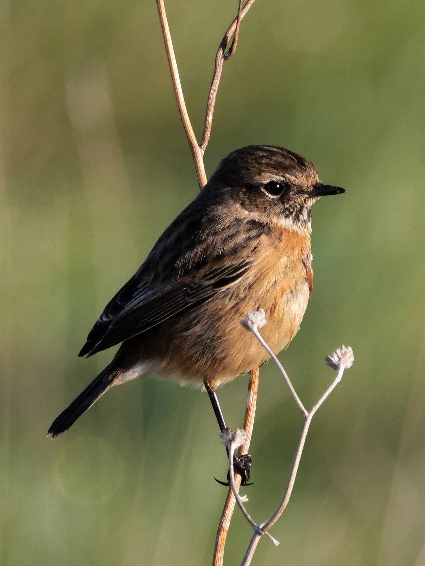
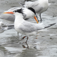
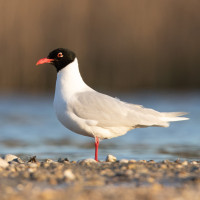
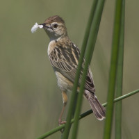
Classified as a regional nature reserve in 2008, with an area of 133 hectares, this is an excellent spot to see migratory birds during winter and spring. The Polder is a site where terrestrial and aquatic habitats with varying salinities coexist. Among its ecological roles, hosting waterbirds is of primary importance, whether during breeding season, migration, or wintering.. More than 170 bird species have been recorded of which about 40 are nesting. In spring, you can see Avoceta Común, Archibebe Común, Charrán Común and Charrán Patinegro, Gaviota Reidora and Gaviota Cabecinegra. In winter, the site serves as a resting place during high tides (see the link to the tide table below) for birds like Aguja Colipinta, Aguja Colinegra, Chorlito Dorado Europeo, Chorlito Gris and Zarapito Real. From mid-May to mid-July, the polders host the nesting of a Charrán Elegante and one or more hybrids, which is of particular interest for birdwatchers looking to spot a rare species!
_________________________
Français: Réserve naturelle régionale classée en 2008 d'une surface de 133 hectares, bon endroit pour les hivernants en halte et lors du printemps. Le Polder est un site où se côtoient milieux terrestres et aquatiques aux salinités variables. Parmi ses fonctions écologiques, l’accueil des oiseaux d’eau représente l’enjeu majeur, aussi bien en période de reproduction qu’en migration ou hivernage. L'avifaune compte plus de 170 espèces dont une quarantaine sont nicheuses. Au printemps, on pourra trouver l'Avoceta Común, le Archibebe Común , les Charrán Común et Charrán Patinegro, les Gaviota Reidora et Gaviota Cabecinegra. En hiver, le site sert de reposoir lors de fortes marées aux Aguja Colipinta et Aguja Colinegra, Chorlito Dorado Europeo et Chorlito Gris et Zarapito Real. De mi-mai à mi-juillet, les polders sont l'objet de la nidification d'une Charrán Elegante et d'un ou plusieurs hybrides, intéressant pour la coche d'oiseau rare !
Detalles
Accesso
Easy to get there by car following the path and then park to the parking lot (click on the P on the map to get directions). The best way to explore the site is on foot or by bicycle.
_________________________
Français: Facile de s'y rendre en voiture en suivant le chemin puis de se garer jusqu'au parking (voir le P sur la carte). Le meilleur moyen de visiter le site est à pied ou à vélo.


 ) insertar los nombres de aves en tu propio idioma. ¡Los nombres de las aves serán traducidos automáticamente para otros usuarios!