

Descripción
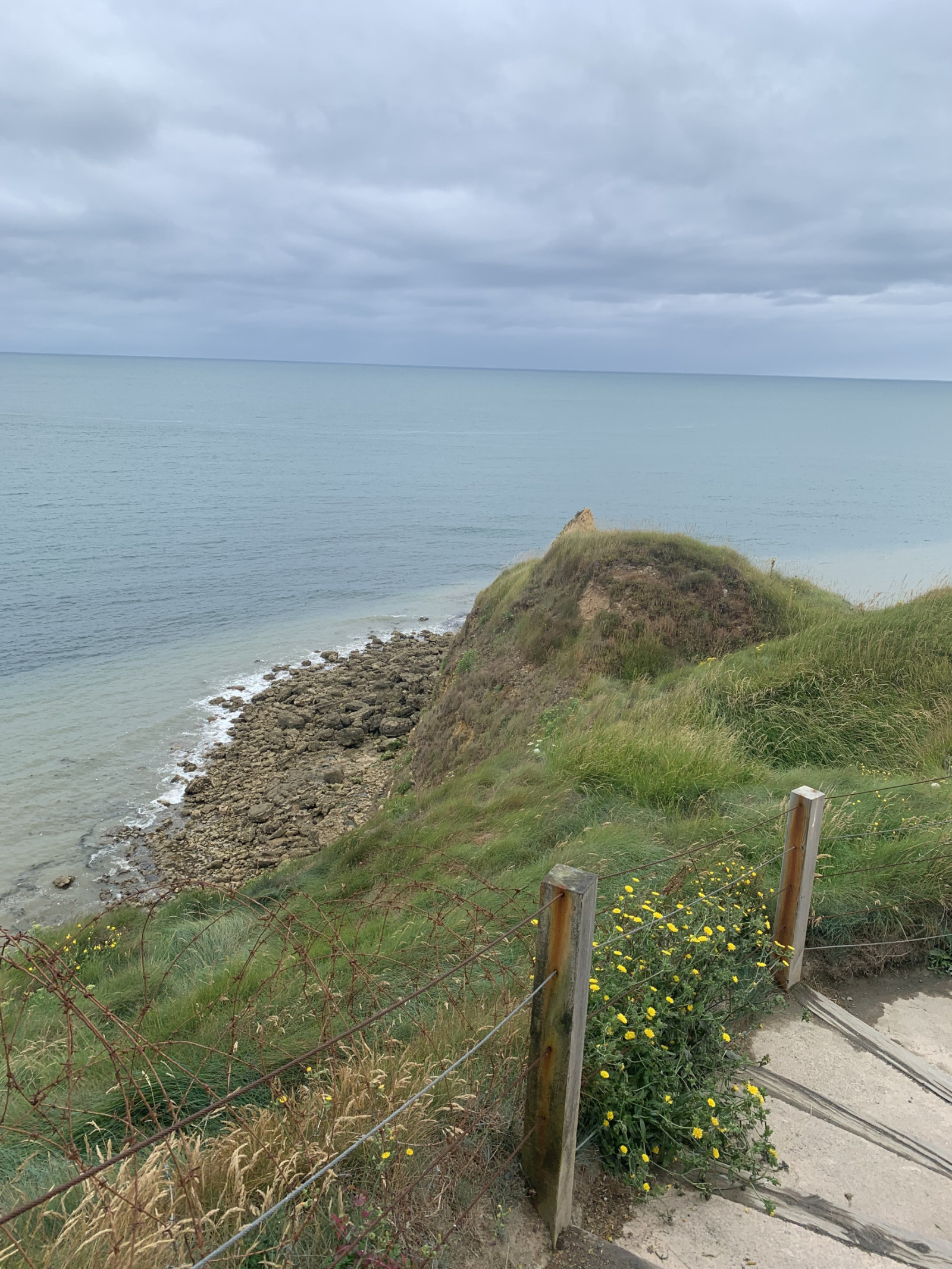
Pointe du Hoc is a prominent cliff on the coast of Normandy that played a significant role during World War II, particularly during the D-Day landings on June 6, 1944. Today, Pointe du Hoc is a memorial site, with remnants of the bunkers and bomb craters still visible.
In the first part of the circular walking route shown on the map you can observe songbirds such as Pardillo Común or Bisbita Pratense and many other species. Along the coast you can observe Gaviota Tridáctila, Arao Común and many other seabirds. A good place for seawatching!
Detalles
Accesso
Pointe du Hoc is located on the northwestern coast of Normandy situated between Omaha Beach and Utah Beach. There is a big parking lot for visitors. Press P on the map for directions to the parking. The circular walking route shown on the map is about 1,5 km.
Terreno y habitat
Pradera , Mar , DunasCondiciones
Arenoso , Sin sombra , Montañoso , PolvorientoCamino circular
Sí¿Se necesita telescopio?
Puede ser útilBuena época para el avistamiento de aves
Todo el añoMejor momento para visitar
Primavera , OtoñoRuta
Camino anchoCamino difícil de andar
FácilAccesible vía
A pie , Silla de ruedasEscondite de observación / plataforma
NoInformación extra
On D-Day, the United States Army Rangers, led by Lieutenant Colonel James Earl Rudder, scaled the 30-meter-high cliffs to capture the German positions. Despite facing heavy resistance and difficult terrain, the Rangers successfully took control of the area, which was crucial for the success of the Normandy landings.


 ) insertar los nombres de aves en tu propio idioma. ¡Los nombres de las aves serán traducidos automáticamente para otros usuarios!