Descripción
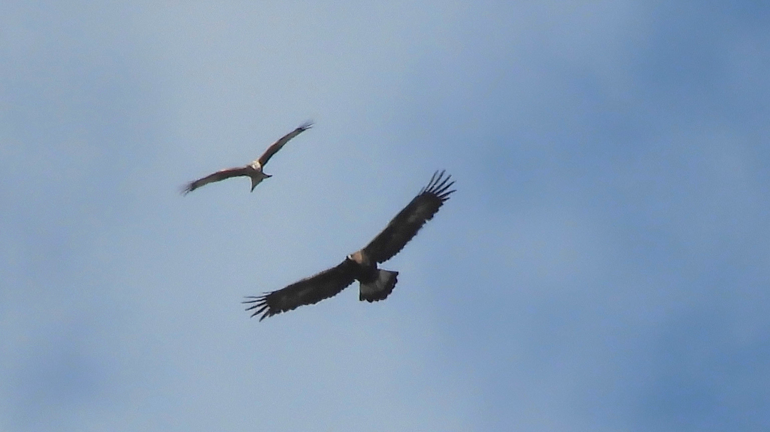
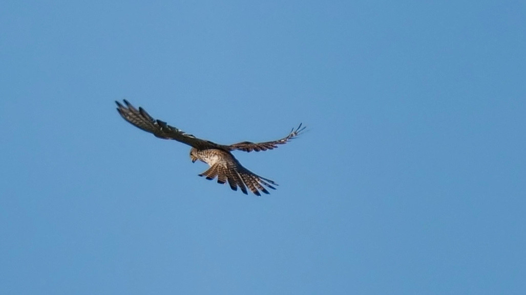
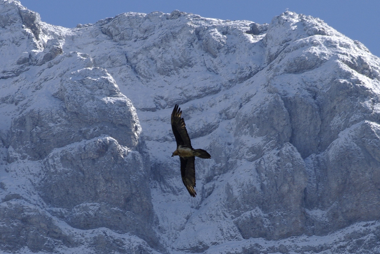
Plateau des Glières is a limestone plateau nestled in the Bornes Massif of Haute-Savoie, sitting at about 1,450 meters above sea level. It is a protected natural area of 450 hectares of mountain pastures, forests, peat bogs, and cliffs that create a diverse landscape. The flora and fauna are remarkable and the area is very good for observing birds of prey like Águila Real, Quebrantahuesos, Abejero Europeo, Mochuelo Alpino, Mochuelo Boreal and Búho Real. But also Gallo lira común and Lagópodo Alpino are possible.
_________________________
Français: La montagne des Frettes. Le Plateau des Glières est un Espace Naturel Sensible protégé de 450 ha d’alpages, de forêts et de tourbières et de falaises qui en font un paysage diversifié. La faune et la flore y sont remarquables : droséras, gelinotte, tétras…
Detalles
Accesso
The Plateau des Glières is located between the towns of Glières-Val-de-Borne and Fillière, about 33 km from Annecy, 29 km from La Roche-sur-Foron and 15 km from Thorens-Glières. Acces through Usillon Valley, via Thorens les Glières or from Petit Bornand, via the Borne Valley. From Annecy it takes about 45 minutes. Press P on the map for directions to the parking. The circular walking route shown on the map is about 3 km, but it is easy to make longer walks, as there are many signposted hiking trails in the area.
_________________________
Français: Vallée d'Usillon, par Thorens les Glières ou depuis le Petit Bornand, par la vallée du Borne. Appuyez sur P sur la carte pour obtenir les directions vers le parking.
Terreno y habitat
Bosque , Montaña , Cañón/acantilado , Meseta , Pradera , HumedalCondiciones
Montañoso , Paisaje abierto , Pantanoso , MontañosoCamino circular
Sí¿Se necesita telescopio?
Puede ser útilBuena época para el avistamiento de aves
Todo el añoMejor momento para visitar
VeranoRuta
Camino anchoCamino difícil de andar
Caminata mediaAccesible vía
A pie , Bicicleta , CocheEscondite de observación / plataforma
NoInformación extra
Chosen as a parachute drop zone by the Allies, the Plateau des Glières housed more than 460 resistance fighters in February and March 1944, tasked with receiving weapons for the entire Haute-Savoie resistance movement. You can do a self-guided or guided tour of this site. The historical discovery tour allows visitors to discover, in about two hours, the daily lifestyle of the resistance fighters during the winter of 1944, as well as the National Monument to the Resistance of Émile Gilioli.
_________________________
Français: Choisi comme terrain de parachutage par les Alliés, le Plateau des Glières abrita en février et mars 1944 plus de 460 maquisards chargés de réceptionner les armes destinées à l’ensemble de la résistance haut-savoyarde. Le service Mémoire et Citoyenneté du Conseil départemental propose des visites libres ou guidées sur ce site, et pour tout type de public. Le circuit de découverte historique, permet aux visiteurs de découvrir en deux heures environ, le mode de vie quotidien des maquisards durant l’hiver 1944 ainsi que le Monument national à la Résistance d’Émile Gilioli.


 ) insertar los nombres de aves en tu propio idioma. ¡Los nombres de las aves serán traducidos automáticamente para otros usuarios!