
Descripción
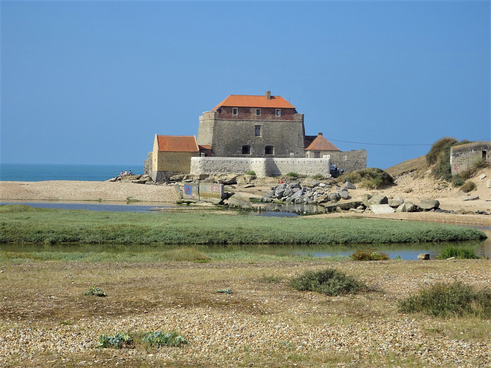
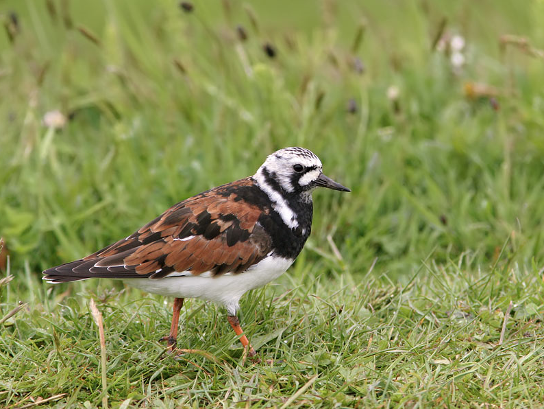
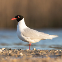
Twice a day, the Slack, the coastal river that originates upstream of the Marquise and flows into the English Channel, fills with each tide with a large volume of seawater, taking the appearance of a small inland sea. The estuary is a very rich biotope that attracts many migratory birds and waders. For example Chorlitejo Grande, Vuelvepiedras Común, Correlimos Tridáctilo, Agachadiza común, Andarríos Chico, Gaviota Cabecinegra and Garceta Común.
_________________________
Français: Deux fois par jour en effet, la Slack, ce fleuve côtier qui prend naissance en amont de Marquise et qui se jette dans la Manche, se remplit à chaque marée d'un volume important d'eau de mer, prenant l'aspect d'une petite mer intérieure. C'est un biotope très riche qui permet à la faune marine de se reproduire tout en offrant une halte appréciable aux oiseaux migrateurs.
Detalles
Accesso
The Estuaire de la Slack is located directly south of the village of Ambleteuse. You can park on the small parking at the beginning of the estuary or in the village. During low tide you can make a 3 km circular walk around Fort Mahon (although it is possible that on some small parts you have to wade through shallow water). A circular walk is not not possible at high tide. See a link to the tide table below. Click on a P on the map for directions to a parking lot.
_________________________
Français: L'Estuaire de la Slack est situé directement au sud du village d'Ambleteuse. Vous pouvez vous garer sur le petit parking au début de l'estuaire ou dans le village. À marée basse, vous pouvez vous promener dans la zone, mais vous devez parfois patauger dans des eaux peu profondes. Ce n'est pas possible à marée haute. Cliquez sur un P sur la carte pour accéder à un parking.
Terreno y habitat
Playa , Pisos de barro , Río , Mar , Dunas , Cañizos , Ciudad/PuebloCondiciones
Nivel del agua alto probable , Paisaje abierto , PantanosoCamino circular
Sí¿Se necesita telescopio?
NoBuena época para el avistamiento de aves
Todo el añoMejor momento para visitar
Migración de primavera , Migración de otoñoRuta
Camino anchoCamino difícil de andar
FácilAccesible vía
A pieEscondite de observación / plataforma
NoInformación extra
Photo Ambleteuse - Fort Mahon by Pierre André Leclercq, CC BY-SA 4.0, https://creativecommons.org/licenses/by-sa/4.0, via Wikimedia Commons


 ) insertar los nombres de aves en tu propio idioma. ¡Los nombres de las aves serán traducidos automáticamente para otros usuarios!