

Description
The Humedal de la Degollada is made up of three different zones. The first area is a steppe plain crossed by ravines and gullies, known as Yasa de las Conchas. The second zone is a wetland with lagoons, a breeding and resting place for numerous species of waterfowl during the migratory season. The third zone is part of the largest forest patch in the Ebro Valley in La Rioja.
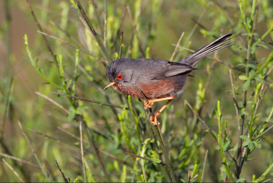
Along the route there are bird hides, viewpoints, a picnic area and information panels. Among the birds you can observe are depending on the time of year Καλαμόκιρκος, Τσίφτης, (Ευρωπαϊκή) Νεροκοτσέλα, (Κοκκινόλαιμο) Νανοβουτηχτάρι, Ρεικοτσιροβάκος, Ασπροκωλίνα, (Ευρωπαϊκός) Μελισσοφάγος, Τσαλαπετεινός, Κοκκινοκεφαλάς and Iberian Grey Shrike. Beyond the signposted path, there are remains of an ancient Roman dam that supplied part of the ancient area of Calagurris.
_________________________
Espagnol: Área compuesta por tres zonas diferenciadas que forman el recorrido de una Senda Natural de 3’5 Kilómetros. La primera zona visible está formada por una planicie esteparia surcada por barrancos y cárcavas, conocida como Yasa de las Conchas. La segunda zona es un humedal. Cinco lagunas en serie que comensan la pérdida de hábitat acuático que supuso el recrecimiento del embalse de El Perdiguero. En poco tiempo, se ha convertido en lugar de cría y descanso de numerosas especies de aves acuáticas durante la época migratoria. La tercera zona forma parte de la mayor mancha forestal del Valle del Ebro en La Rioja. Los pinares de pino carrasco dan cobijo a fauna poco frecuente en la zona como corzos, jabalíes o búhos, entre otros.
A lo largo del recorrido se encuentran observatorios de aves, miradores, zona de merenderos y paneles informativos. En los distintos ambientes del humedal podemos observar garzas, azulones, fochas, somormujos, cigüeñuelas o aguiluchos laguneros dependiendo de la época del año. Más allá de la senda señalizada, se hallan restos de una antigua presa romana alto-imperial que abasteció parte de la zona centuriada de Calagurris.
Details
Access
The Humedal de la Degollada is located south of the village of Calahorra. Click on the P in the map to get directions to the parking. From the parking you can follow the marked nature trail (3,5 km one way) and explore the area on foot.
_________________________
Espagnol: Humedal de la Degollada está situada al sur del pueblo de Calahorra. Haga clic en la P en el mapa para obtener indicaciones para llegar al estacionamiento. Desde el parking puedes seguir el sendero natural señalizado ((3,5 km de ida) y explorar la zona a pie.


 ) to insert bird names in your own language. The birdnames will automatically be translated for other users!