Description
The Hook Head peninsula includes rocky cliffs, flat fields with stone walls, agricultural fields, and a nearby village with small, sheltered gardens. The area is best during migration periods, particularly if the weather is poor with rain or fog, possibly helped by the attraction of the light from the historic lighthouse. Note that on clearer days, migration can be very poor, with very few unusual birds. Passerine migration is best in the autumn.
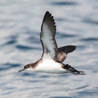
Seabird movement past the head consists mainly of common seabirds such as Σούλα (του Βορά), Μύχος, Κηλιδοβούτι and Common Guillemot and other auks, but can occasionally bring more interesting species such as Sooty Shearwater, Γαλαζόραμφος Ληστόγλαρος and Κόκκινος Φαλαρόποδας. Whales and dolphins, including the occasional Hump-backed Whale, visit the waters to the south of the head.
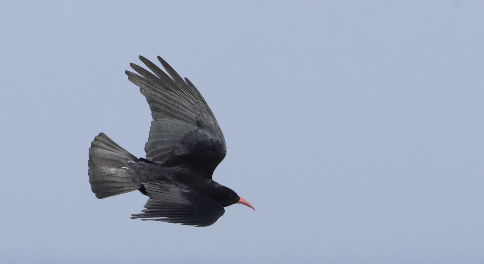
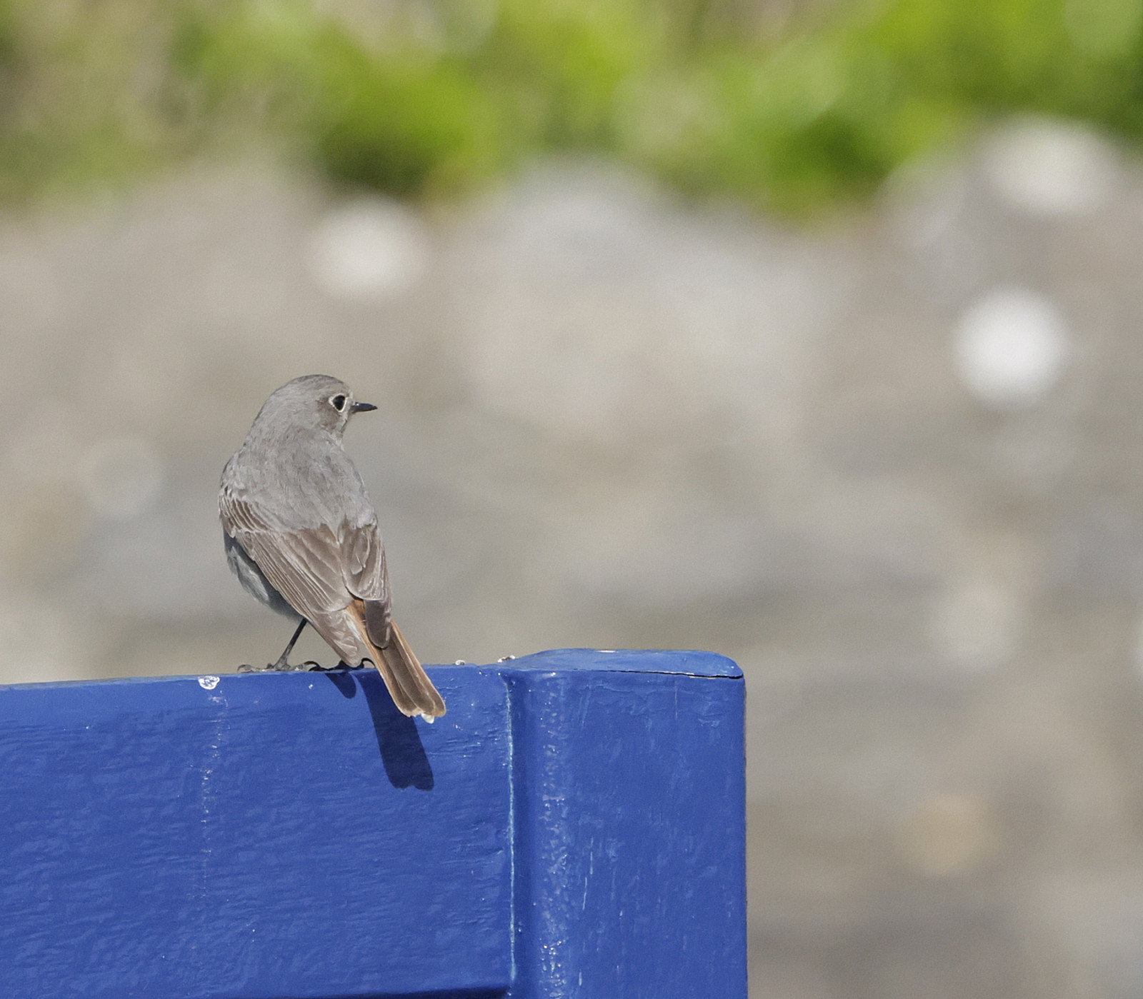
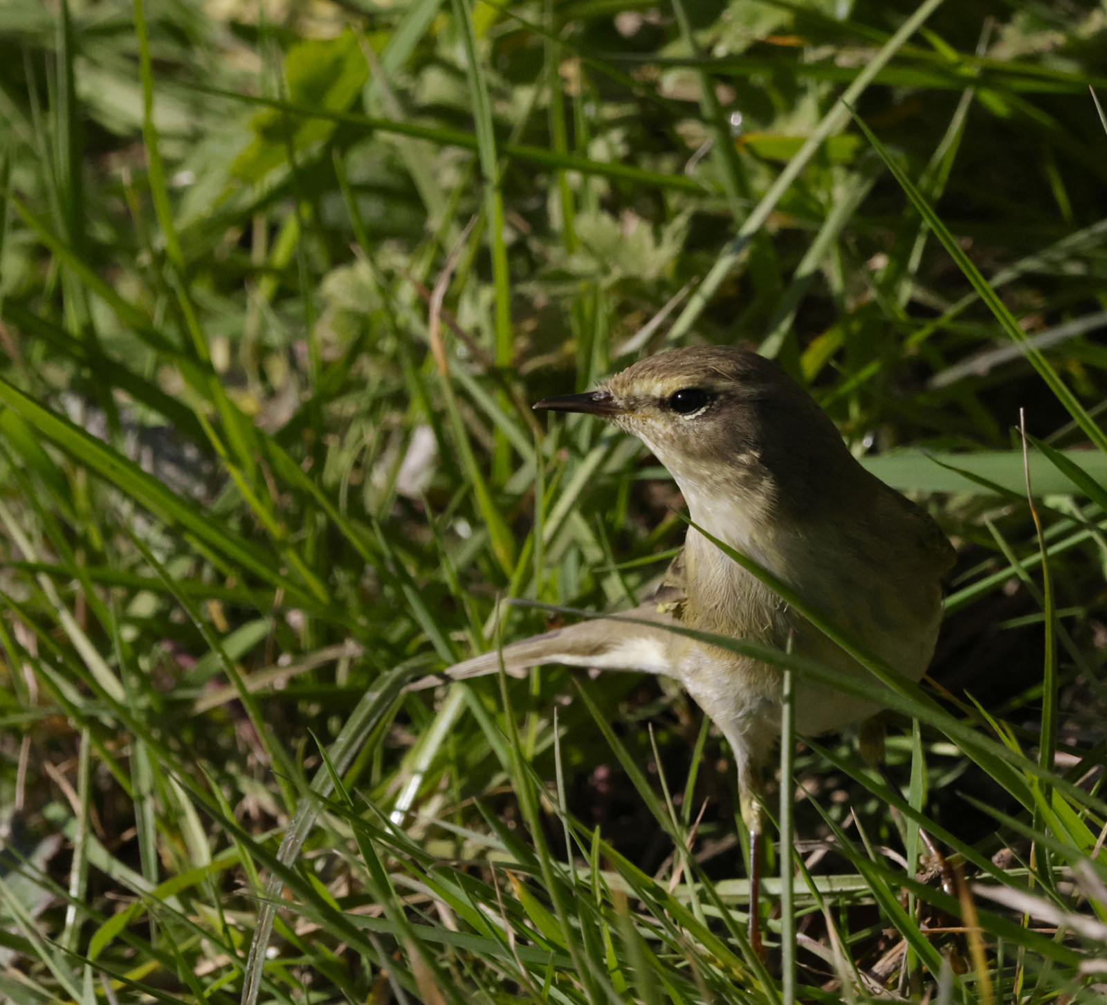
Passerine migration in autumn can bring in birds such as Χιονοκότσυφας, Κιτρινόφρυδος Φυλλοσκόπος, Πυροβασιλίσκος, Γερακοτσιροβάκος, Διπλοκελάδα, (Κοινός) Φοινίκουρος, Καρβουνιάρης and Μαυρομυγοχάφτης. In addition, there can be large movements of larks, thrushes, and pipits through the area. A pair of Κοκκινοκαλιακούδα breed in the area.
Details
Access
Hook Head can be accessed by car via the R733 and then the R737 if coming from Wexford town. Access by bicycle is possible but is lengthy and somewhat dangerous along narrow, twisty roads. The area is not accessible by public transport. Parking is available at the lighthouse (plenty of space), Slade Harbour (limited parking), the most southerly point of the head (limited parking) or near the ruined church in the village (very limited parking). Click on a P in the map for directions.
Once parked, one can walk along the road through the village and/or around the headland from the lighthouse to Slade harbour, though access near the lighthouse requires climbing a wall, which can be very awkward for those with limited mobility. The circular walking route indicated on the map is about 5 km.
Terrain and Habitat
City/village , Agriculture , Scattered trees and bushes , Canyon/cliff , SeaConditions
FlatCircular trail
YesIs a telescope useful?
Can be usefulGood birding season
Spring , AutumnBest time to visit
Autumn migrationRoute
Paved road , Wide pathDifficulty walking trail
Average walkAccessible by
Foot , Bicycle , CarBirdwatching hide / platform
NoExtra info
Some areas of the cliffs are extremely slippery and dangerous. Some areas of the cliffs have blow-holes that pose a danger of falling. During windy weather and high tides, freak waves can occur - take great care at all times not to get too close to the sea.


 ) to insert bird names in your own language. The birdnames will automatically be translated for other users!