Beschreibung
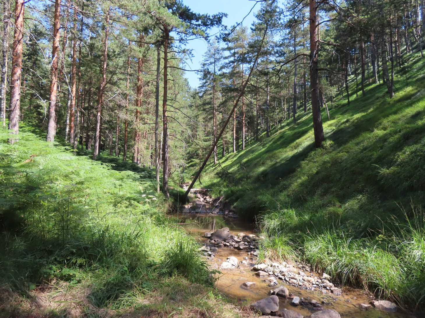
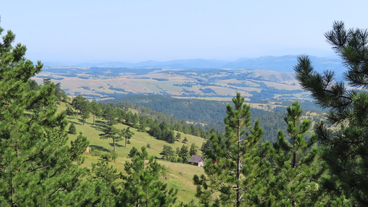
Divčibare and Maljen are at the center of the Valjevske Mountains range, situated between the Povlen and Suvobor mountains. Divčibare is on the 980m highland plateau covered with pine forest. The highland is surrounded by several Maljen peaks, like Kraljev Sto ("King's Dish") at 1104m, Crni Vrh ("Black Summit") at 1096m, Paljba ("Shooting") at 1051m, and Golubac at 1056m. Two mountain streams, Bela and Crna Kamenica ("White and Black Stonestream") pass through the plateau, carving deep cuts through the Maljen mountain. The two Kamenica streams flow to the southeast and eventually join into the Kamenica River in the Tometino Polje village, on the southern Maljen slopes.
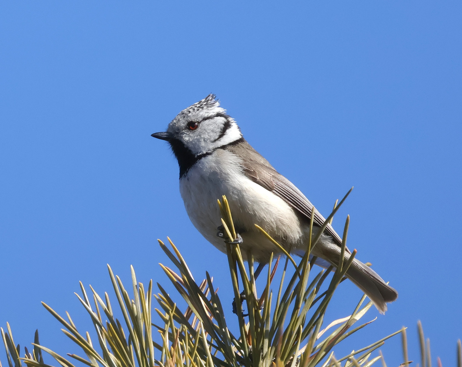
The pine forest that dominates the plateau is inhabited by numerous Haubenmeise and Tannenmeise, while the deciduous forest on the steep northern slopes hosts many thrush and woodpecker species. Between these two habitats, there are patches of mixed spruce and birch forest where Weidenmeise can be found. The southern slopes of Tometino Polje are milder and only partly covered with pine forest, with a lot of steppe, scrubby, and grassland slopes inhabited with Heidelerche, Feldlerche, Neuntöter, Braunkehlchen, Schwarzkehlchen, Ortolan, Zippammer, Goldammer, Brachpieper, and patrolled by Mäusebussard, Wespenbussard, and Schlangenadler. One pair of Steinadler nests on the northern Divčibare slopes. Rötelschwalbe can be found near the bridges in the upper course of the Kamenica stream.
The area is part of the IBA Valjevske Mountains.
Details
Zugang
Divčibare is accessible via well-maintained roads from the northwest (Valjevo), northeast (Mionica), and south (Požega). Click on the 'P' markings for directions. Note: there is a military camp near the very peak of Maljen, Kraljev Sto, be sure not to take photographs or use binoculars in its vicinity.
Terrain und Habitat
Wald , Plateau , Berg , Steppe , Vereinzelte Bäume und BüscheBedingungen
Hügelig , Gebirgig , Offene LandschaftRundweg
JaIst ein Spektiv nützlich?
Möglicherweise hilfreichGute Beobachtungszeit
Frühjahr , SommerBeste Beobachtungszeit
Frühjahr , SommerRoute
Normaler Weg , Schmaler PfadSchwierigkeitsgrad der Tour
Schwierig/anstrengendErreichbarkeit
zu FußBeobachtungshütten oder -türme
NeinLinks
- 'Divčibare' eBird hotspot
- 'Tometino polje' eBird hotspot
- 'Tometino polje--Orlovo gnezdo' eBird hotspot
- 'Divčibare--vidikovac Paljba' eBird hotspot
- 'Maljen i Divčibare (general area)' eBird hotspot
- eBird barchart of all hotspots
- IBA Valjevske Mountains


 ) Tragen Sie die Vogelnamen in Ihrer Sprache ein. Sie werden automatisch für andere Nutzer übersetzt!