Beschreibung
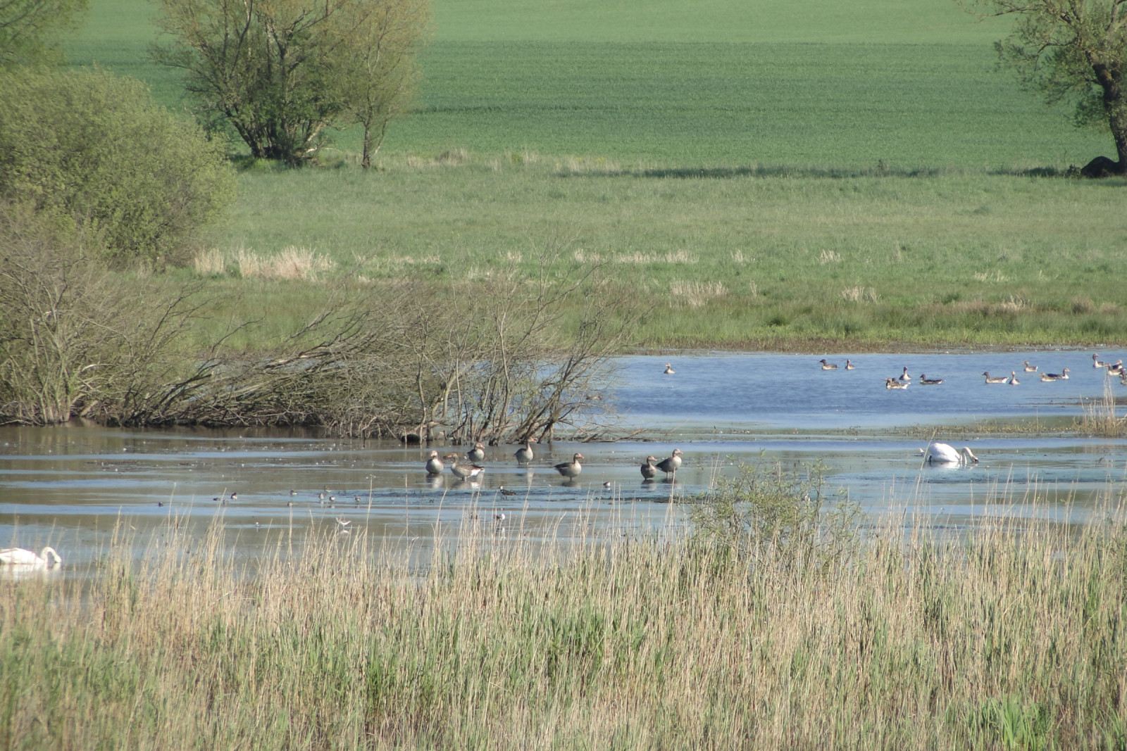
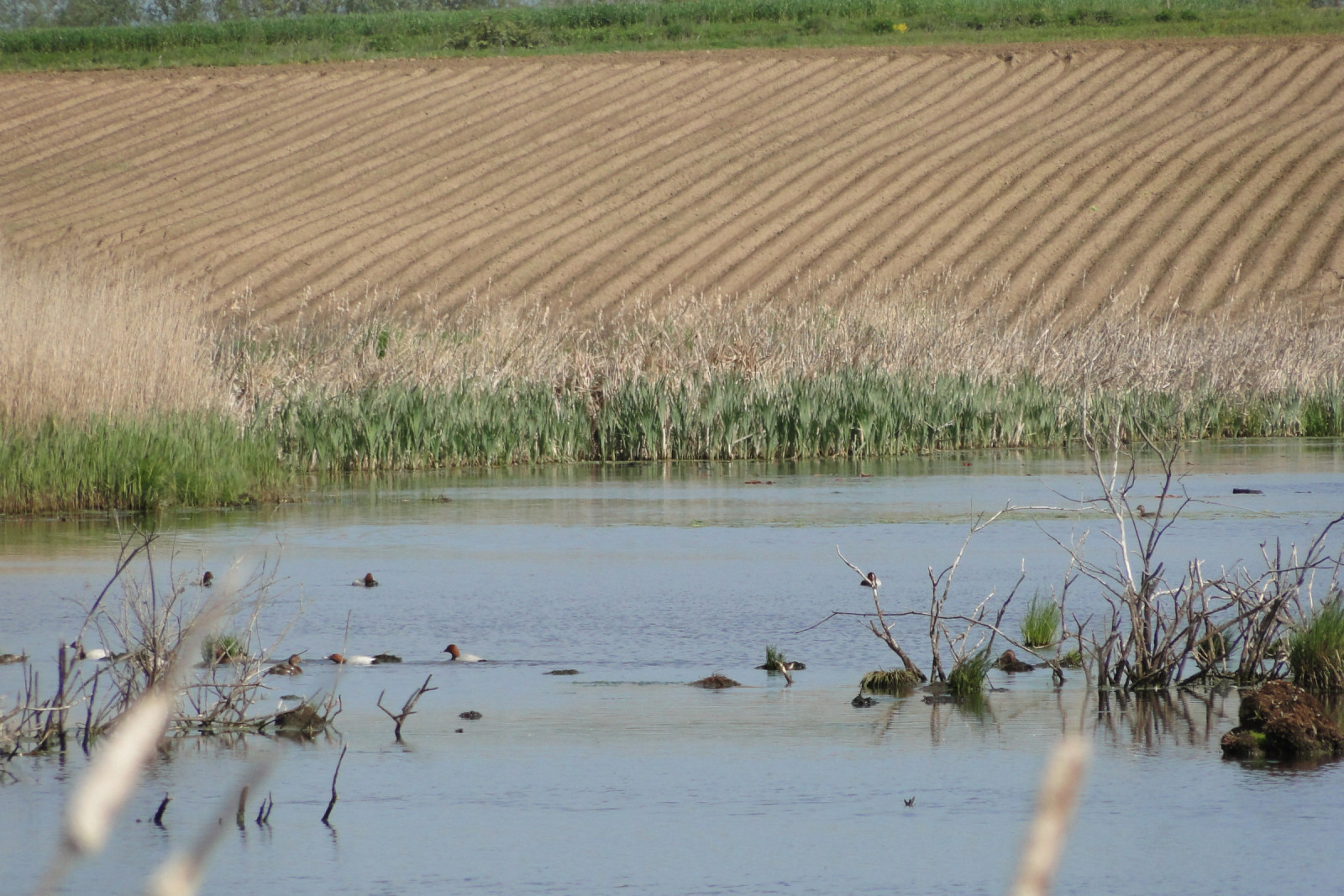
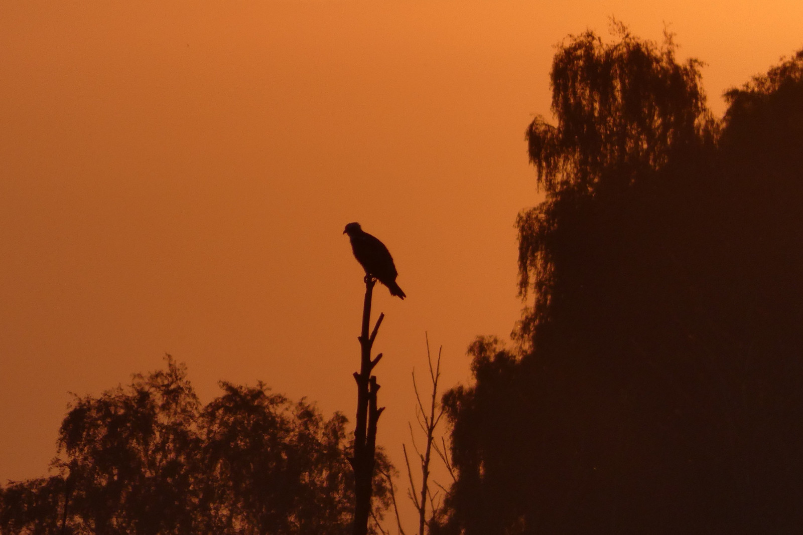
Łabędzie Rozlewisko is a mid-field backwater that is a breeding ground for Schnatterente, Höckerschwan, Zwergtaucher, Rothalstaucher, Lachmöwe, Flußseeschwalbe, Bläßhuhn, Rohrdommel and Rohrweihe. During the migration period, significant numbers of various ducks, and in favorable water level conditions, the possibility of observing Bruchwasserläufer, Grünschenkel, Kampfläufer and Alpenstrandläufer. The place is a roost for Kranich. Among predators, you can often find here: Seeadler, Fischadler and Schreiadler.
_________________________
Polski: Rozciągnięte rozlewisko, zwłaszcza jako miejsce lęgowe: Schnatterente , Höckerschwan , Zwergtaucher , Rothalstaucher , Lachmöwe , Flußseeschwalbe , Bläßhuhn , Rohrweihe , Rohrdommel. Na przelotach stada kaczkowatych, a przy odpowiednich warunkach Bruchwasserläufer , Grünschenkel , Kampfläufer , Alpenstrandläufer . Noclegowisko Kranich. Polowania Seeadler, Schreiadler i Fischadler.
Details
Zugang
The two best routes to get to Łabędzie Rozlewisko from the south: 1. By car in Benice turn left towards Ducin and behind the buildings take a dirt, bumpy road to the right to the very edge of the floodplain (may be impassable). 2. Park on the side of the road along the Benice-Chomino road and a marked footpath along the western edge of the floodplain (difficult, overgrown road).
_________________________
Polski: Dwie najlepsze trasy dojazdu od południa: 1. Samochodem w Benicach w lewo w kierunku Ducina i za zabudowaniami polną, wyboistą drogą w prawo do samego brzegu rozlewiska (może być nieprzejzdna). 2. Parkowanie na poboczu wzdłuż drogi Benice-Chomino i zaznaczoną ścieżką pieszo wzdłuż zachodniego brzegu rozlewiska (droga trudna, zarośnięta).
Terrain und Habitat
Feuchtgebiet , Teich , Schlammflächen , Grasland, Wiesen , Vereinzelte Bäume und BüscheBedingungen
Flach , Sumpfig , Offene Landschaft , HügeligRundweg
NeinIst ein Spektiv nützlich?
Möglicherweise hilfreichGute Beobachtungszeit
Frühjahr , SommerBeste Beobachtungszeit
FrühjahrRoute
Schmaler Pfad , unbefestigte StraßeSchwierigkeitsgrad der Tour
DurchschnittlichErreichbarkeit
zu FußBeobachtungshütten oder -türme
NeinZusätzliche Informationen
It is possible to walk along the entire western bank of the floodplain, but there are no roads or paths (the route leads through fields and wasteland).
_________________________
Polski: Można przejść wzdłuż całego zachodniego brzegu rozlewiska, ale nie ma dróg ani ścieżek (trasa prowadzi przez przez pola i nieużytki).


 ) Tragen Sie die Vogelnamen in Ihrer Sprache ein. Sie werden automatisch für andere Nutzer übersetzt!