Beschreibung
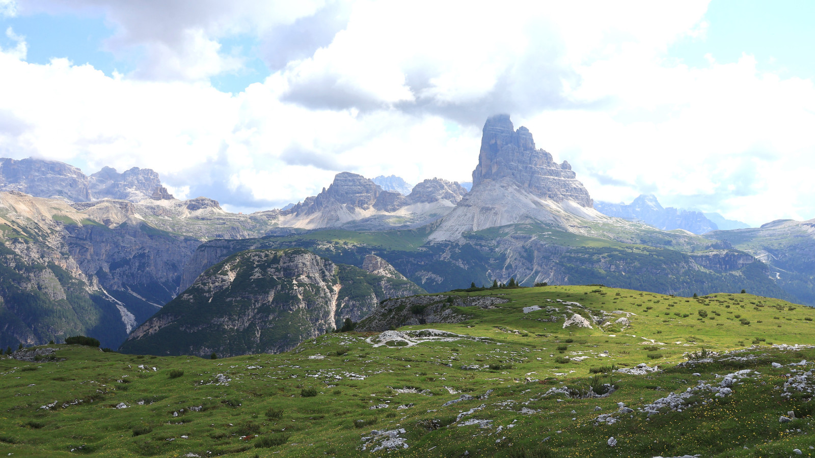
Monte Piana is a historic mountain plateau once between Italy and the Austro-Hungarian Empire, now between Italy's Veneto and South Tyrol regions. The historic battles of World War I were fought on the plateau between the Austro-Hungarian and Italian armies, leaving many remnants of the fierce fighting, like fortifications and trenches carved into the stone all over the mountain. The 360° view from the mountain top to the Tre Cime di Lavaredo, Croda Rossa, and other surrounding peaks, as well as to the valleys and alpine lakes below, is nothing short of extraordinary.
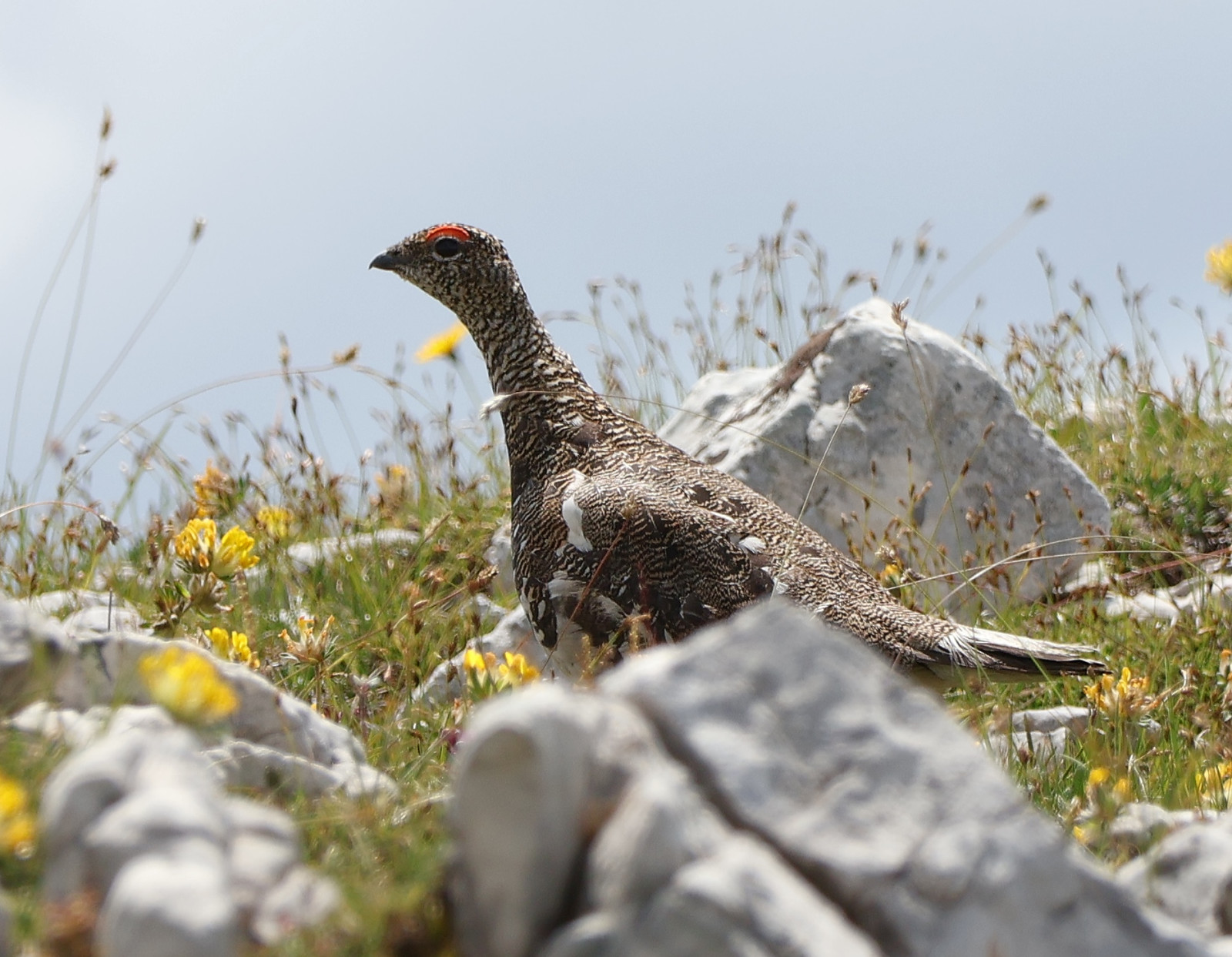
The ascent to the flat Monte Piana top at 2324 meters is through a mixed forest of spruce and fir, where you can encounter Tannenmeise, Haubenmeise, Waldbaumläufer, Fichtenkreuzschnabel, and Misteldrossel. If you opt for a route via the old military road (see Access section below) that passes beneath steep cliffs, Felsenschwalbe and Alpensegler are quite possible. Once you near the plateau the forest is replaced by alpine meadows, hosting Steinschmätzer, Hausrotschwanz, Bergpieper, Steinhuhn, and Alpenschneehuhn, while the presence of refugio (mountain hut) attracts Alpendohle. If you are lucky, alpine lakes at the bottom of the mountain, like Lago Antorno, Lago di Missurina, and Lago di Landro, may host some not-so-common waterfowl, like Reiherente.
Details
Zugang
The route from the south presented on the map below starts at the parking place north of the Lago di Missirina (click on the 'P' marking for directions). This parking place also serves as the primary base parking place for the famous Tre Cime di Lavaredo, so come early, or your chances of finding a free place in the high season are practically zero. If this parking place is full, try the one at the Lago di Misurina.
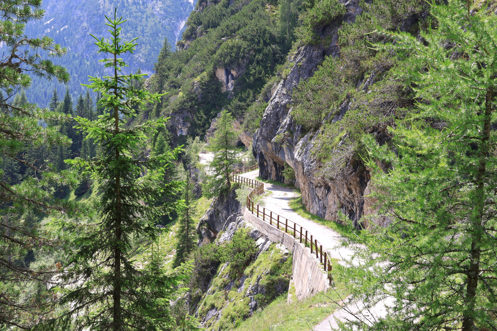
From the parking place, follow the paved road to Tre Cime di Lavaredo, then curve around the Lago Antorno. After the lake, depart to the left into the forest, where the main ascent to the Monte Piana begins. The ascent is medium hard, but there are a few steep sections. Alternatively, you can take an old military road. But be aware that this road is heavily damaged by the landslide and officially closed for passing by. The sections most affected are marked with stars on the map. If you are willing to risk it, the award is breathtaking scenery around the road, and the general ambiance can give some glimpse of how the WWI battles were fought. Taking one road for ascent and the other for descent is probably the best option, but be extremely cautious on the military road. Once on the plateau, there are many paths; choose the circular one around the plateau, as most birds will probably be on the plateau borders.


 ) Tragen Sie die Vogelnamen in Ihrer Sprache ein. Sie werden automatisch für andere Nutzer übersetzt!