

Beschreibung
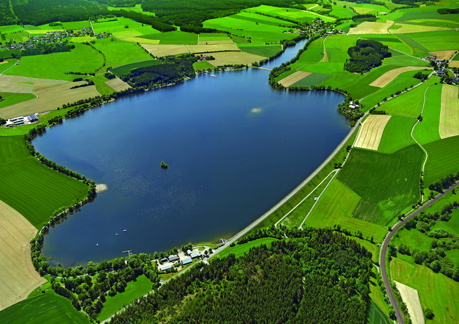
The Förmitzspeicher is a reservoir in the gently hilly landscape of the Münchberger Gneismasse on the northwestern edge of the Fichtelgebirge. It was completed in 1978 and lies 529 m above sea level and has a 126 ha water surface when it is completely filled. The climate here is continental. The reservoir is attractive especially for wading birds and waterfowl during the migration period. Then sometimes remarkable rarities can show up. The total number of bird species seen so far in the Förmitzspeicher is 250, waterrelated species 115. The reservoir is very easily accessible. Best observations mostly in spring and late summer / autumn. In high summer there are many leisure activities on the water: swimming, surfing, sailing.
Details
Zugang
The Förmitzspeicher is located approx. 3 km southwest of the town of Schwarzenbach / Saale, coordinates 50 ° 11’39.62 “N 11 ° 54’46.39“ O. Access via Schwarzenbach or Münchberg. Two parking spaces on the north-west bank at both ends of the dam (Navi: Schwarzenbach / Saale, Dammstraße), one on the south-east bank.
Terrain und Habitat
Wald , SeeBedingungen
Hügelig , Offene LandschaftRundweg
JaIst ein Spektiv nützlich?
JaGute Beobachtungszeit
Frühjahr , HerbstBeste Beobachtungszeit
Frühjahr , Herbst , Frühjahrszug , HerbstzugRoute
Normaler WegSchwierigkeitsgrad der Tour
EinfachErreichbarkeit
zu Fuß , Fahrrad , Auto , RollstuhlBeobachtungshütten oder -türme
NeinZusätzliche Informationen
There are three webcams and a page with the current water levels: see the links below.
Links
- Der Förmitzspeicher, ein wichtiges Rastgewässer für Wasser- und Watvögel in Oberfranken
- http://www.wwa-webcams.de/ho/p-foermitz-foermitz/p-fm-foermitz.jpg
- http://www.wwa-webcams.de/ho/s-fts/s-fts.jpg
- http://www.foermitzspeicher.de/
- https://www.hnd.bayern.de/pegel/oberer_main_elbe/foermitz-seepegel-56113700


 ) Tragen Sie die Vogelnamen in Ihrer Sprache ein. Sie werden automatisch für andere Nutzer übersetzt!