Beschreibung
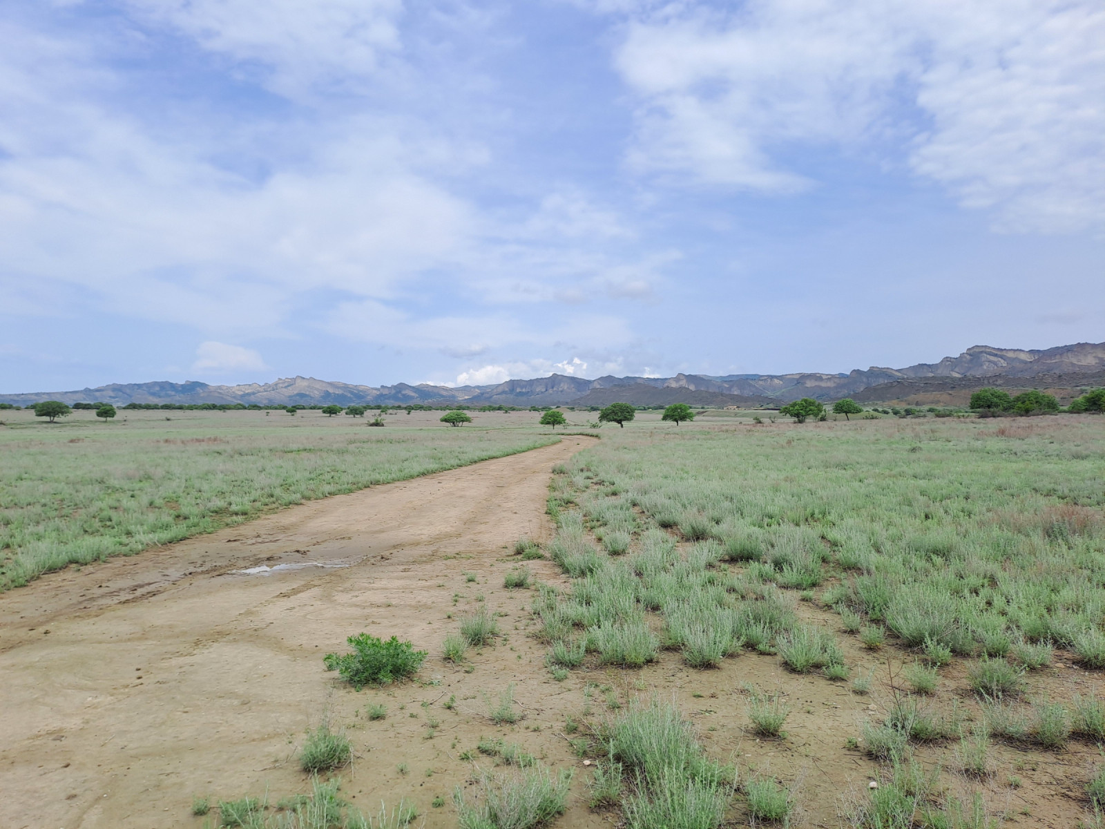
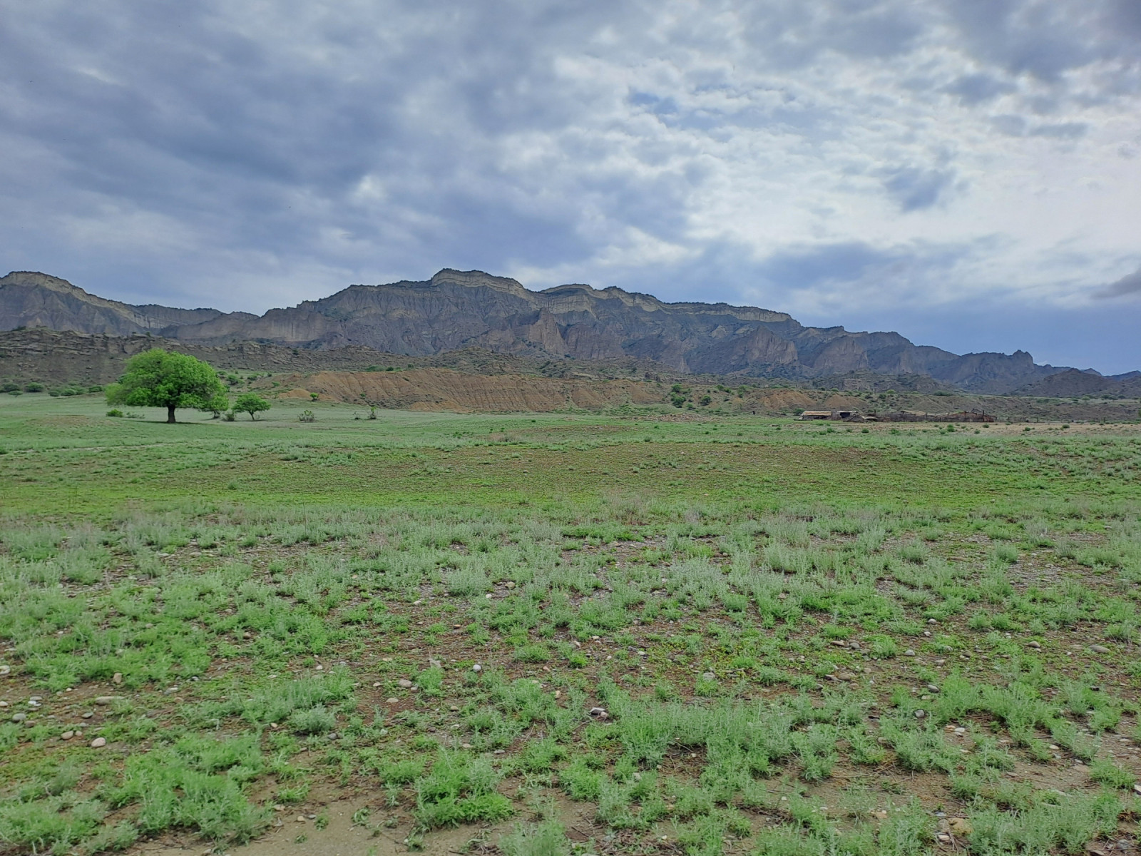
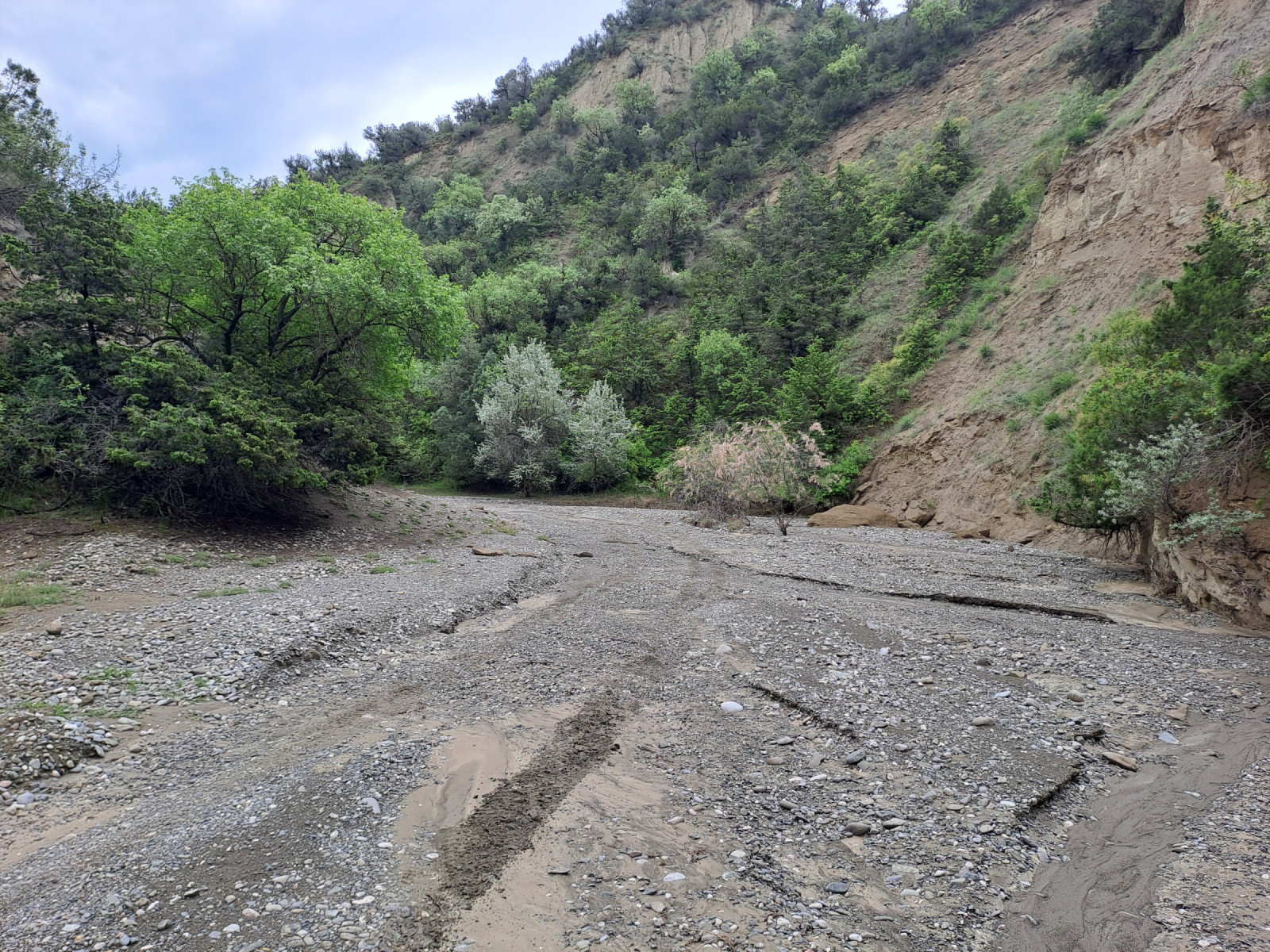
The western part of Vashlovani National Park consists of a semi-desert region dominated by steppes, small deciduous forests, dwarf shrubs, and limestone cliffs. Annual rainfall is low. The northern part of the region consists of flat, dry terrain that gives way to hills and a riverbed surrounded by canyons and juniper vegetation. On the border with Azerbaijan, a steppe extends to the southernmost point of Georgia.
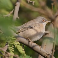
The canyons, riverbed and vegetation provide a habitat for breeding birds such as: Felsenkleiber, Maurensteinschmätzer, Chukarhuhn, Gänsegeier, Zippammer, Steinsperling en Heckensänger. The riverbed ends in flat terrain that changes into sparsely vegetated steppes. Here you can find the species: Rotkopfwürger, Schwarzstirnwürger, Isabellsteinschmätzer Kurzzehenlerche, Halsbandfrankolin,Kalanderlerche, Schlangenadler, Wiesenweihe , Kaiseradler and Mönchsgeier. Further south in the area Tamariskengrasmücke can be found.
During winter, the species spectrum is less abundant, but large numbers of Zwergtrappe can be present.
Details
Zugang
Vashlovani National Park is located in the Kakheti region of southeastern Georgia, near the border with Azerbaijan. The western part of Vashlovani National Park is accessible by high-clearance four-wheel drive vehicle. Be aware of muddy roads and high river water levels during heavy rainstorms.
The steppes are accessible by driving along a riverbed. From Kasristskali, take the dirt road southwest. This dirt road leads to the riverbed between the canyons (Pantishara Valley). The riverbed opens onto flat terrain, where you turn left to enter the steppe. From the steppe, you can continue driving southeast.
Terrain und Habitat
Vereinzelte Bäume und Büsche , Steppe , Schlucht/Cliff , FlussBedingungen
Hügelig , Felsig , Trocken , Offene Landschaft , Sandig , Hochwasser möglich , FlachRundweg
NeinIst ein Spektiv nützlich?
Möglicherweise hilfreichGute Beobachtungszeit
Sommer , FrühjahrBeste Beobachtungszeit
FrühjahrRoute
unbefestigte StraßeSchwierigkeitsgrad der Tour
Erreichbarkeit
AutoBeobachtungshütten oder -türme
NeinZusätzliche Informationen
A border permit is required to enter the area. This permit can be obtained at the National Park Administration Office in Dedoplistsqaro. You may be checked by border police at various border checkpoints. You must carry your passport and border permit when exploring the area.


 ) Tragen Sie die Vogelnamen in Ihrer Sprache ein. Sie werden automatisch für andere Nutzer übersetzt!