_fêmea.jpg)
_(4089434391).jpg)
Beschreibung
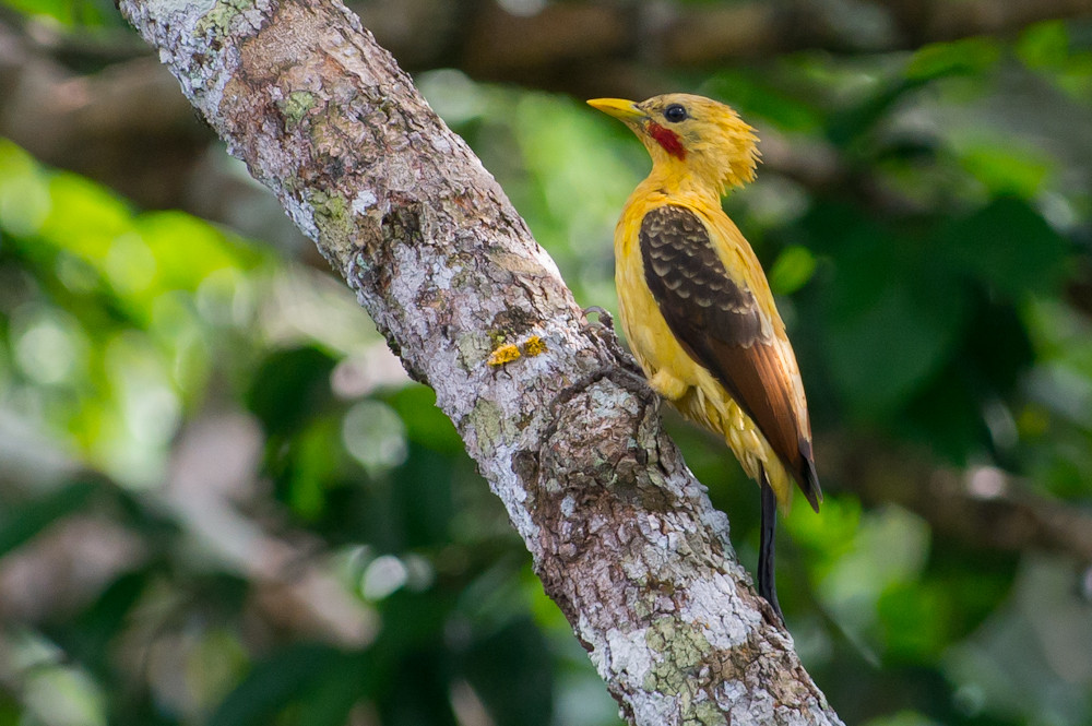
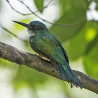
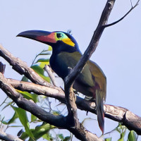
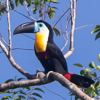
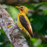
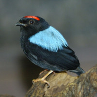
Sentier du Rorota is a trail known to be one of the first places to visit when arriving in Guyana. Most of the path is in the forest, but there also are lookout point where you have views of the coastline and inland bodies of water. It is possible to encounter undergrowth and coastal birds. For example Little Hermit, Crane Hawk, Black Vulture, American Pygmy Kingfisher, Cream-colored Woodpecker, Guianan Toucanet, Channel-billed Toucan, Blue-backed Manakin, Spectacled Owl, Northern Slaty-Antshrike, Black-necked Aracari, Double-toothed Kite, Bright-rumped Attila, Lineated Woodpecker, Red-rumped Cacique, Forest Elaenia, Yellow-bellied Elaenia, Silver-beaked Tanager, Blue-grey Tanager, White-tailed Trogon, Yellow-rumped Cacique, Orange-winged Parrot, Plain-brown Woodcreeper, Wedge-billed Woodcreeper, Least Grebe and Muscovy Duck. You can also spot several species of mammals, reptiles and insects.
_________________________
Français: La zone est une boucle en forêt de 5 km par le parcours principal. Elle est plus ou moins vallonée et traverse des cours d'eaux. Le sentier est connu pour être un des premiers lieux à visiter lors de son arrivée en Guyane. la majeure partie du chemin est en forêt, mais donne sur des points de vue notament sur le litoral et des plans d'eau intérieurs. Il est possible de rencontrer un certain nombre d'oiseaux de sous bois et du littoral. Mais aussi plusieurs espèces de mamifères, reptiles et enthomofaune.
Details
Zugang
Sentier du Rorota is accessible by bike, on foot from the beach road. There is parking at the foot of the trail. It is a 5 km loop that is more or less hilly depending on the direction in which you start it.
_________________________
Français: Le sentier est accessible en vélo, à pied depuis la route des plage, un parking permet de se garer au pied du sentier. C'est une boucle de 5 km plus ou moins vallonée suivant le sens par lequel on le commence.
Terrain und Habitat
WaldBedingungen
HügeligRundweg
JaIst ein Spektiv nützlich?
NeinGute Beobachtungszeit
GanzjährigBeste Beobachtungszeit
Sommer , WinterRoute
Normaler WegSchwierigkeitsgrad der Tour
EinfachErreichbarkeit
zu Fuß , FahrradBeobachtungshütten oder -türme
NeinLinks
- Photo Guianan toucanet by Nortondefeis, CC BY-SA 4.0, via Wikimedia Commons
- Photo Cream-colored Woodpecker by Joao Quental, CC BY 2.0, via Wikimedia Commons
- Photo Blue-backed Manakin by Dominic Sherony, CC BY-SA 2.0, via Wikimedia Commons
 ) Tragen Sie die Vogelnamen in Ihrer Sprache ein. Sie werden automatisch für andere Nutzer übersetzt!