

Beschreibung
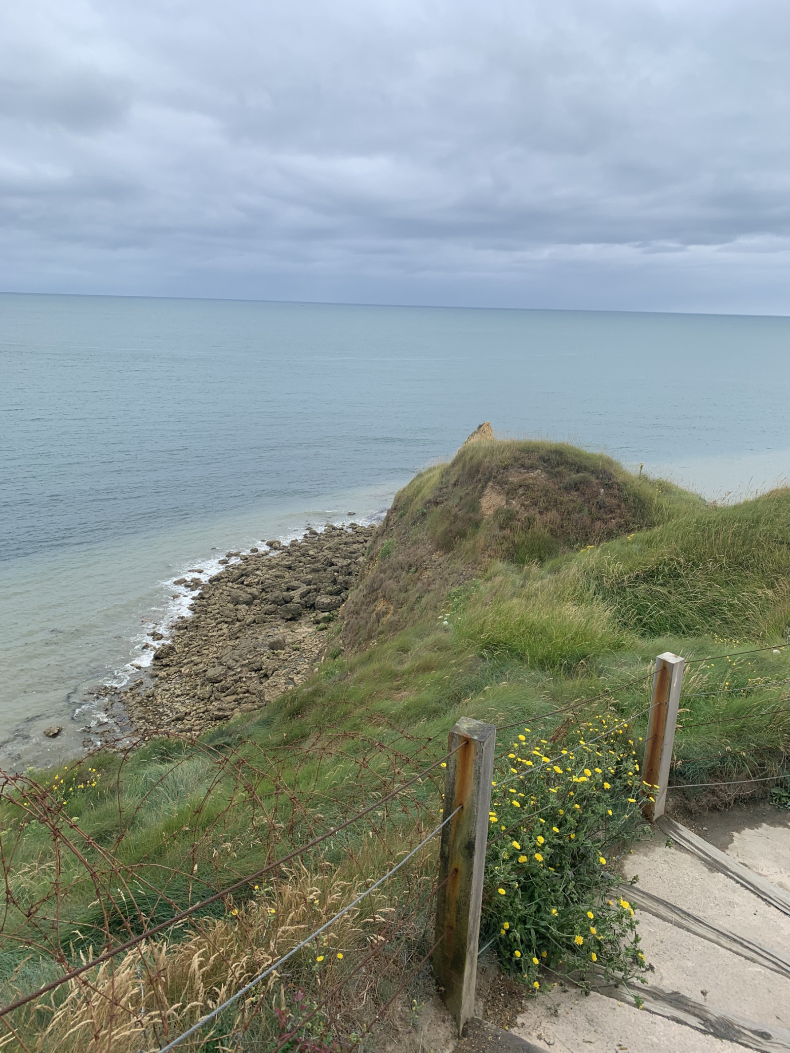
Pointe du Hoc is a prominent cliff on the coast of Normandy that played a significant role during World War II, particularly during the D-Day landings on June 6, 1944. Today, Pointe du Hoc is a memorial site, with remnants of the bunkers and bomb craters still visible.
In the first part of the circular walking route shown on the map you can observe songbirds such as Bluthänfling or Wiesenpieper and many other species. Along the coast you can observe Dreizehenmöwe, Trottellumme and many other seabirds. A good place for seawatching!
Details
Zugang
Pointe du Hoc is located on the northwestern coast of Normandy situated between Omaha Beach and Utah Beach. There is a big parking lot for visitors. Press P on the map for directions to the parking. The circular walking route shown on the map is about 1,5 km.
Terrain und Habitat
Grasland, Wiesen , Meer , DünenBedingungen
Sandig , Kein Schatten , Hügelig , StaubigRundweg
JaIst ein Spektiv nützlich?
Möglicherweise hilfreichGute Beobachtungszeit
GanzjährigBeste Beobachtungszeit
Frühjahr , HerbstRoute
Normaler WegSchwierigkeitsgrad der Tour
EinfachErreichbarkeit
zu Fuß , RollstuhlBeobachtungshütten oder -türme
NeinZusätzliche Informationen
On D-Day, the United States Army Rangers, led by Lieutenant Colonel James Earl Rudder, scaled the 30-meter-high cliffs to capture the German positions. Despite facing heavy resistance and difficult terrain, the Rangers successfully took control of the area, which was crucial for the success of the Normandy landings.


 ) Tragen Sie die Vogelnamen in Ihrer Sprache ein. Sie werden automatisch für andere Nutzer übersetzt!