
Description
update 02/2026:
Access to both sides of the pier (staketsel) remains difficult. The eastern pier could open again in March 2026 or summer 2026 (depending on the source). The western pier is closed, and opens only during easter holiday 2026 and in July-August 2026. From September 2026 on, it will be closed again.
The rest of the area remains worth a visit
The estuary of the IJzer River is one of the few places along the Belgian coast that still features some nice nature. Birding depends on the tide and tidal amplitude, and spending a few hours to cover both high tide and low tide makes for a great day out.
Overall this site falls apart in four parts:
- the nature reserve and harbour (mainly tidal mudflats and meadows)
- tidal mudflats along the river
- hiking to the eastern pier and beach (closed until March 2026?)
- the western pier (closed most of 2026)
The harbour and nature reserve features some mudflats and salty grassland, that (partially) flood during high tide (depending on tidal amplitude). Good views are possible from the car parking/viewpoint in the harbour or from the bird hide nearby.
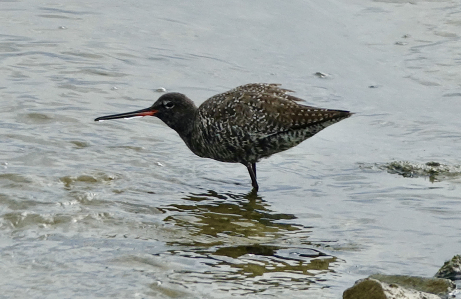
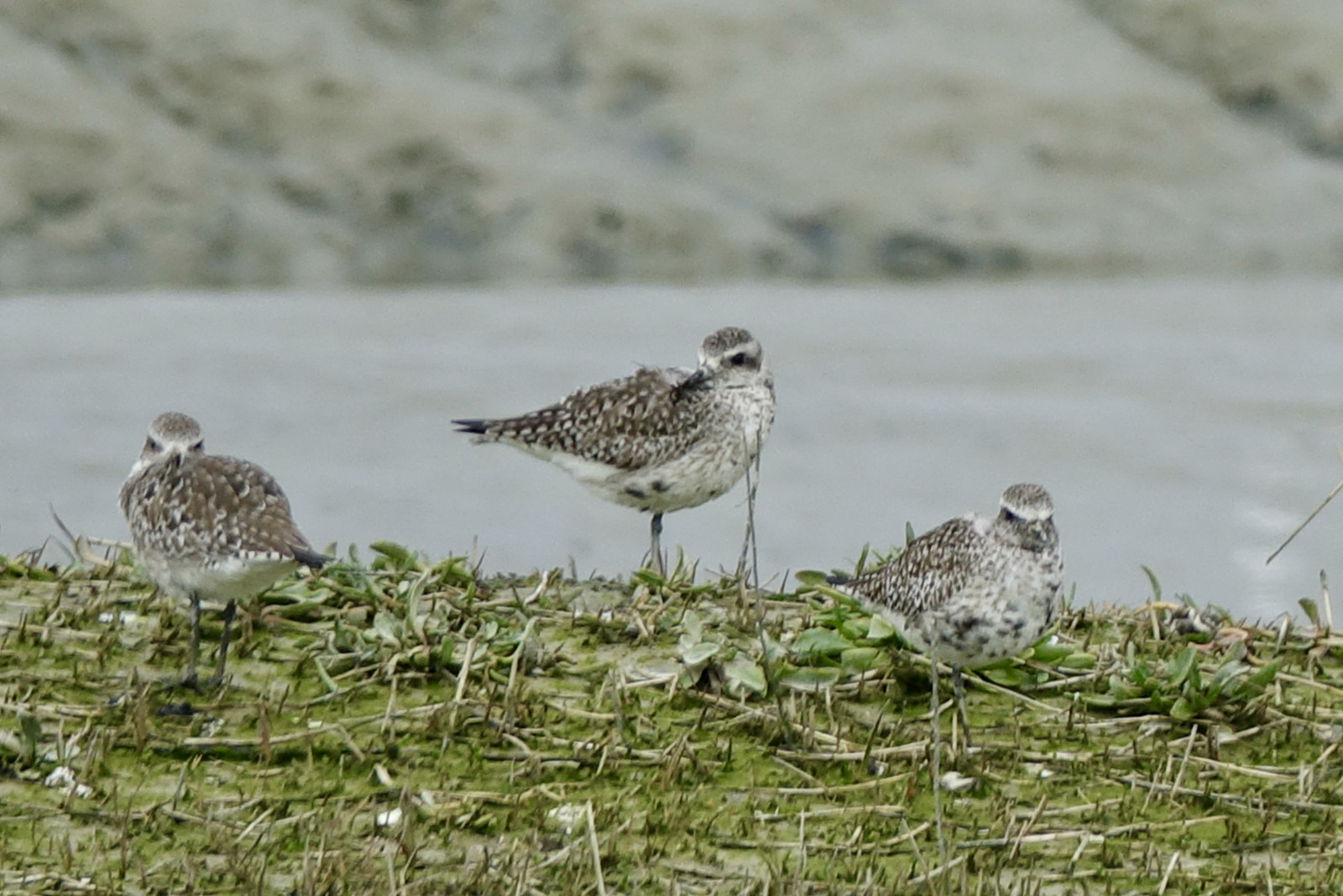
This site looks very different during high tide compared to low tide, so I always try to start at high tide and end at low tide. Depening of the season check for Rødben , Sortklire , Strandhjejle , Stenvender , Stor Præstekrave , Almindelig Ryle , Islandsk Ryle , Krumnæbbet Ryle , Storspove. In winter ducks can also be common ( Spidsand , Krikand , Pibeand). Other birds are Silkehejre , Fiskehejre , Engpiber , Gråspurv. Both high or low tide can be good for seals.
From the harbour you can walk (or bike) on the eastern edge of the reserve in the direction of the coast to visit the pier and beach. Between the harbour and the pier there are some viewing points, but often not many birds are around (except for Agerhøne ). Near the coast there are some important infrastructure works since 2020 (flood defence system), and the situation changes often - follow signs indicating directions as trails also change. Since summer 2022 the pier can not be reached most of the time, but this changes from time to time. It is worth checking the beach (can be viewed from near the lighthouse or from near the pier) as this beach is not accesible for people and often has quiet some birds.
At the river estuary there is a small pedestrian ferry (again follow signs as paths change). Just upstream of the ferry you can have a view of the mudflats, that is especially good at or just after high tide. Waders tend to come close, and there is a large Digesvale colony. An alternative to observe these mudflats is the other bank (see below). Check for all waders, but also check resting terns and gulls. This is especially a good place for Middelhavs-sølvmåge and Svartbag . Check the river channel ( Nordisk Lappedykker , Toppet Skallesluger) and also the stone banks at the other side of the channel ( Småspove , even during winter). Check the dune area for Vestlig Sortstrubet Bynkefugl and Stenpikker .
If it is open, the eastern pier often offers better views of seabirds than the western pier. Note that it is a long walk from the car parking in the harbour. Next to the pier there is a beach that is closed for public for nature conservation. Check for waders and gulls on the beach and along the breakwater: Sandløber , Sortgrå Ryle , Stenvender , Svartbag. Walk on the pier if weather allows and at the end scan the sea. Depending on conditions this can be an excellent site for seabirds with Sortand , Bjergand , Ederfugl , Sule , Toppet Skallesluger , Rødstrubet Lom, Ride and maybe Sortstrubet Lom .
As mentioned above, the beach is not open to the public, but near the lighthouse and near the pier (if open) you can have decent views of the resting gulls and Skarv . The dunes have some Toplærke , but most reliable places are 2-3 km to the east of the lighthouse.
The western banks of the river estuary also offer great but distant birding. Here you have sights on the mudflats along the river, which can be viewed also from near the ferry on the eastern bank (see above). So check for the same species: waders, terns, gulls. There is a viewing tower and you can walk along the river estuary (touristy when weather is good!). There are often seals around, especially near the viewing tower. The western bank also has a pier, but views are slightly less then the eastern pier. If the eastern pier is closed this is a good alternative. This was the best site to sea the 2021/2022 Rosenmåge . Check for other seabirds at the pier. Note that for most of 2026 the western pier is closed.
On the west side you can use one of the paid parkings. A pedestrian ferry connects both sides on weekend-days and during holiday periods. This can safe a lot of time and walking effort if combining both sides.
Details
Access
Park at the harbour and from here walk or bike. There is a lookout tower on the other bank (payed parking) and also a pier on the other bank (payed parking, sometimes hard to find a parking spot). In some seasons a small ferry crosses the river.
From 2020 to 20?? flood protection works take place in the harbour. Acces to the eastern pier might be difficult.


 ) to insert bird names in your own language. The birdnames will automatically be translated for other users!